

Remote sensing image classification and labeling method based on compound graph conditional random field
A conditional random field and remote sensing image technology, applied in computer components, instruments, calculations, etc., can solve the problems of conditional random field classification performance impact, lack of ability to integrate global interactive information, etc., to achieve enhanced classification and labeling performance, high classification Labeling accuracy, effect of enhanced capabilities
- Summary
- Abstract
- Description
- Claims
- Application Information
AI Technical Summary
Problems solved by technology
Method used
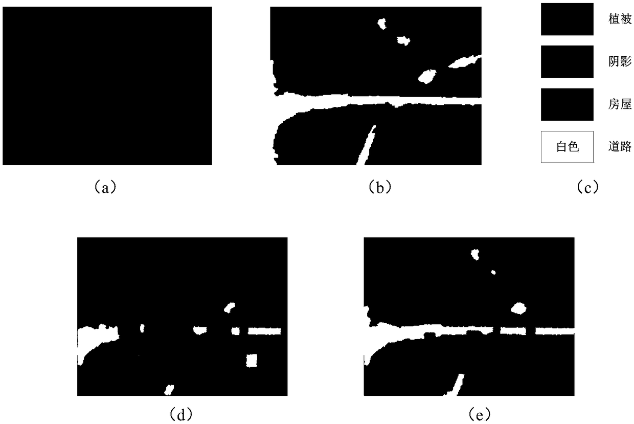
Image


Examples
Embodiment Construction
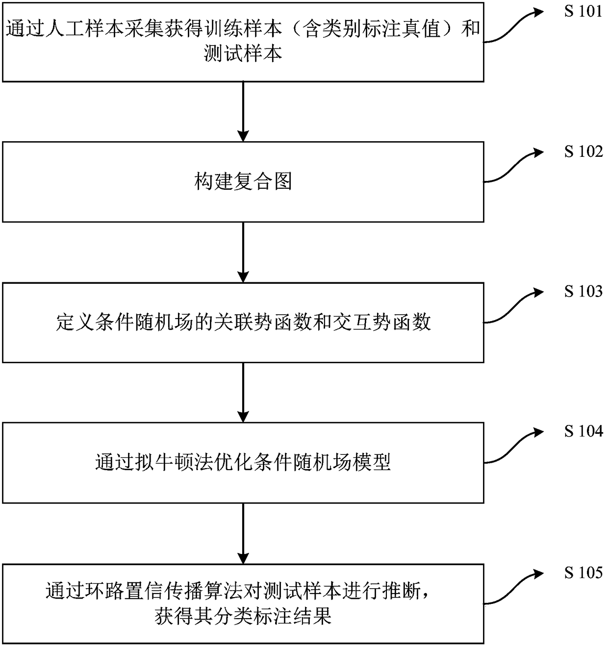
[0035] In the following description, various aspects of the invention will be described. However, for those skilled in the art, only some or all of the structures or procedures of the present invention can be used to implement the present invention. For clarity of explanation, specific data sets and spatial neighborhoods are set forth, but it will be apparent that the invention may be practiced without these specific details. In other instances, well-known features have not been described in detail in order not to obscure the invention.
[0036] Therefore, the present invention provides a method for classifying and labeling remote sensing images based on conditional random fields of composite graphs. In this method, a sparse graph is firstly constructed through a sparse representation, and combined with a spatial graph to construct a composite graph. Sparse representation can find the interaction between samples in the whole sample, so that the newly constructed composite gr...
PUM
 Abstract
Description
Claims
Application Information