Subway location method and system based on inertial sensor

An inertial sensor and positioning method technology, which is applied in directions such as navigation through speed/acceleration measurement, can solve the problems of low positioning accuracy and large delay in subways, and achieve the effects of improving positioning accuracy, reducing accumulation between stations, and facilitating market promotion.

Active Publication Date: 2016-12-07
湖南超能机器人技术有限公司
View PDF4 Cites 18 Cited by
  • Summary
  • Abstract
  • Description
  • Claims
  • Application Information

AI Technical Summary

Problems solved by technology

[0004] Under the background of the above application, in order to solve the problems of low positioning accuracy and large delay of the current subway
The use of mobile phone inertial sensors to achieve high-precision subway positioning has great application prospects

Method used


Image

  • Subway location method and system based on inertial sensor
  • Subway location method and system based on inertial sensor
  • Subway location method and system based on inertial sensor

Examples


Embodiment Construction

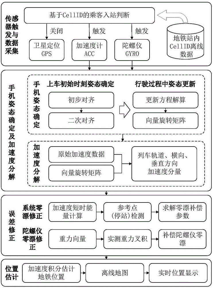
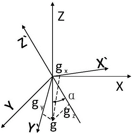
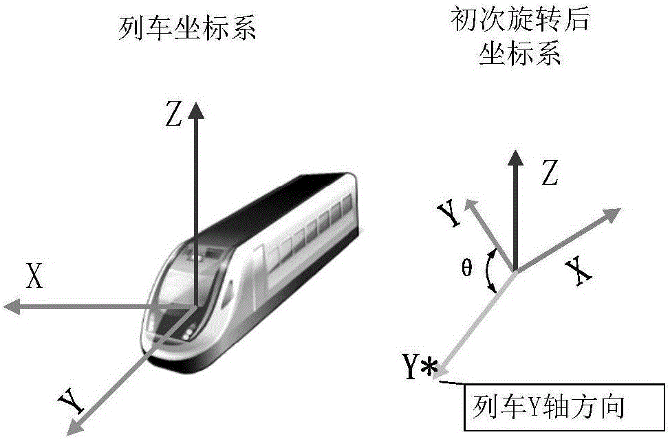
[0052] In order to make the object, technical solution and advantages of the present invention clearer, the present invention will be further described in detail below in conjunction with the accompanying drawings and embodiments. It should be understood that the specific embodiments described here are only used to explain the present invention, not to limit the present invention. In addition, the technical features involved in the various embodiments of the present invention described below can be combined with each other as long as they do not constitute a conflict with each other.

[0053] Aiming at the optimization of the positioning accuracy of the smart phone map positioning software in the subway, it can be dealt with mainly from two aspects: on the one hand, taking advantage of the advantage that the subway company has all the subway line scheduling information, try to open its scheduling information to the map software company, so as to improve the quality of the subwa...


PUM


Abstract

The invention discloses a subway location method based on an inertial sensor. The location method comprises the steps: (1) collecting starting acceleration of a train through an acceleration sensor of a mobile terminal; (2) determining an initial state of the mobile terminal relative to the train according to gravity acceleration and the starting acceleration, and resolving the acceleration of the train according to the initial state; (3) calculating out a zero-drift vector of an acceleration sensor of the train and a zero-drift vector of a gyroscope sensor of the train; (4) correcting an acceleration component in a train rail direction and calculating out displacement of the train according to the corrected acceleration component in the trail rail direction. According to the location method, high-precision location in a subway can be achieved through a gyroscope of the mobile terminal, an accelerometer of the mobile terminal, an off-line map and an id of a base station cell. The method has the characteristics of being low in cost and high in accuracy, has good application prospect and can solve the problems that an existing mobile terminal map base station is large in location mode error and slow in switch.

Description

technical field [0001] The invention belongs to the technical field of geographic positioning, and more specifically relates to a subway positioning method and system based on an inertial sensor. Background technique [0002] In recent years, with the continuous development of the economy, various mobile terminals (such as smart phones, tablet computers, etc., in the present invention, follow-up are all taken as smart phones for convenience of description) are becoming more and more popular in my country. A variety of map software on the Internet can easily call the GPS and base station positioning system of the mobile phone to navigate for oneself easily. This type of navigation method has been widely used in all aspects of our lives, such as driving, traveling, public transportation and so on. The two positioning methods of GPS and base station cover most of the smart phone map positioning software on the market. The existence of smart phone map positioning software greatl...

Claims


Application Information

Patent Timeline
Patent Type & Authority Applications(China)
IPC IPC(8): G01C21/16
CPCG01C21/16
Inventor 李方敏栾悉道唐伟
Owner 湖南超能机器人技术有限公司
Why Eureka
Try Eureka