
GPS track data completion method based on third-order Bezier curve and interpolation

A Bezier curve and trajectory data technology, applied in the field of GPS trajectory data processing, can solve the problems of GPS trajectory data offset, too much calculation data, and complicated implementation, and achieves high accuracy, simple calculation logic, and low implementation cost. Effect

Active Publication Date: 2019-06-11
北京创业公社数据科技有限公司
View PDF4 Cites 0 Cited by
  • Summary
  • Abstract
  • Description
  • Claims
  • Application Information

AI Technical Summary

Problems solved by technology

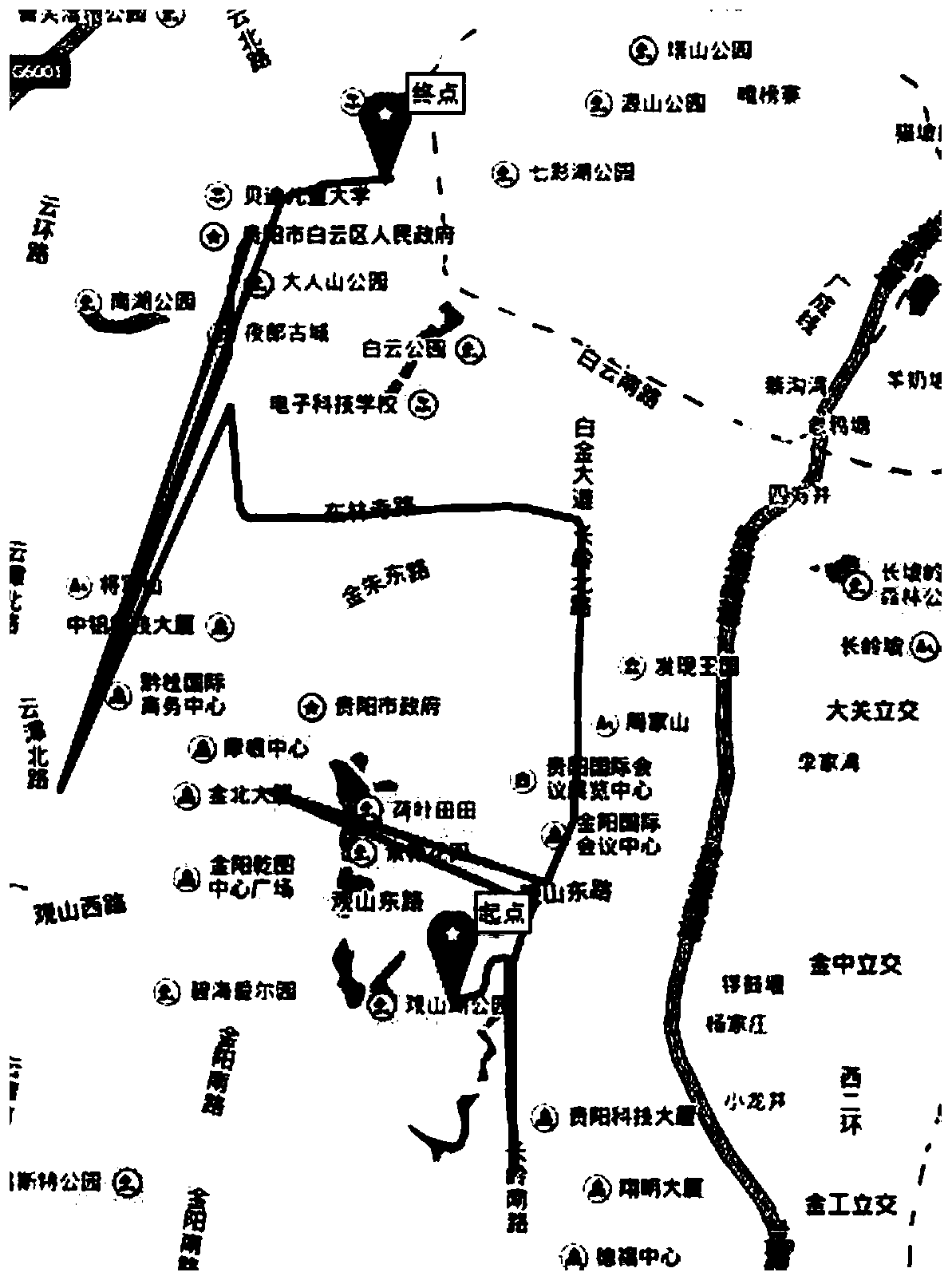
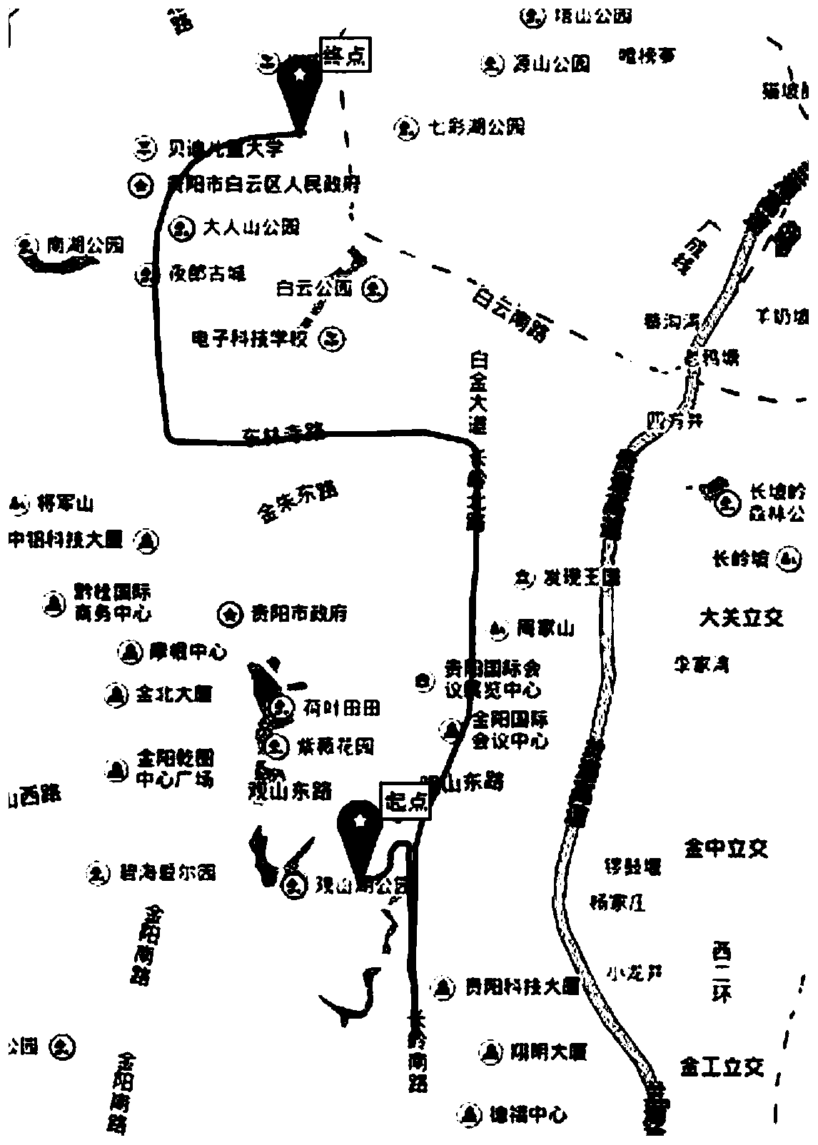
[0004] The present invention aims at the problem that when the GPS signal of the mobile device is weak or lost, the GPS trajectory data collected by the mobile device is seriously offset or lost, and the existing method relies on the map entity data, the calculation data is large and the implementation is complicated, and a third-order based method is provided. Bezier curve and interpolation GPS trajectory data completion method to achieve fast trajectory data completion

Method used


Image

  • GPS track data completion method based on third-order Bezier curve and interpolation
  • GPS track data completion method based on third-order Bezier curve and interpolation
  • GPS track data completion method based on third-order Bezier curve and interpolation

Examples


Embodiment Construction

[0028] The technical solutions of the present invention will be described in detail below with reference to the accompanying drawings and embodiments.

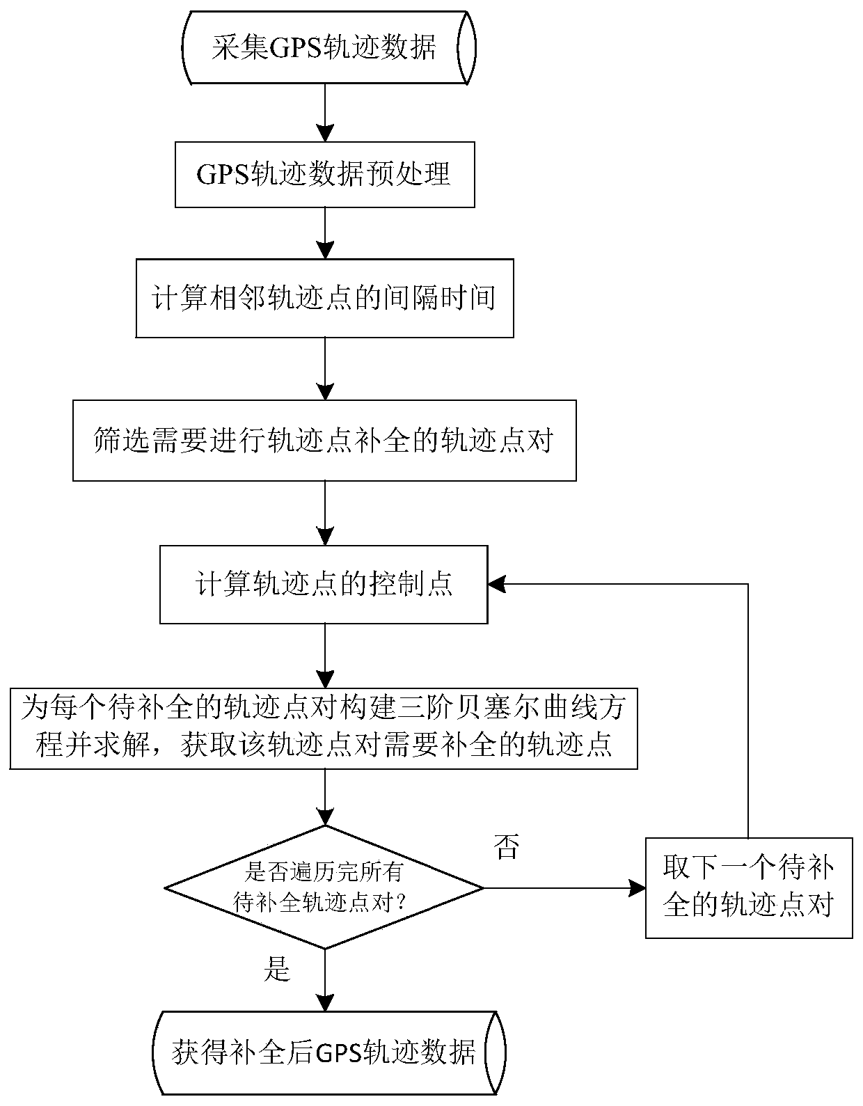
[0029] The GPS track data completion method based on the third-order Bezier curve and interpolation of the present invention, the overall process is as follows figure 1 shown. The following steps are used to repair and complete the GPS trajectory data generated by an Android device.

[0030] Step 1. Collect GPS trajectory data for a period of time T through the Android terminal device, and sort all the trajectory points according to the chronological order. The trajectory points include five attributes: collection time, longitude, latitude, speed and movement direction. The true north of the GPS direction is set as 0°, and the clockwise angle with the true north direction is the movement direction.

[0031] The GPS trajectory is formally described as: Tra T =(P 1 ,P 2 ,…,P i ,…,P n ); where n is the number of trajectory...


PUM


Abstract

The invention provides a GPS trajectory data complementing method based on a third-order Bezier curve and interpolation, and belongs to the technical field of GPS trajectory data processing. The method comprises the following steps: acquiring and preprocessing GPS trajectory data and eliminating trajectory points that do not meet a requirement, traversing the trajectory points, calculating the interval time of adjacent trajectory points, and selecting the trajectory point pairs required to be complemented, acquiring control points of the starting point and the ending point of each trajectory point pair to be complemented, constructing and solving a third-order Bezier curve equation for a quadrilateral formed by the trajectory point pair and the two control points to calculate a trajectory point set required to be complemented of the trajectory point pair. The method is independent of high-cost map entity data, low in cost, simple in computation logic, convenient in process, and low in dependence, complements straight and curved GPS trajectory data, and achieves high repair completion accuracy.

Description

technical field [0001] The invention relates to the processing of GPS track data, in particular to a GPS track data completion method based on third-order Bezier curves and interpolation. Background technique [0002] Trajectory data is the data information obtained by sampling the motion process of one or more moving objects in a space-time environment, including sampling point position, sampling time, speed, etc. These sampling point data information constitutes the trajectory data according to the sampling sequence. With the development of satellites, wireless networks, and positioning equipment, the trajectory data of a large number of moving objects is rapidly increasing, such as traffic trajectory data, animal migration data, climate airflow data, and personnel movement data. The study of trajectory data and the acquisition of unknown knowledge about the motion of objects will become a future research hotspot and application growth point. [0003] The GPS receiving mo...

Claims


Application Information

Patent Timeline
Patent Type & Authority Patents(China)
IPC IPC(8): G01S19/05
CPCG01S19/05
Inventor 袁伟张建伟蔡明
Owner 北京创业公社数据科技有限公司
Learn More