
Spatial data storage organization method and system considering load balancing and disk efficiency

A spatial data and load balancing technology, applied in transmission systems, geographic information databases, structured data retrieval, etc., can solve the problem of not being able to meet the load balancing requirements of geographic information systems and high-efficiency disk I/O requirements at the same time.

Inactive Publication Date: 2020-02-14
WUHAN UNIV
View PDF6 Cites 0 Cited by
  • Summary
  • Abstract
  • Description
  • Claims
  • Application Information

AI Technical Summary

Problems solved by technology

[0005] In short, the existing methods of distributing and storing spatial data purely from the perspective of improving the concurrency capability of geographic information systems or improving the continuous reading efficiency of spatial data through combined storage cannot meet the load balancing requirements of geographic information systems and efficient disk I / O at the same time. O demand

Method used


Image

  • Spatial data storage organization method and system considering load balancing and disk efficiency
  • Spatial data storage organization method and system considering load balancing and disk efficiency
  • Spatial data storage organization method and system considering load balancing and disk efficiency

Examples


Embodiment Construction

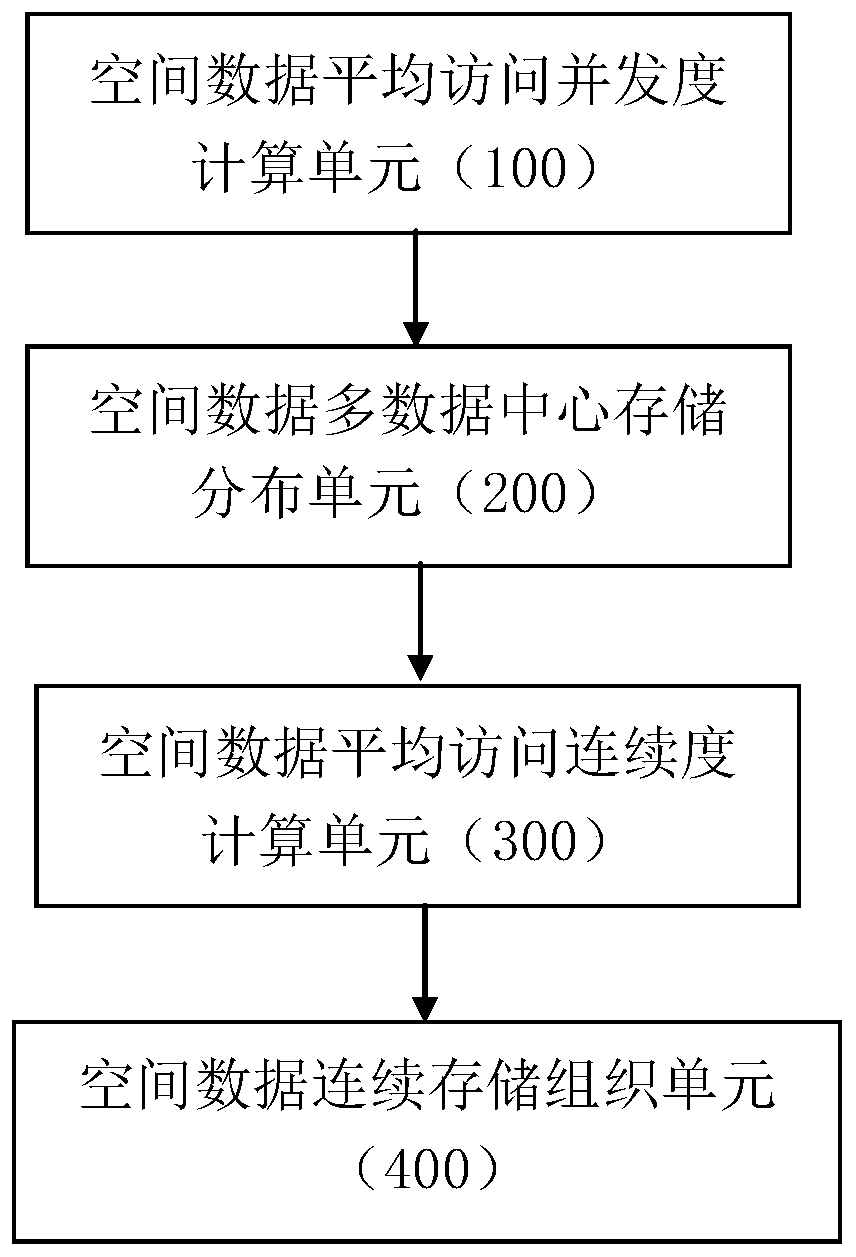
[0095] In the face of large-scale user access, the distributed geographic information system needs to distribute and store simultaneously accessed spatial data on different server to improve load balancing performance; at the same time, store continuously accessed spatial data in the continuous disk space of the memory to reduce the search and movement of the magnetic head and improve storage performance. Considering the requirements of the above two aspects of geographic information system, the distributed storage organization of spatial data is an effective way to meet the large-scale user access service performance of distributed geographic information system.

[0096] The present invention designs a spatial data storage organization method considering load balance and disk efficiency, and ensures load balance performance by distributing and storing data with high average access concurrency in different servers. At the same time, within the same server, the spatial data wit...


PUM


Abstract

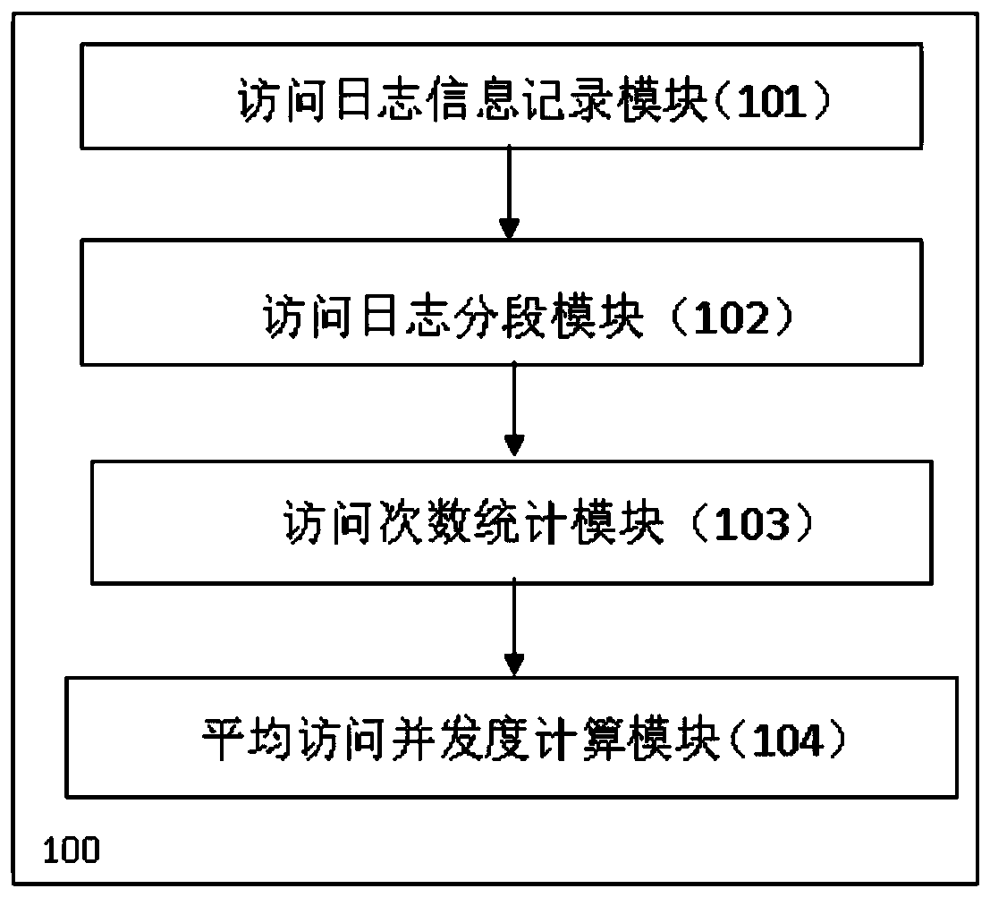
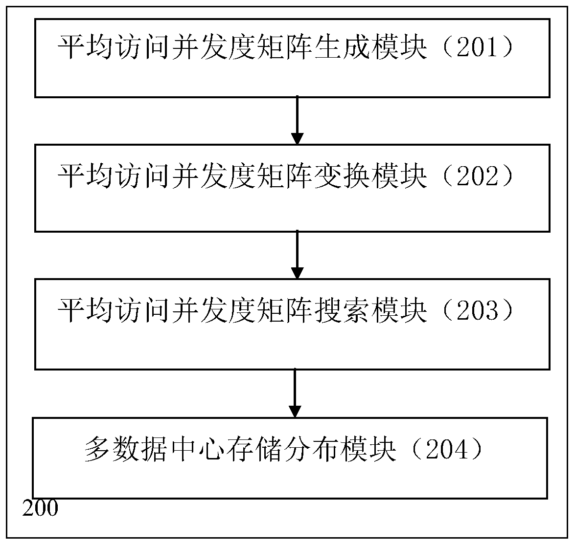
The invention discloses a spatial data storage organization method and system considering load balancing and disk efficiency, comprising: counting the average access concurrency of spatial data files according to the number of access requests of spatial data files by users; Load balancing requirements, according to the average access concurrency, the spatial data files are distributed and stored in the distributed geographic information system server; according to the average access concurrency and the average access interval distance of the spatial data files, the average access continuity of the spatial data files is calculated; according to The average access continuity of spatial data files, the spatial data files in the same server are stored and organized continuously. The invention realizes effective batch reading of continuously accessed spatial data while satisfying the requirement of load balance, and ensures the storage efficiency of the geographic information system. This project is supported by the National Natural Science Foundation of China (fund number: 41671382, 41271398).

Description

technical field [0001] The invention belongs to the technical field of spatial data storage organization, and in particular relates to a spatial data storage organization method and system considering load balancing and disk efficiency. Background technique [0002] The application of geographic information system in the fields of urban planning, environmental monitoring, and disaster prevention and mitigation is becoming more and more popular. It is necessary to focus on solving the infinite bandwidth demand (Infinite Bandwidth) and infinite capacity demand (Infinite Capacity) brought about by the intensive access of users. As well as Infinite Processing Capability, distributed systems provide storage and access services for massive spatial data and become one of the effective ways to solve the above problems. At present, traditional network geographic information systems, such as NASA WorldWind, usually adopt a data-driven spatial data storage organization method, which ma...

Claims


Application Information

Patent Timeline
Patent Type & Authority Patents(China)
IPC IPC(8): G06F3/06G06F9/50G06F16/29H04L29/08
CPCG06F3/061G06F3/067G06F9/505G06F9/5083G06F16/29H04L67/1001
Inventor 潘少明种衍文李红汤戈
Owner WUHAN UNIV
Learn More