A method and system for clustering and quantitative forecasting of mountain fires on transmission lines
A technology for transmission lines and mountain fires, which is applied in the field of quantitative forecasting methods and systems for mountain fires on transmission lines. It can solve the problems of not considering the suppression of mountain fires, the prediction accuracy needs to be further improved, and it is difficult to accurately guide mountain fire prevention equipment.
- Summary
- Abstract
- Description
- Claims
- Application Information
AI Technical Summary
Problems solved by technology
Method used
Image
Examples
Embodiment 1
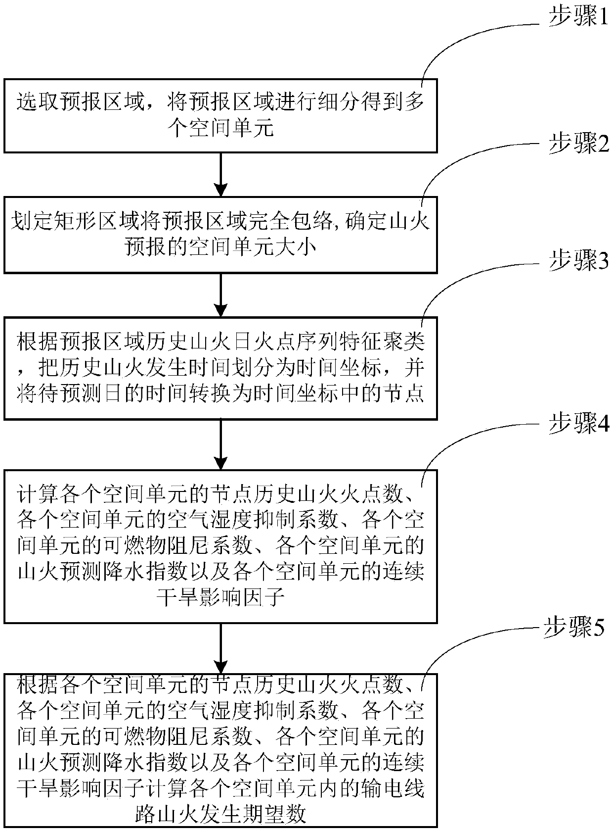
[0090] Example 1, such as figure 1 As shown, a method for clustering and quantitative forecasting of mountain fires on transmission lines according to an embodiment of the present invention includes:
[0091] Step 1. Select the forecast area, subdivide the forecast area to obtain multiple spatial units, and select the area covering the transmission line as the area to be tested, where the forecast area is a 1°×1° area based on latitude and longitude, and the spatial unit Based on longitude and latitude, it is divided into 0.25°×0.25°. Subdividing the area into multiple spatial units can make the forecast data more accurate and reasonable.
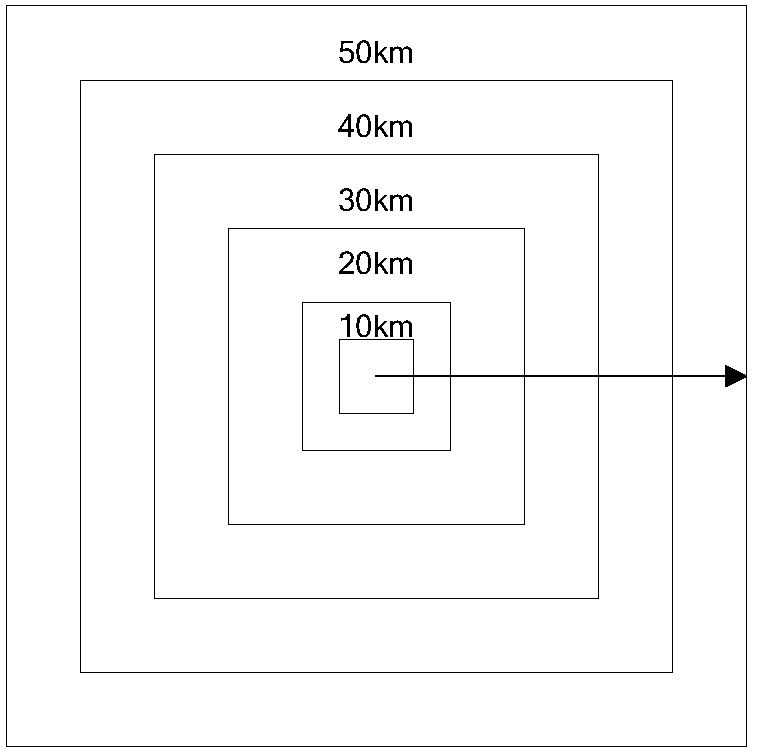
[0092] Step 2, such as figure 2 As shown in Fig. 1, the delineation of a rectangular area completely envelops the forecast area, centering on the intersection point of the diagonal lines of the rectangular area, and expanding to the surroundings with a step difference of equal length of 10 km, and counting different spatial scales to cal...
Embodiment 2
[0142] Embodiment 2, a transmission line mountain fire clustering quantitative forecasting system described in the second embodiment of this law, the system includes:
[0143]The area division module is used to select the forecast area, subdivide the forecast area to obtain multiple spatial units, and select the area covering the transmission line as the area to be tested.
[0144] The spatial unit selection module is used to define a rectangular area to completely envelop the forecast area, take the intersection of the diagonals of the rectangular area as the center, and expand to the surroundings with a step difference of equal length of 10km, and calculate similar meteorological conditions within different spatial scales The ratio of the number of wildfires in the i-th year to the j-th year under the data conditions in the same period D ij , when the spatial scale is greater than A, the number of wildfires continues to satisfy 0.85ij <1.18, choose A as the size of the space...
PUM
 Abstract
Description
Claims
Application Information
 - R&D
- Intellectual Property
- Life Sciences
- Materials
- Tech Scout
- Unparalleled Data Quality
- Higher Quality Content
- 60% Fewer Hallucinations
Browse by: Latest US Patents, China's latest patents, Technical Efficacy Thesaurus, Application Domain, Technology Topic, Popular Technical Reports.
© 2025 PatSnap. All rights reserved.Legal|Privacy policy|Modern Slavery Act Transparency Statement|Sitemap|About US| Contact US: help@patsnap.com


