Aerial photographing method, device and unmanned aerial vehicle
An aerial photography and image technology, applied in the field of unmanned aerial vehicles, can solve the problems of not being able to give full play to the advantages of VR glasses, and achieve the effect of improving the aerial photography experience and low cost.
- Summary
- Abstract
- Description
- Claims
- Application Information
AI Technical Summary
Problems solved by technology
Method used
Image
Examples
Embodiment 1
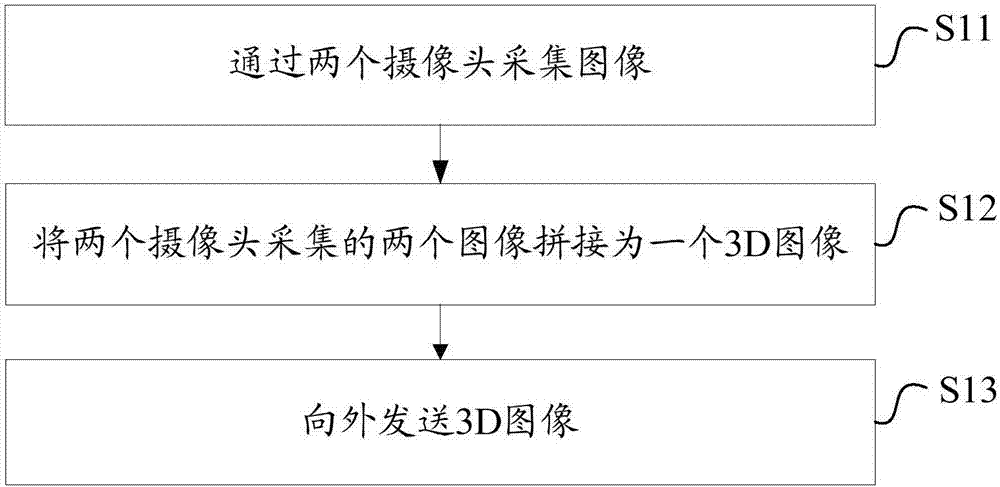
[0045] see figure 1 , propose the aerial photography method of the first embodiment of the present invention, described method comprises the following steps:
[0046] S11. Collect images through two cameras.
[0047] In the embodiment of the present invention, the drone is provided with two cameras to form a group of binocular cameras. The two cameras are preferably arranged side by side. Of course, it can also be set in a staggered manner, that is, the two cameras are not on the same horizontal line. There is a certain distance between the two cameras. In theory, the larger the distance, the better.
[0048] In this step S11, the UAV collects images simultaneously (synchronously) through two cameras, and the collected images may be photos or video streams.
[0049] S12. Stitch the two images collected by the two cameras into one 3D image.
[0050] Specifically, the two images collected by the two cameras are spliced side by side, preferably, the images collected by the...
Embodiment 2
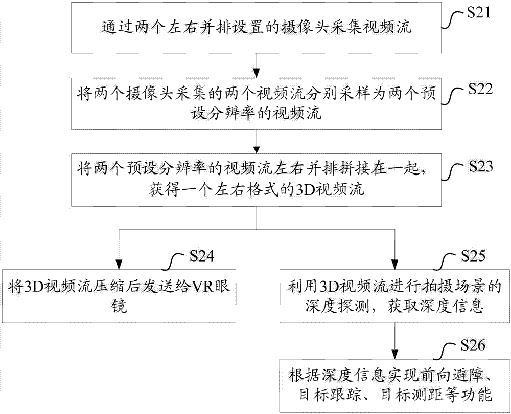
[0071] see figure 2 , propose the aerial photography method of the second embodiment of the present invention, described method comprises the following steps:
[0072] S21. Collect video streams through two cameras arranged side by side.
[0073] In this embodiment, the binocular cameras of the UAV are arranged side by side, and the UAV simultaneously collects video streams through the binocular cameras.
[0074] S22. Sampling the two video streams collected by the two cameras respectively into two video streams with preset resolutions.
[0075] S23. Splice two video streams with preset resolution side by side side by side to obtain a 3D video stream in left and right format.
[0076] Specifically, the UAV first samples the two video streams collected by the binocular camera into two video streams with preset resolutions, and then stitches the two video streams with preset resolutions side by side. Preferably, The video streams collected by the left camera are spliced on...
Embodiment 3
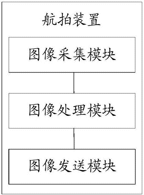
[0088] see image 3 , the aerial photographing device of the third embodiment of the present invention is proposed, the device includes an image acquisition module, an image processing module and an image sending module, wherein:
[0089] Image acquisition module: used to acquire images through two cameras.
[0090] In the embodiment of the present invention, the drone is provided with two cameras to form a group of binocular cameras. The two cameras are preferably arranged side by side. Of course, it can also be set in a staggered manner, that is, the two cameras are not on the same horizontal line. There is a certain distance between the two cameras. In theory, the larger the distance, the better.
[0091] The image acquisition module simultaneously (synchronously) acquires images through two cameras, and the acquired images can be photos or video streams.
[0092] Image processing module: used to stitch two images collected by two cameras into one 3D image.
[0093] Sp...
PUM
 Abstract
Description
Claims
Application Information
 - R&D
- Intellectual Property
- Life Sciences
- Materials
- Tech Scout
- Unparalleled Data Quality
- Higher Quality Content
- 60% Fewer Hallucinations
Browse by: Latest US Patents, China's latest patents, Technical Efficacy Thesaurus, Application Domain, Technology Topic, Popular Technical Reports.
© 2025 PatSnap. All rights reserved.Legal|Privacy policy|Modern Slavery Act Transparency Statement|Sitemap|About US| Contact US: help@patsnap.com


