

A Geological Information Interpolation Calculation Method Based on Spatial Variation Analysis
A technology of spatial variation and calculation method, applied in the field of geological exploration, can solve problems such as insufficient precision and inability to calculate deep data
Active Publication Date: 2014-11-05
BEIJING RES INST OF URANIUM GEOLOGY
View PDF0 Cites 4 Cited by
- Summary
- Abstract
- Description
- Claims
- Application Information
AI Technical Summary
Problems solved by technology
The defect of prior art is: 1. prior art is only based on simple mathematical formula
③ Existing data processing methods can basically only deal with shallow data, and cannot calculate deep data, and shallow data
The accuracy is not high enough
Method used
View moreImage
Smart ImageViewing Examples

Examples
Embodiment Construction
[0036] Convert the data obtained from exploration. Since the location information of the exploration points in the exploration process uses geodetic coordinates
[0040] The variogram is calculated for each mineralization point. The calculation of the variation function is based on the existing basic theory of geostatistics
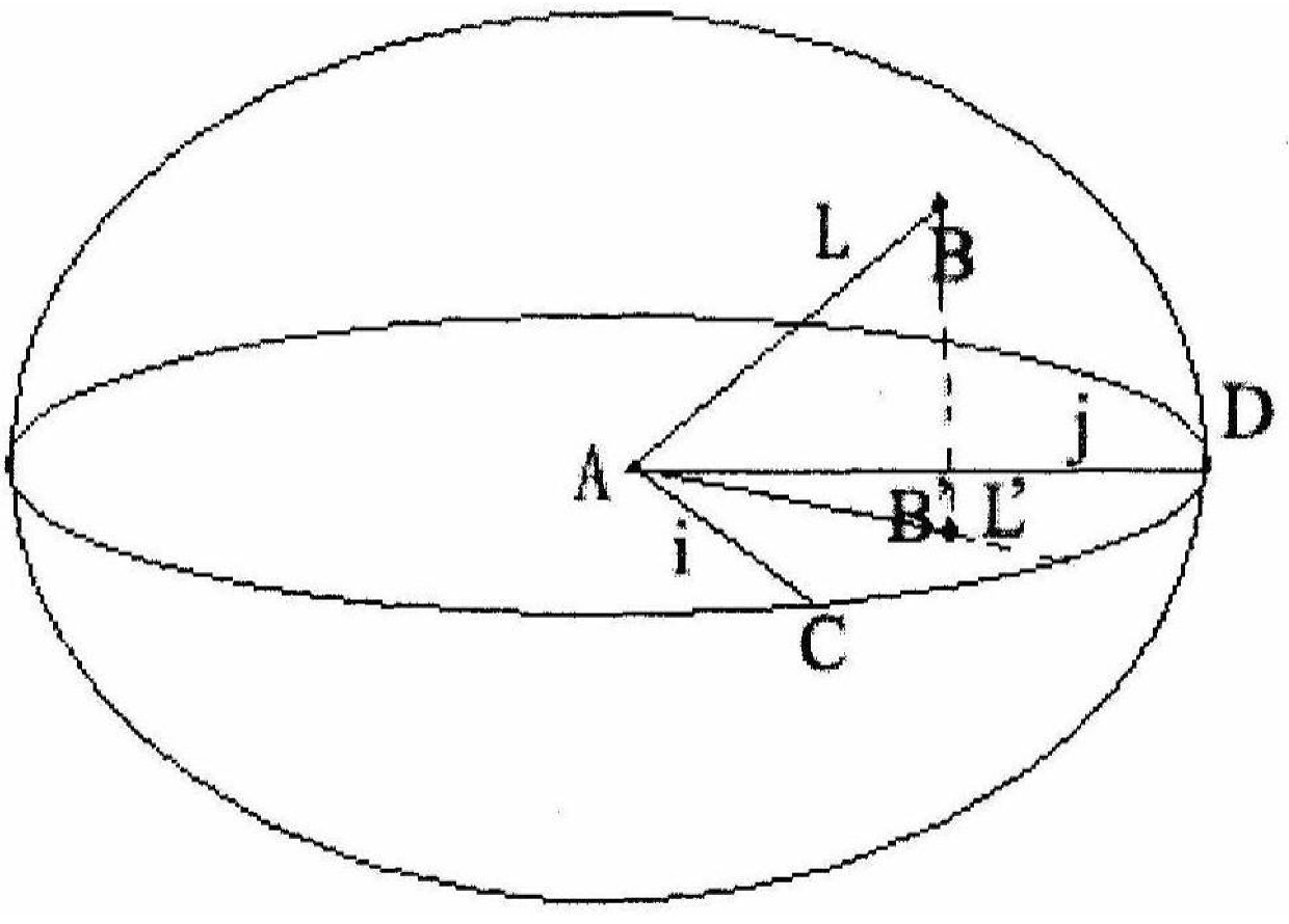
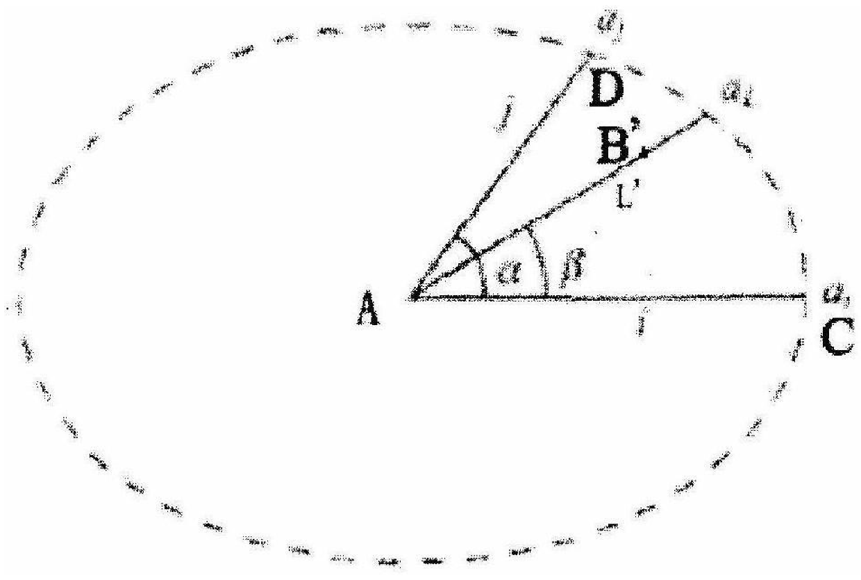
[0043] (4.1) Get two adjacent grid points, denoted as point A, point B, and the connection line between AB is denoted as L. Since it is taken
[0046] (4.4) build ellipse. Use the distance length in the two directions of i and j as parameters to construct a
[0047]
[0050]
[0052] Steps (4.1) to (4.6) are repeated to calculate the mineralization information of all unknown grid points.
Login to View More PUM
 Abstract
The present invention relates to the field of geological exploration, and specifically relates to a geological information interpolation calculation method based on spatial variation analysis. A geological information interpolation calculation method based on spatial variation analysis, comprising the following steps: (1) geological exploration; (2) data conversion; (3) calculating the variation function of mineralized points, and calculating the variation for each mineralized point (4) Generation of fitting structure of variation function, calculating mineralization grade information for all non-exploration points; (5) Using Kriging variance method to evaluate the quality of fitting structure, and draw conclusions on whether re-exploration is needed. The remarkable effect of the present invention is: use the variation function fitting structure to calculate the mineralization information of unexplored points, fully consider the degree of influence of known points on unexplored points, and the method can not only perform interpolation calculation for shallow mineralization information, but also Interpolation calculations can be performed on deep mineralization information.
Description
A geological information interpolation calculation method based on spatial variation analysis Technical field Geological exploration field of the present invention, be specifically related to a kind of geological information interpolation calculation method based on spatial variation analysis Law. Background technique [0002] Spatial variation analysis is an analysis method of geostatistics. Geostatistics is from the 1920s to the 1960s Especially after the 1970s, it was developed by Krige et al. based on the assessment of South African gold reserves. land Qualitative statistics combines the contents of geology, statistics and other disciplines, based on the theory of regional variables, with the variation function as the main tool Tools, using different Kriging methods, to study those natural phenomena that are both random and structured in space. Because geostatistics provides necessary theory and method description again while using traditional statistical method ...
Claims
Login to View More Application Information
Patent Timeline
 IPC IPC(8): G06F19/00
Inventor伊丕源鲁学军黄树桃赵英俊
OwnerBEIJING RES INST OF URANIUM GEOLOGY