A three-dimensional coordinate conversion method and device based on coordinate projection
A technology of three-dimensional coordinates and projection, applied in measuring devices, instruments, height/horizontal measurement, etc., can solve problems such as low conversion accuracy and limited scope of application, and achieve the effects of simple processing methods, improved computing speed, and guaranteed accuracy
- Summary
- Abstract
- Description
- Claims
- Application Information
AI Technical Summary
Problems solved by technology
Method used
Image
Examples
Embodiment 1
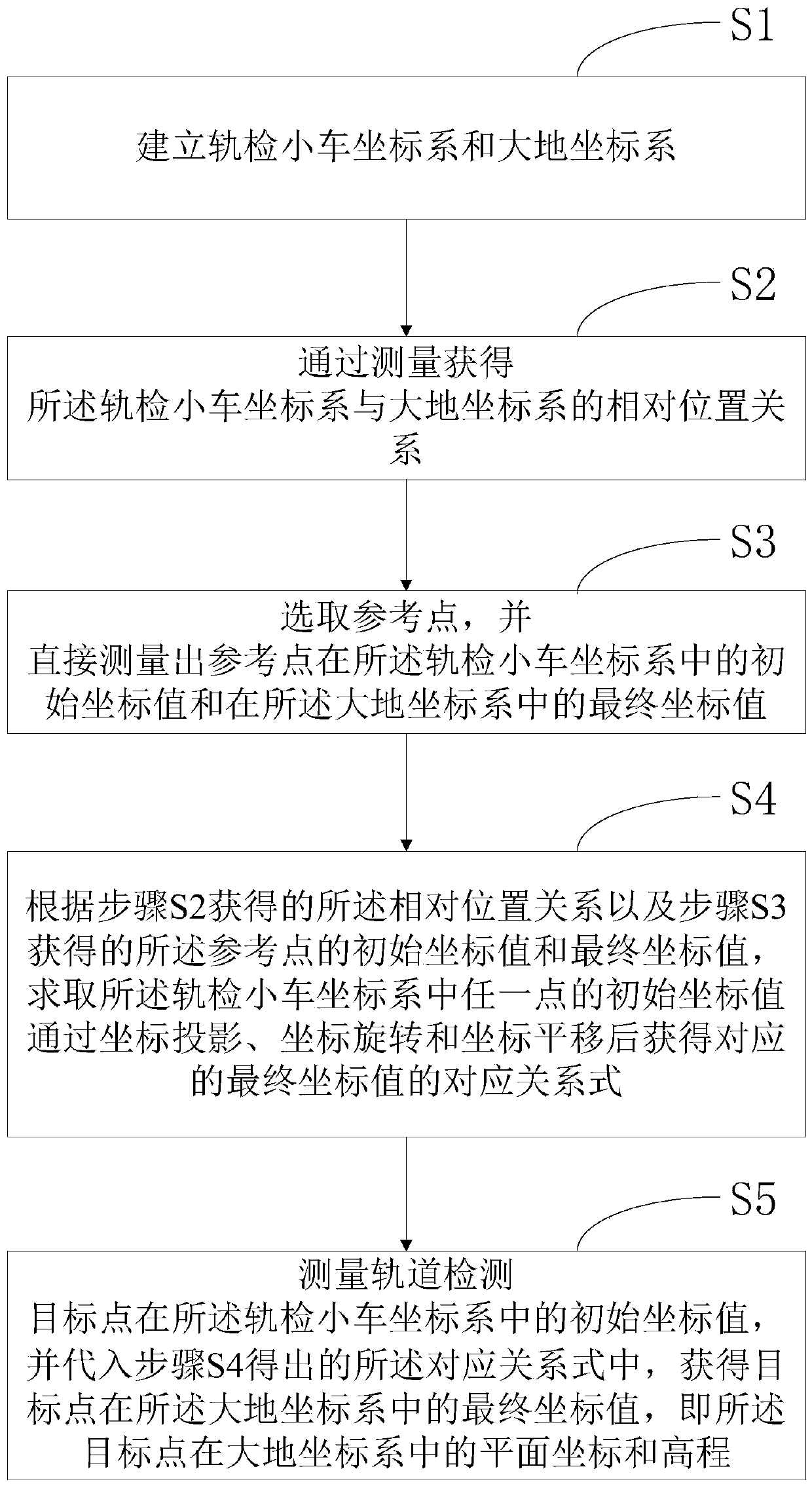
[0057] figure 1 It shows a three-dimensional coordinate conversion method based on coordinate projection provided by this embodiment, including:
[0058] Step S1: Establish the track inspection trolley coordinate system and the earth coordinate system.
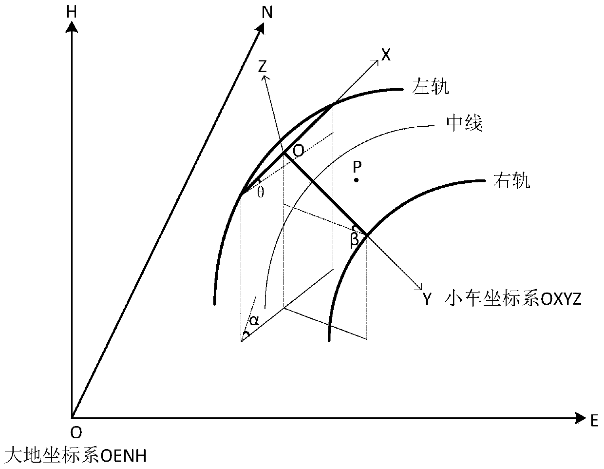
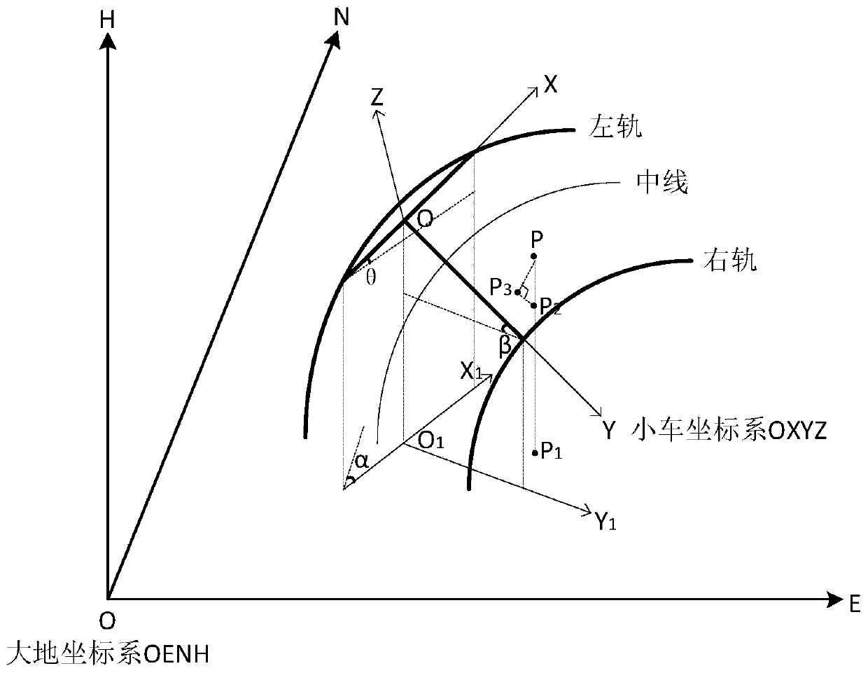
[0059] Such as figure 2 As shown, the track inspection car coordinate system OXYZ and the earth coordinate system OENH are established. The specific establishment method of the coordinate system OXYZ of the track inspection trolley is: take the intersection point of the double-wheel beam and the single-wheel beam of the track inspection trolley as the coordinate origin O, take the straight line where the double-wheel beam is located as the X-axis, and take the straight line where the single-wheel beam is located as the Y-axis , establish the track inspection trolley coordinate system OXYZ with the Z axis perpendicular to the XOY plane, wherein the direction of the track mileage increase is the positive axis direction of the...
Embodiment 2
[0110] Such as Figure 6 As shown, the present invention also provides a three-dimensional coordinate conversion device based on coordinate projection, including: a coordinate system establishment module 10, a relative position acquisition module 20, a reference point acquisition module 30, a correspondence derivation module 40 and an application module 50, wherein , the corresponding relationship derivation module 40 further includes a plane coordinate relationship submodule 41 , an elevation coordinate relationship submodule 42 and a merging submodule 43 .
[0111] The coordinate system establishing module 10 is used to establish the track inspection trolley coordinate system and the earth coordinate system.
[0112] Specifically, the coordinate system establishing module 10 takes the intersection point of the double-wheel beam and the single-wheel beam of the track inspection trolley as the coordinate origin O, the straight line where the double-wheel beam is located as the...
PUM
 Abstract
Description
Claims
Application Information
 - R&D
- Intellectual Property
- Life Sciences
- Materials
- Tech Scout
- Unparalleled Data Quality
- Higher Quality Content
- 60% Fewer Hallucinations
Browse by: Latest US Patents, China's latest patents, Technical Efficacy Thesaurus, Application Domain, Technology Topic, Popular Technical Reports.
© 2025 PatSnap. All rights reserved.Legal|Privacy policy|Modern Slavery Act Transparency Statement|Sitemap|About US| Contact US: help@patsnap.com


