Supercharge Your Innovation With Domain-Expert AI Agents!

Quadrat investigation method for obtaining accurate spatial positioning data of forest community

A technology of spatial positioning and forest communities, applied in data processing applications, structured data retrieval, electronic digital data processing, etc., can solve the problems of inability to accurately obtain spatial vegetation data in forest communities, reduce subjectivity, overcome Boundary, the effect of improving data precision

Inactive Publication Date: 2018-04-20
NORTHEAST INST OF GEOGRAPHY & AGRIECOLOGY C A S
View PDF2 Cites 2 Cited by
  • Summary
  • Abstract
  • Description
  • Claims
  • Application Information

AI Technical Summary

Problems solved by technology

[0003] The purpose of the present invention is to solve the problem that the traditional sample method and the sample circle method cannot accurately obtain the vegetation data in the interior space of the forest community, and provide a sample quadrat investigation method for obtaining the precise spatial positioning data of the forest community

Method used


Image

  • Quadrat investigation method for obtaining accurate spatial positioning data of forest community
  • Quadrat investigation method for obtaining accurate spatial positioning data of forest community

Examples


specific Embodiment approach 1

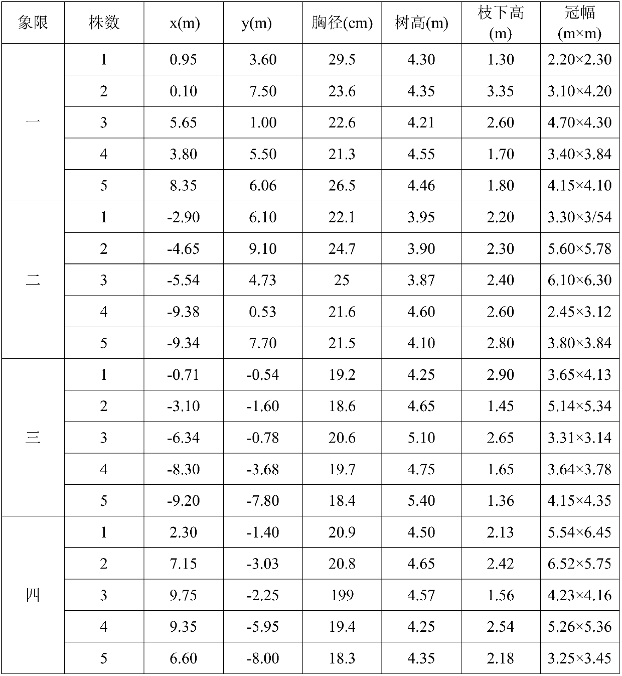
[0018] Specific implementation mode 1: This implementation mode is a sample survey method for obtaining precise spatial positioning data of forest communities, which is specifically completed according to the following steps:

[0019] 1. Layout of forest quadrats:

[0020] First, determine the total number of sample quadrats to be surveyed according to the size of the forest area in the research area. The total area of ​​the sample quadrats accounts for 1% to 5% of the forest area in the research area, and then use stratified random sampling to carry out the layout of specific survey sample quadrats; Stratified random sampling is specifically as follows: on the basis of stratified sampling, random sampling is used for each stratum, and on the basis of stratification, the total sampling amount is allocated according to the volume of each stratum, when (maximum value - minimum value ) / 4<the mean difference of each stratum<(maximum value-minimum value) / 2, random sampling shall be...

specific Embodiment approach 2

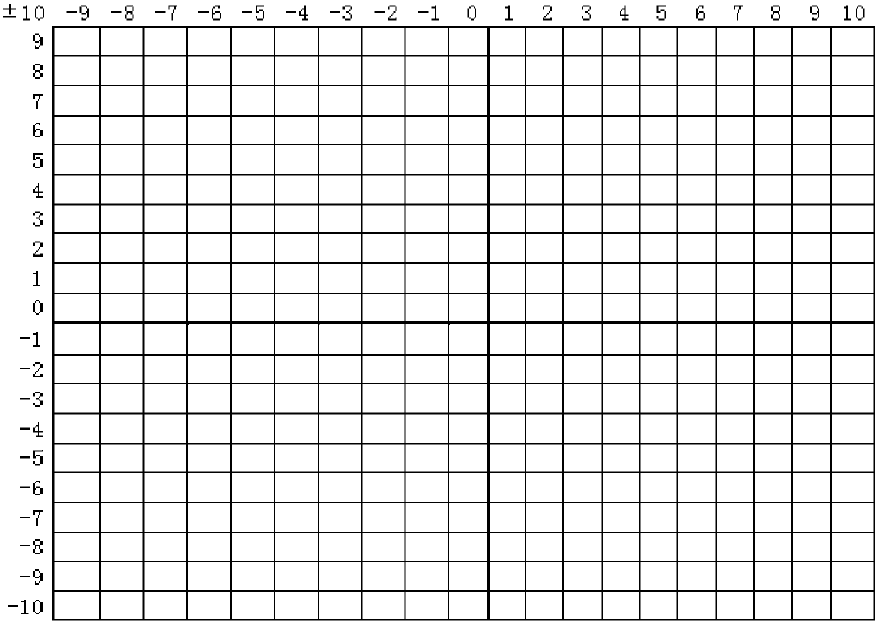
[0027] Specific embodiment 2: The difference between this embodiment and specific embodiment 1 is that in step 2, the measuring rope is used to take true north as y positive axis, true south as y negative axis, true east as x positive axis, and true west as x Negative axis, take 1m as a unit length, fix two vertically intersecting measuring ropes on the ground, and divide the quadrat with an area of ​​(10~30)m×(10~30)m into 4 (5~15)m × (5 ~ 15) m quadrant. Others are the same as the first embodiment.

specific Embodiment approach 3

[0028] Embodiment 3: The difference between this embodiment and Embodiment 1 or 2 is that in Step 2, the central point of the sample plot is taken as the reference, and the area of ​​the sample plot is 30m×30m. Others are the same as those in Embodiment 1 or 2.


PUM


Abstract

The invention discloses a quadrat investigation method for obtaining the accurate spatial positioning data of a forest community, and relates to an investigation method for collecting the individual data and the site data of a plant after sample plot plant data is subjected to accurate spatial positioning in the forest ecological environment. The invention aims to solve the problem that a traditional quadrat method and circle sample method can not accurately obtain the vegetation data of the inner space of the forest community. The quadrat investigation method comprises the following steps that: 1: adopting stratified random sampling to carry out specific investigated quadrat arrangement; 2: carrying out plant fixing and sampling; and 3: referring to a UFORE (urban forest effects) model field investigation manual to measure the canopy density, the crown breadth, the height of tree, the clear bole height and the diameter class index of each plant. The method has the advantages that: 1:the method is favorable for observing the horizontal structure of a community; 2: the method is favorable for tracking the growth change situation of each sample point which is specific to an individual; 3: subjectivity, a data size and errors are reduced, and manpower and materials are saved; and 4: data accuracy is greatly improved. The method is mainly used for the quadrat investigation of theaccurate spatial positioning data of the forest community.

Description

technical field [0001] The invention relates to an investigation method for collecting plant individual data and site data after precise spatial positioning of sample plot plant data in a forest ecological environment. Background technique [0002] As an important component of terrestrial ecosystems, forests play an irreplaceable role in optimizing the ecological environment, maintaining ecological security, and safeguarding ecological civilization. The spatial layout of forest communities is a key link in forest planning and management. In the case of similar forest stands, similar plant numbers, and similar growth conditions, the spatial structure of the community directly affects ecological effects such as cooling and humidification, which can lead to significant differences in ecological functions. . The structure of the forest community comes from the design, and to seek to maximize the ecological benefits, sufficient attention should be given to the study of the spati...

Claims


Application Information

Patent Timeline
IPC IPC(8): G06F17/30G06Q50/02G01S19/42
CPCG01S19/42G06Q50/02G06F16/29
Inventor 郑海峰任志彬何兴元李茗蕊张斯屿沈国强唐泽
Owner NORTHEAST INST OF GEOGRAPHY & AGRIECOLOGY C A S
Features
  • R&D
  • Intellectual Property
  • Life Sciences
  • Materials
  • Tech Scout
  • Unparalleled Data Quality
  • Higher Quality Content
  • 60% Fewer Hallucinations
Learn More