Method and apparatus for identifying forest hotspots based on multi-source satellite monitoring

A hotspot identification and hotspot technology, applied in the field of satellite remote sensing monitoring, to achieve the effect of improving recognition accuracy and resolution efficiency

Active Publication Date: 2018-04-20
北京中科锐景科技有限公司
View PDF19 Cites 3 Cited by
  • Summary
  • Abstract
  • Description
  • Claims
  • Application Information

AI Technical Summary

Problems solved by technology

[0004] In view of this, the embodiment of the present application provides a method and equipment for identifying forest hotspots based on multi-source satel

Method used


Image

  • Method and apparatus for identifying forest hotspots based on multi-source satellite monitoring
  • Method and apparatus for identifying forest hotspots based on multi-source satellite monitoring
  • Method and apparatus for identifying forest hotspots based on multi-source satellite monitoring

Examples


Embodiment Construction

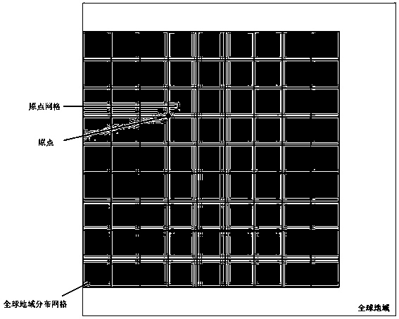
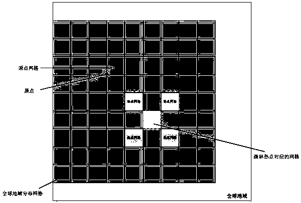
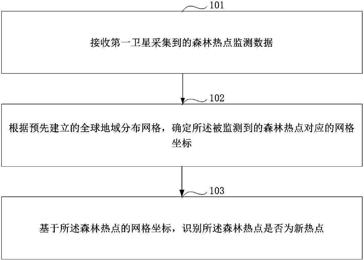
[0022] In order to make the purpose, technical solution and advantages of this application clearer, the embodiment of this application provides a method and equipment for identifying forest hotspots based on multi-source satellite monitoring. Whether the forest hotspots are emerging hotspots or continuing hotspots improves the recognition accuracy of forest hotspots, and then effectively numbers the detected forest hotspots, improves the resolution efficiency of forest hotspots, and provides valuable time guarantee for subsequent forest fire processing .

[0023] It should be noted that the forest hotspots described in the embodiments of the present application refer to areas where forest fires occur.

[0024] The multi-source satellites described in the embodiments of this application refer to a variety of different types or multiple satellites. During the process of orbiting the earth, the satellites use remote sensing technology to scan the earth's surface, and then can obt...


PUM


Abstract

The present application discloses a method and apparatus for identifying forest hotspots based on multi-source satellite monitoring. The method includes the following steps: forest hot spot monitoringdata collected via a first satellite is received, and the forest hot spot monitoring data includes position information of at least one monitored forest hotspot; according to a pre-established globalgeographical distribution grid, grid coordinates corresponding to the monitored forest hotspot are determined; based on the grid coordinates of the forest hotspot, whether the forest hotspot is a newhotspot is determined. Via use of te global geographical distribution grid, whether the monitored forest hotspot is a new hotspot or a continued hotspot, forest hotspot identification accuracy is improved, the monitored forest hotspot can be effectively numbered, forest hotspot distinguishing efficiency can be improved, and valuable time guarantee can be provided for dealing with subsequent forest fires.

Description

technical field [0001] This application relates to the field of satellite remote sensing monitoring, in particular to a method and equipment for identifying forest hotspots based on multi-source satellite monitoring. Background technique [0002] As a valuable natural resource, forest is an important factor in maintaining ecological balance. However, as a serious natural disaster, forest fire needs to be effectively monitored so that relevant departments can be notified in time to control it. At present, there are many ways to monitor forest fires, and monitoring them through satellite remote sensing technology provides a huge support for the development and improvement of forest fire monitoring. [0003] When using satellite remote sensing technology to monitor forest fires, due to the limitations of the inherent parameters of satellites, the forest hotspots detected by different satellites may be the same or different. For satellite 2, it may not be detected when it pass...

Claims


Application Information

Patent Timeline
IPC IPC(8): G08B17/00G08B17/12
CPCG08B17/005G08B17/12
Inventor 陶金花柴向停夏石明王子峰
Owner 北京中科锐景科技有限公司
Why Eureka
Try Eureka