Monitoring system and method of subgrade settlement
A monitoring system and roadbed technology, applied in measurement devices, surveying and navigation, height/level measurement, etc., can solve the problems of slow information transmission, the influence of scale expansion and contraction on accuracy, and the interference of filling construction, and achieve the effect of improving convenience.
- Summary
- Abstract
- Description
- Claims
- Application Information
AI Technical Summary
Problems solved by technology
Method used
Image
Examples
Embodiment 1
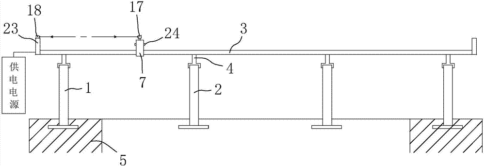
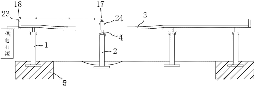
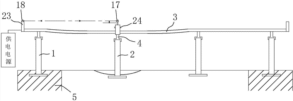
[0052] Based on the above content, this embodiment provides a monitoring system for subgrade settlement, combining figure 1 , figure 2 and image 3 As shown, it includes reference piles 1 arranged on the bedrock 5 at both ends of a section of roadbed, and several settlement piles 2 are arranged at equal intervals between the two reference piles 1 of the road foundation, and the reference piles 1 are arranged within the range of bedrock 5 of the roadbed , which does not undergo settlement deformation, the settlement pile 2 is arranged on the roadbed, and its height changes with the settlement deformation of the roadbed. In this embodiment, the height of the reference pile 1 and the settlement pile 2 above the ground is between 10 cm and 20 cm. The distance between two adjacent settlement piles 2 is distributed according to the soil quality of the subgrade, and is between 20m and 25m.
[0053] combine Figure 4 and Figure 5 As shown, the subgrade settlement monitoring sys...
Embodiment 2
[0072] Based on the foregoing, the present embodiment provides a method for monitoring subgrade settlement, comprising the following steps:
[0073] Arrangement steps: install benchmark piles 1 on the bedrock 5 at both ends of a section of roadbed, arrange a number of settlement piles 2 at equal intervals between the two benchmark piles 1, and erect guide rails 3 on the benchmark piles 1 and settlement piles 2 through support rods 4 superior;
[0074] Monitoring steps: control the monitoring vehicle to travel along the guide rail 3, the monitoring vehicle stays on the guide rail 3 above each settlement pile 2 one by one to obtain the vehicle body height value, and send the obtained vehicle body height value to the monitoring center for real-time monitoring;
[0075] Circulation steps: After the monitoring vehicle completes the section of roadbed along the guide rail 3, it restarts after a preset period and moves in the reverse direction along the guide rail 3 to repeat the monit...
PUM
 Abstract
Description
Claims
Application Information
 - R&D
- Intellectual Property
- Life Sciences
- Materials
- Tech Scout
- Unparalleled Data Quality
- Higher Quality Content
- 60% Fewer Hallucinations
Browse by: Latest US Patents, China's latest patents, Technical Efficacy Thesaurus, Application Domain, Technology Topic, Popular Technical Reports.
© 2025 PatSnap. All rights reserved.Legal|Privacy policy|Modern Slavery Act Transparency Statement|Sitemap|About US| Contact US: help@patsnap.com


