Tile map with time dimension and service method thereof

A tile map and time dimension technology, applied in the field of map services, can solve the problems of resource waste, no time dimension, and inability to directly express temporal information, etc., and achieve the effect of saving resources

Inactive Publication Date: 2018-07-06
CHINARS GEOINFORMATICS GUANG DONG +2
View PDF5 Cites 1 Cited by
  • Summary
  • Abstract
  • Description
  • Claims
  • Application Information

AI Technical Summary

Problems solved by technology

[0003] A single tile map service such as WMS, WMS-C, WMTS, TMS, KML or XYZ and other standard tile services has no time dimension and cannot directly express temporal information; tile maps can only express temporal information through multiple Service, each service expresses a time information to express temporal information, which causes a waste of resources

Method used


Image

  • Tile map with time dimension and service method thereof
  • Tile map with time dimension and service method thereof

Examples


Embodiment

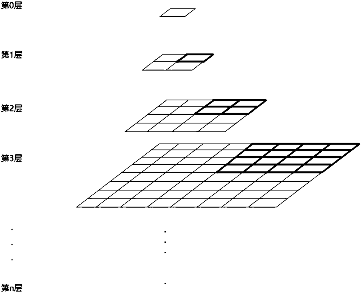
[0027] refer to figure 1 , the usual tile pyramid is to layer the data, and the resolution of adjacent layers has a 2-fold relationship; Adjacent 4 tiles form a 2×2 tile matrix, which just corresponds to a tile at the same geographical range in a layer with a larger resolution.

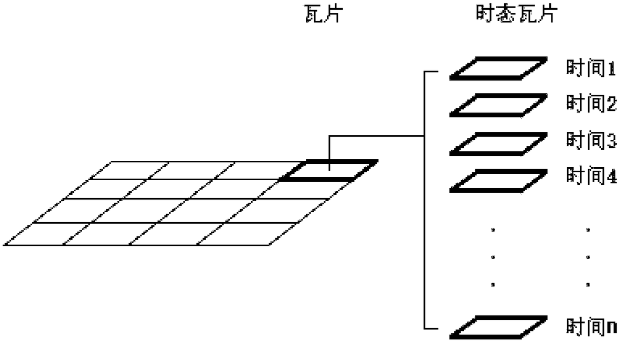
[0028] The convenient-to-use tile map with time dimension described in the present invention is a temporal tile map. By expanding the tile pyramid structure and combining the characteristics of the data, the tile pyramid is combined with the time dimension to construct a temporal Tile pyramid structure. The temporal tile map is obtained by extending the tile map on the basis of the tile pyramid. The extension method is: for a tile of the tile pyramid, expand it into a group consisting of multiple tiles with temporal information (also called The tile group composed of tiles of time information), the tile group is the temporal tile, and the specific structure refers to figure 2 . Therefore, the til...


PUM


Abstract

The invention discloses a tile map with a time dimension and a service method thereof. The tile map is a temporal tile map which is obtained by expanding the tile map on the basis of a tile pyramid, wherein the expansion method includes the step of expanding a tile of the tile pyramid into a group of tile group consisting of a plurality of temporal information tiles, wherein the tile group is temporal tiles. According to the method, through expansion of the tile pyramid structure and combination of data characteristics, the tile pyramid and the time dimension are combined to construct a temporal tile pyramid structure, a standard service interface is extended, parameters such as starting time, end time and matching type are added to match the tile data in one period of time or the tile data closest to a time point (the end time), or precisely match a tile data function of the time point, different temporal tile data are accessed in a single tile map service, thus the temporal information can be directly expressed and the resource is saved.

Description

technical field [0001] The invention relates to the technical field of map services, in particular to a tile map with a time dimension and a service method thereof. Background technique [0002] The tile map pyramid model is a multi-resolution hierarchical model, refer to figure 1 , from the bottom to the top of the tile pyramid, the resolution gets lower and lower, but the geographic range represented remains the same. Now more and more map services use tile technology. For example, the Tiantu map service released in my country now uses map tile technology. In fact, the map tile after slicing is a raster image and does not have positioning information. However, after the slice uses the relevant slicing algorithm, the specific positioning position can be calculated. For example, use the WGS84 geodetic coordinate system as the spatial reference to slice the map, and use a certain slicing algorithm, such as dividing the map tiles with the latitude and longitude steps in equa...

Claims


Application Information

Patent Timeline
Patent Type & Authority Applications(China)
IPC IPC(8): G06F17/30
CPCG06F16/29
Inventor 王晋年龚正坤肖少林周朝龙郭泽亮
Owner CHINARS GEOINFORMATICS GUANG DONG
Why Eureka
Try Eureka