A Satellite Remote Sensing Estimation Method of Surface Soil Moisture Content without the Effect of Vegetation Coverage
A soil water content and satellite remote sensing technology, which is applied in the field of satellite remote sensing estimation of surface soil water content affected by vegetation cover, and can solve the problem of less estimated soil water content
- Summary
- Abstract
- Description
- Claims
- Application Information
AI Technical Summary
Problems solved by technology
Method used
Image
Examples
Embodiment 1
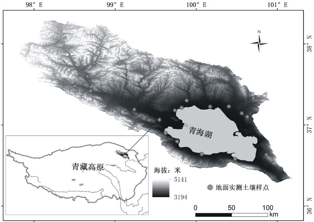
[0104] This embodiment provides a method for estimating surface soil water content by satellite remote sensing without the influence of vegetation coverage. The steps of this method include (1) materials and data; (2) calculation of auxiliary parameters (calculation of surface albedo and vegetation coverage); (3) Decompose the bare soil albedo from the surface albedo; (4) Remote sensing estimation model and mapping of soil moisture content; (5) Evaluation of the accuracy of the estimation method.
[0105] (1) Materials and data
[0106] (a) Measured data of soil moisture content
[0107] Field soil samples were collected from September 27 to October 4, 2016. Soil samples from the surface (0-10 cm, 10-20 cm, 20-30 cm) were taken by the ring knife method. After the sample is brought back to the laboratory, it is measured as follows:
[0108] Preparations: number and weigh the aluminum boxes indoors, and record the weight as W 0 .
[0109] Sampling: Take about 50 g of the so...
Embodiment 2
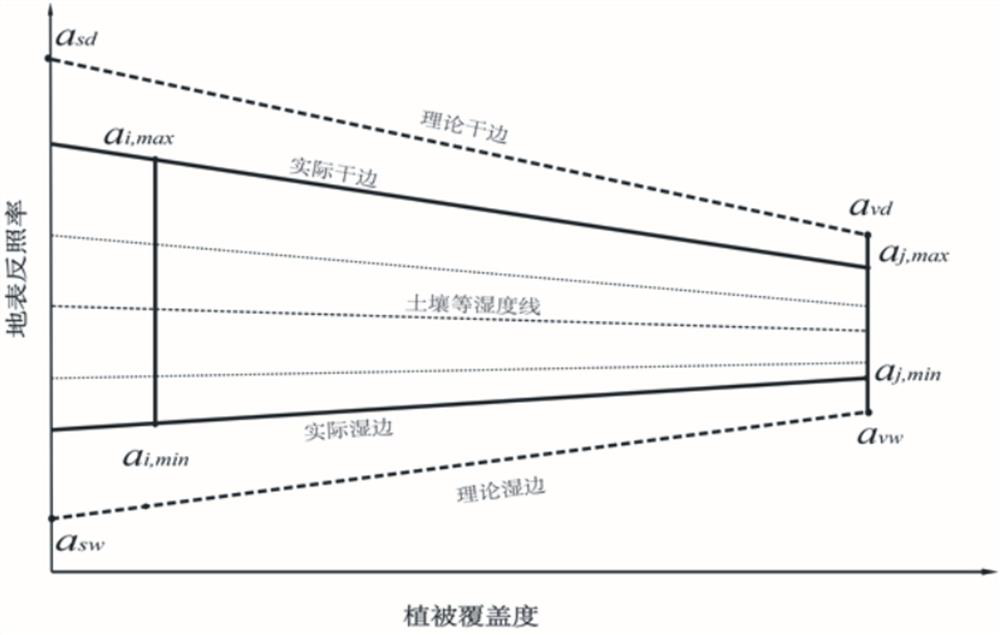
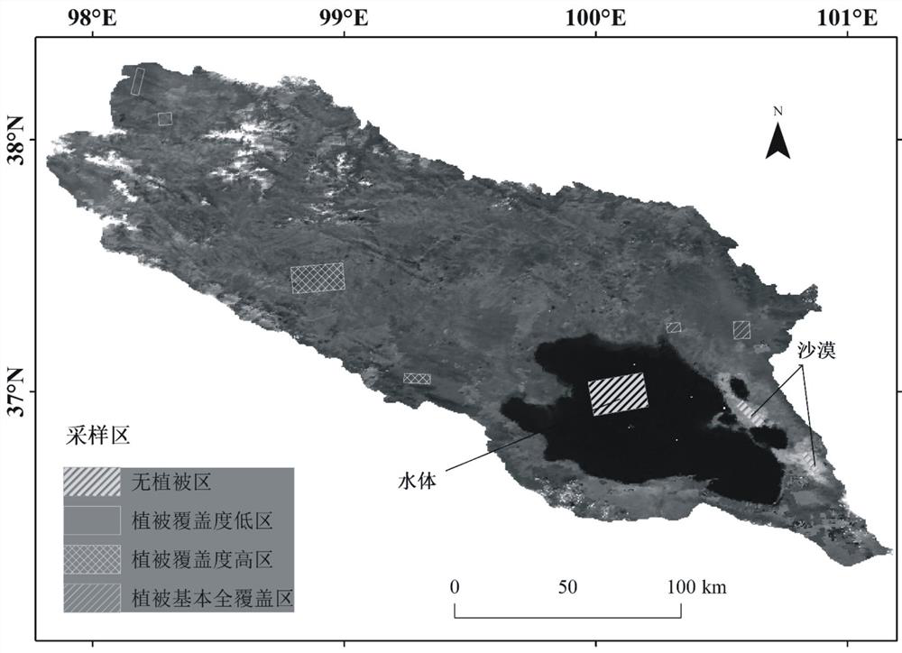
[0184] Example 1 is to visually select typical features on the remote sensing image (requires a professional technical background in remote sensing to accurately identify these typical features), and then obtain the vegetation coverage and surface albedo values of these typical features at the geographic location, and draw The actual surface albedo-vegetation coverage trapezoidal space. In order to make this method more general, the research area can be divided into a certain number of grids, and then the vegetation coverage and surface albedo values at each grid position can be extracted, and then the actual surface albedo-vegetation coverage can be drawn trapezoidal space. The specific method is as follows:
[0185] First, use the fishnet tool of ArcGIS 10 software to divide the research area into a grid of 500 m*500 m (if the research area is large, it can be divided into grids of 1 km*1 km or 10 km*10 km).
[0186] Then, use the Extract MultiValues To Points tool o...
PUM
 Abstract
Description
Claims
Application Information
 - R&D
- Intellectual Property
- Life Sciences
- Materials
- Tech Scout
- Unparalleled Data Quality
- Higher Quality Content
- 60% Fewer Hallucinations
Browse by: Latest US Patents, China's latest patents, Technical Efficacy Thesaurus, Application Domain, Technology Topic, Popular Technical Reports.
© 2025 PatSnap. All rights reserved.Legal|Privacy policy|Modern Slavery Act Transparency Statement|Sitemap|About US| Contact US: help@patsnap.com


