Satellite remote sensing estimation method for surface soil moisture capable of removing vegetation cover influence

A soil water content and surface soil technology is applied in the field of satellite remote sensing estimation of surface soil water content to remove the influence of vegetation cover, which can solve the problem of less soil water content estimation.

Inactive Publication Date: 2018-10-30
QINGHAI NORMAL UNIV
View PDF6 Cites 12 Cited by
  • Summary
  • Abstract
  • Description
  • Claims
  • Application Information

AI Technical Summary

Problems solved by technology

Because it is easy to operate, it can be combined with other models to estimate vegetation transpiration, surface flux, and soil evaporation, but the estimation of soil water content is less

Method used


Image

  • Satellite remote sensing estimation method for surface soil moisture capable of removing vegetation cover influence
  • Satellite remote sensing estimation method for surface soil moisture capable of removing vegetation cover influence
  • Satellite remote sensing estimation method for surface soil moisture capable of removing vegetation cover influence

Examples


Embodiment 1

[0104] This embodiment provides a satellite remote sensing estimation method of surface soil water content that removes the influence of vegetation cover. The steps of this method include (1) materials and data; (2) auxiliary parameter calculation (surface albedo, vegetation coverage calculation); (3) Decompose the bare soil albedo from the surface albedo; (4) Remote sensing estimation model and mapping of soil water content; (5) Evaluation of the accuracy of estimation methods.

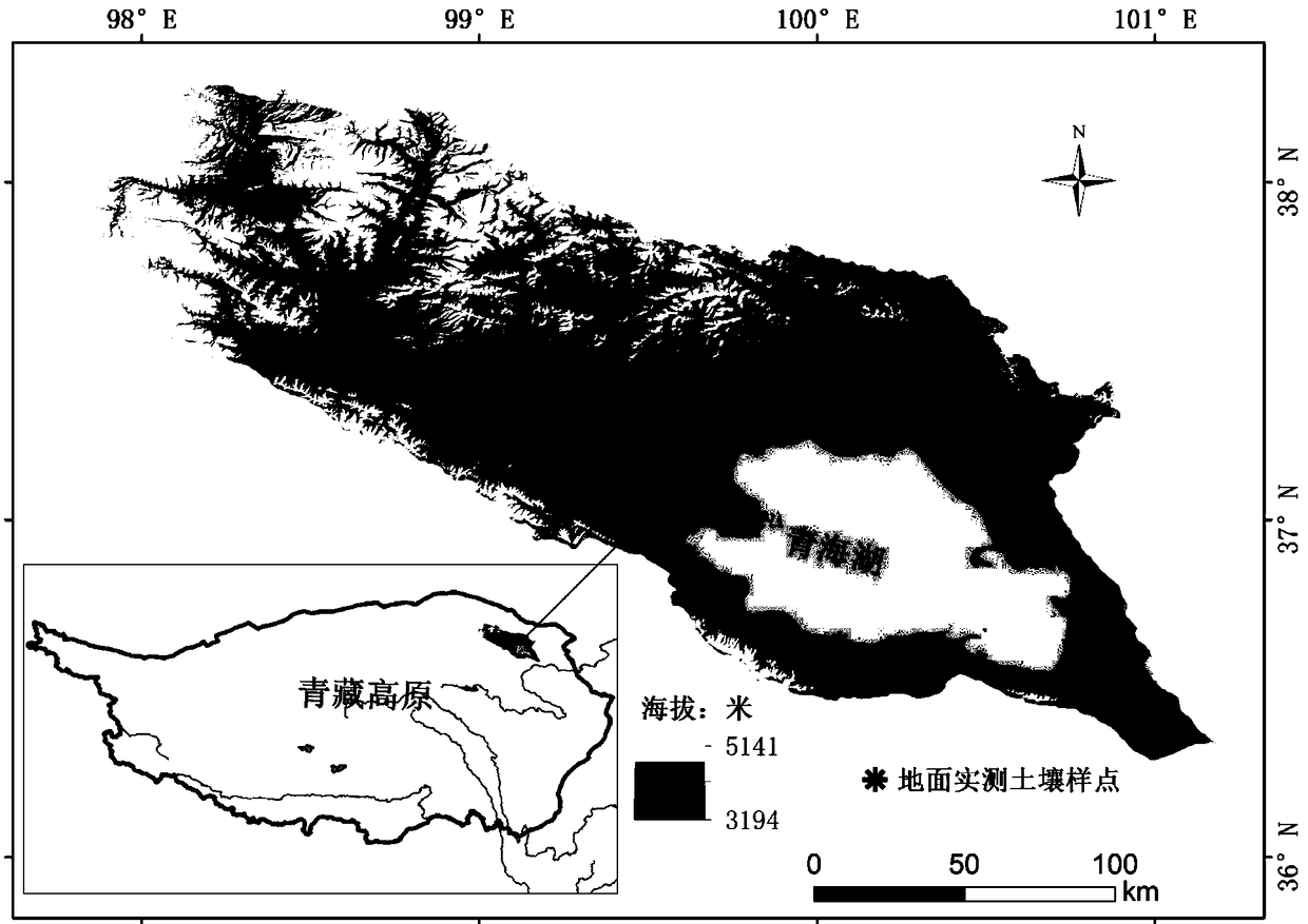
[0105] (1) Materials and data

[0106] (A) Measured data of soil water content

[0107] From September 27 to October 4, 2016, field soil samples were collected. Use the ring knife method to take soil samples from the ground (0-10 cm, 10-20 cm, 20-30 cm). After the sample is brought back to the laboratory, measure it according to the following steps:

[0108] Preparation: Number and weigh the aluminum boxes indoors, and record the weight as W 0 .

[0109] Sampling: Take about 50 g of soil sample with 0-10 cm...

Embodiment 2

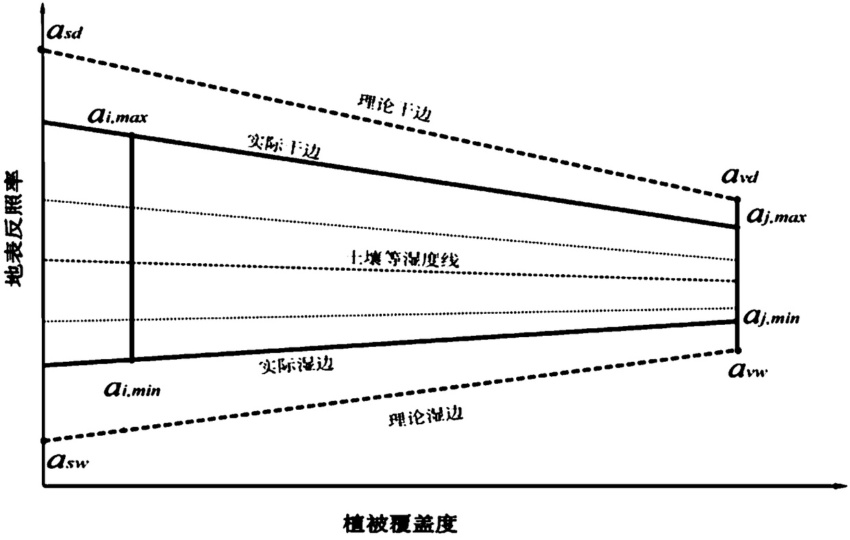
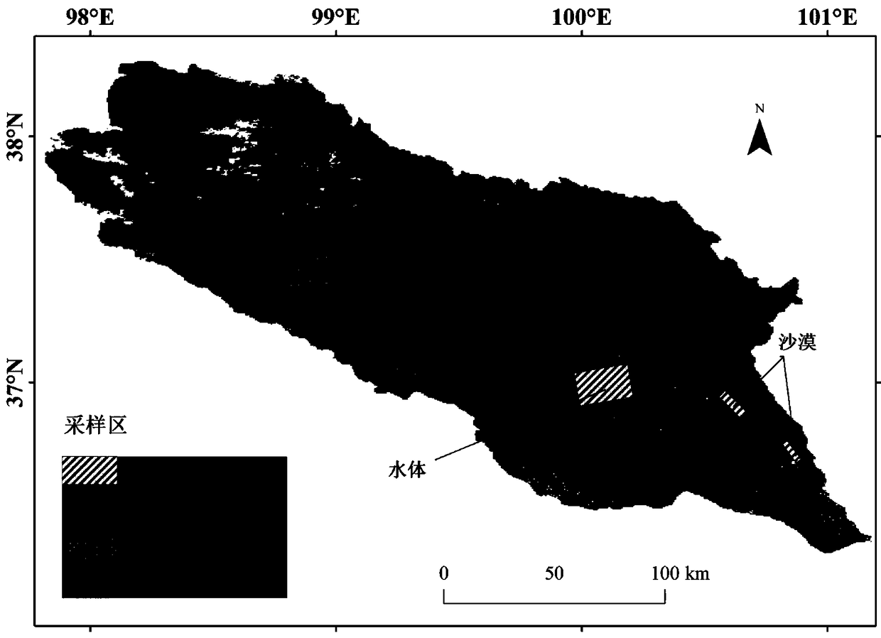
[0184] Example 1 is to visually select typical features on remote sensing images (requires professional technical background in remote sensing to accurately identify these typical features), and then obtain the vegetation coverage and surface albedo values ​​of these typical features in their geographic locations, and draw The actual ground albedo-vegetation coverage trapezoidal space. In order to make this method more universal, the research area can be divided into a certain number of grids, and then the vegetation coverage and surface albedo values ​​at each grid location can be extracted, and then the actual surface albedo-vegetation coverage can be drawn Trapezoid space. The specific method is as follows:

[0185] First, use the fishnet tool of ArcGIS 10 software to divide the study area into a grid of 500 m*500 m (if the study area is large, it can be divided into 1 km*1 km or 10 km*10 km grids).

[0186] Then, the Extract MultiValues ​​To Points tool of the ArcGIS 10 softw...


PUM


Abstract

The invention provides a satellite remote sensing estimation method for surface soil moisture capable of removing vegetation cover influence. The method comprises the following steps: (1) preparing materials and data; (2) auxiliary parameter calculation (calculation of surface albedo and vegetation coverage); (3) resolving bare soil albedo from the surface albedo; (4) sensing estimation of soil moisture and drafting; (5) evaluating the accuracy of the estimation method. According to the method disclosed by the invention, the soil moisture is calculated by directly using the bare soil albedo, the remote sensing physical significance is clear, and essential intension of the soil moisture subjected to remote sensing estimation is prominent; the defect in the traditional method (a method basedon the surface albedo, such as, Peihao, et. al, 1999) that intermediate parameters need to be calculated and measured is overcome, propagation of errors among the parameters is avoided, any excessiveintermediate link does not exist, and the operation is simple and feasible; regional condition constraint that has to be owned by the traditional method (such as an optical vegetation coverage method) is broken. According to the method, the surface soil moisture in any large region can be reliably and stably estimated at high accuracy.

Description

Technical field [0001] The invention relates to the application technology of satellite remote sensing, in particular to a satellite remote sensing estimation method of surface soil water content to remove the influence of vegetation coverage. Background technique [0002] Soil water content is the basic condition for plant growth and development, as well as an effective factor for drought monitoring in agriculture and animal husbandry, and has a profound impact on various physical and chemical properties of soil. It participates in the material energy cycle of the biosphere and atmosphere, and indirectly determines and changes the absorption, reflection and emission of solar short-wave radiation and long-wave radiation on the surface of the land, thereby affecting the energy balance of the earth system. Therefore, soil water content plays an important role in the research of agriculture, terrestrial ecosystems, climate and other fields. The accurate and rapid determination of it...

Claims


Application Information

Patent Timeline
Patent Type & Authority Applications(China)
IPC IPC(8): G01N21/17
CPCG01N21/17G01N2021/1765G01N2021/178G01N2021/1797
Inventor 吴成永陈克龙曹广超鄂崇毅高小红巴丁求英蒋刚
Owner QINGHAI NORMAL UNIV
Why Eureka
Try Eureka