
Navigation path planning method and system

A technology for navigating routes and planning systems, applied in the field of physical instruments, can solve problems such as poor user experience, and achieve the effect of improving user experience

Inactive Publication Date: 2019-01-04
WM SMART MOBILITY (SHANGHAI) CO LTD
View PDF8 Cites 16 Cited by
  • Summary
  • Abstract
  • Description
  • Claims
  • Application Information

AI Technical Summary

Problems solved by technology

However, this kind of reminder does not combine the length of the user's journey or the information of the gas station or charging location on the itinerary. Usually, when receiving this kind of reminder, the vehicle is already in a state that needs to be refueled or charged immediately, which will cause extremely bad user experience

Method used


Image

  • Navigation path planning method and system
  • Navigation path planning method and system
  • Navigation path planning method and system

Examples


Embodiment Construction

[0057] The present invention will be described in detail below in conjunction with the accompanying drawings and specific embodiments. Note that the aspects described below in conjunction with the drawings and specific embodiments are only exemplary, and should not be construed as limiting the protection scope of the present invention.

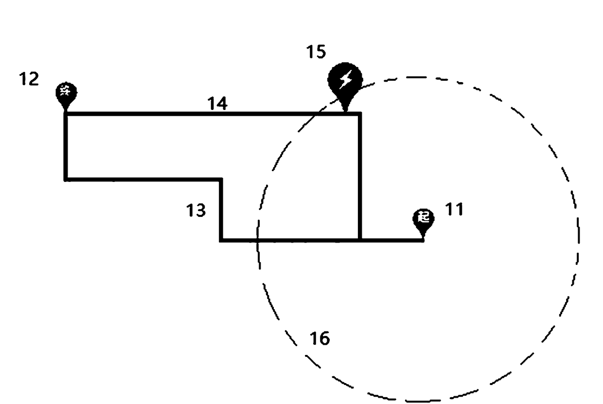
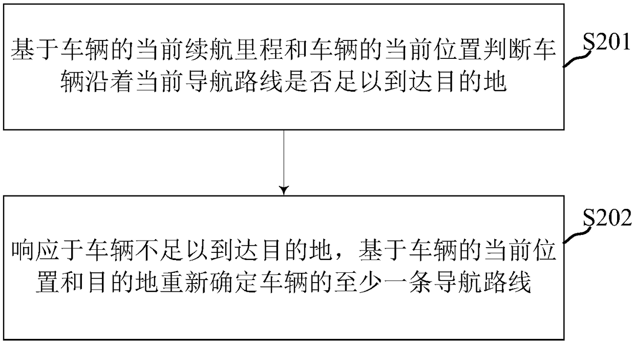
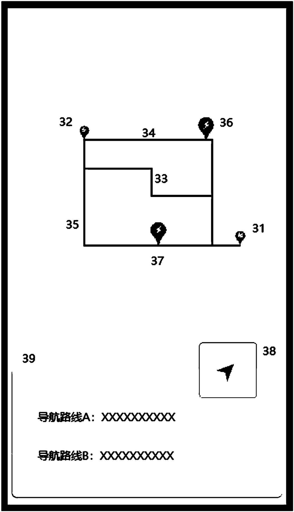
[0058] Such as figure 1 with figure 2 As shown, in order to continuously judge whether the vehicle can reach the destination based on the current cruising range of the vehicle during the vehicle navigation driving process, if not, provide the user with a personalized navigation route including the gas station or charging location that the vehicle can reach, The present invention provides an embodiment of a navigation route planning method, and the navigation route planning method may include:

[0059] S201: Based on the current cruising range of the vehicle and the current location 11 of the vehicle, it is judged whether the vehicle is suff...


PUM


Abstract

The invention relates to the field of physical instruments, and particularly discloses a navigation path planning method and system. The navigation path planning method is used for re-planning a navigation path for a vehicle with insufficient endurance mileage in the navigation driving process of the vehicle and includes the steps: judging whether the vehicle can reach a destination along a current navigation path or not based on the current endurance mileage of the vehicle and the current position of the vehicle; redetermining at least one navigation path of the vehicle based on the current position and the destination of the vehicle when the vehicle cannot reach the destination. Each redetermined navigation path comprises at least one charging place or filling station that the endurancemileage is enough to reach. The navigation path planning method can solve the technical problems that the energy deficiency reminding function of an existing vehicle cannot timely remind a user of charging or fuel filling due to no combination of the route of the user or information of filling stations or charging places on the route, and poor use experience is brought for the user.

Description

technical field [0001] The invention relates to the field of physical instruments, in particular to a navigation route planning system and method thereof, which are used for replanning a navigation route for a vehicle with insufficient mileage during vehicle navigation and driving. Background technique [0002] During the driving process, the driver can base on the estimated mileage and estimated time of the navigation route displayed by the navigation system, the remaining fuel volume of the fuel gauge displayed by the fuel vehicle and / or the estimated cruising range or the remaining battery system displayed by the new energy vehicle. Battery power and / or estimated cruising range to determine whether the vehicle needs to be refueled or charged. However, different driving habits, vehicle performance, and performance differences of battery packs of new energy vehicles will lead to continuous changes in the estimated cruising range and will show nonlinear changes with the incr...

Claims


Application Information

Patent Timeline
Patent Type & Authority Applications(China)
IPC IPC(8): G01C21/34
CPCG01C21/3469G01C21/3476
Inventor 金鑫垚程志俊
Owner WM SMART MOBILITY (SHANGHAI) CO LTD
Learn More