Remote Sensing Image Segmentation Method Combining Complete Residual and Feature Fusion
A remote sensing image and residual technology, applied in the field of remote sensing image processing, can solve the problems of improving grid segmentation accuracy, complex network structure, and memory consumption.
- Summary
- Abstract
- Description
- Claims
- Application Information
AI Technical Summary
Problems solved by technology
Method used
Image
Examples
Embodiment Construction
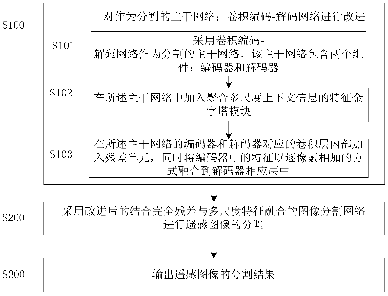
[0026] In one embodiment, such as figure 1 As shown, a remote sensing image segmentation method combining full residual and multi-scale feature fusion is disclosed, including the following steps:
[0027] S100: Improve the backbone network as a segmentation: convolutional encoding-decoding network, specifically:
[0028] S101: Using a convolutional encoding-decoding network as a segmented backbone network, the backbone network includes two components: an encoder and a decoder;
[0029] S102: Add a feature pyramid module for aggregating multi-scale context information to the backbone network;
[0030] S103: Add a residual unit in the convolutional layer corresponding to the encoder and decoder of the backbone network, and at the same time fuse the features in the encoder into the corresponding layer of the decoder in a pixel-by-pixel manner;
[0031] S200: Segmenting remote sensing images using an improved image segmentation network that combines full residuals and multi-scal...
PUM
 Abstract
Description
Claims
Application Information
 - R&D
- Intellectual Property
- Life Sciences
- Materials
- Tech Scout
- Unparalleled Data Quality
- Higher Quality Content
- 60% Fewer Hallucinations
Browse by: Latest US Patents, China's latest patents, Technical Efficacy Thesaurus, Application Domain, Technology Topic, Popular Technical Reports.
© 2025 PatSnap. All rights reserved.Legal|Privacy policy|Modern Slavery Act Transparency Statement|Sitemap|About US| Contact US: help@patsnap.com


