

Converged urban road network traffic estimation method based on taxi GPS data and bayonet data
A technology based on GPS data and urban road network, which is applied in traffic flow detection, road vehicle traffic control systems, instruments, etc., and can solve the problems of expensive bayonet point layout and few existing points
- Summary
- Abstract
- Description
- Claims
- Application Information
AI Technical Summary
Problems solved by technology
Method used
Image

Examples
Embodiment Construction
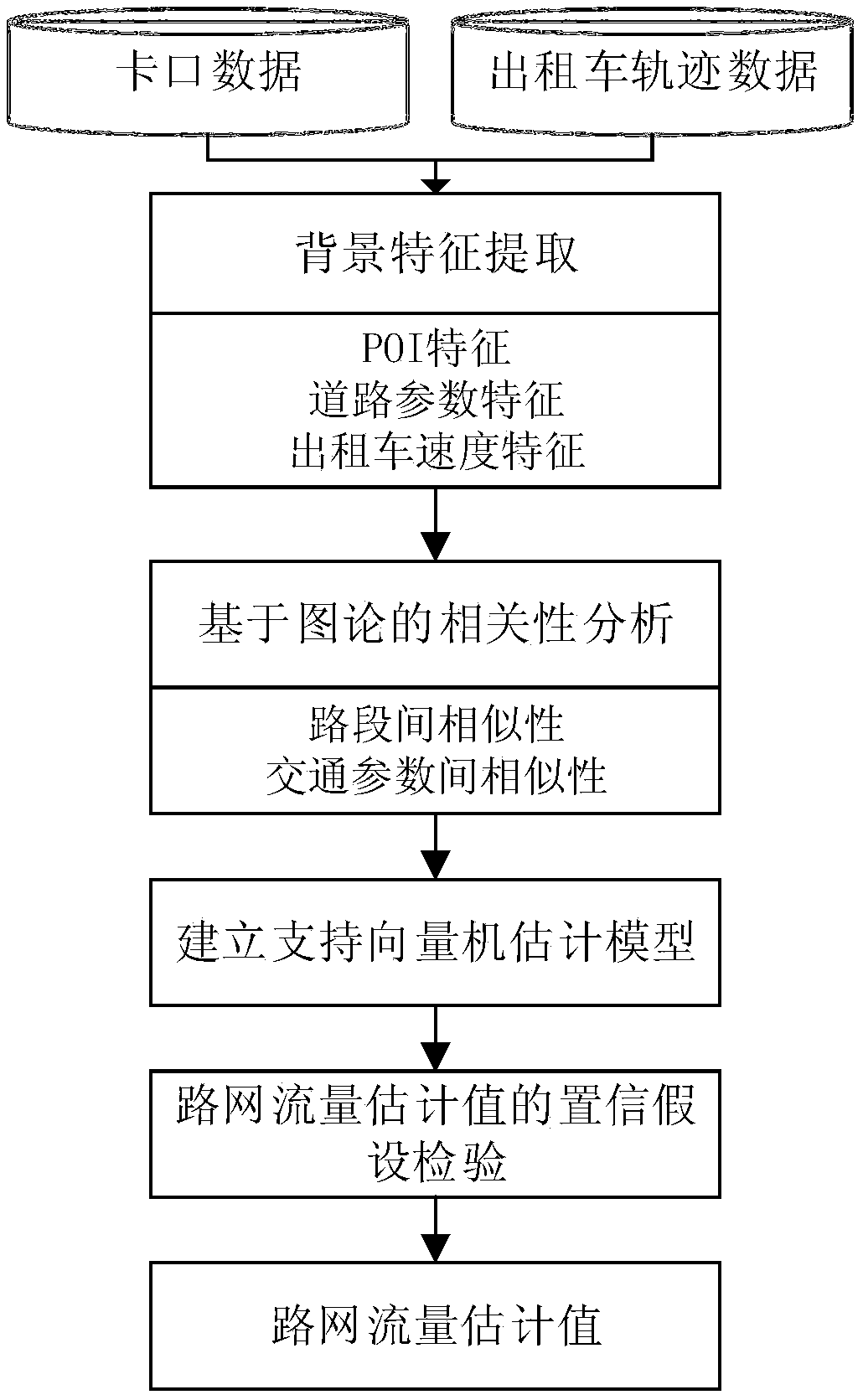
[0058] A method for estimating urban road network flow based on the fusion of taxi GPS data and checkpoint data, comprising the following steps:
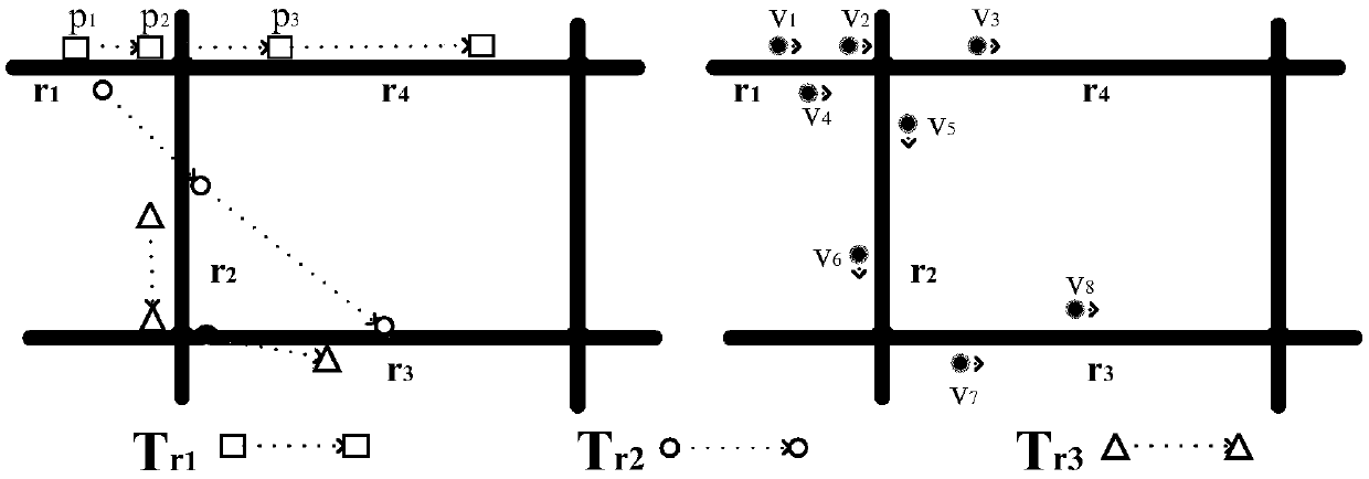
[0059] (1) Taxi GPS trajectory data mapping; use linear interpolation method to fill the road network coordinates, and map the taxi GPS trajectory data to the urban road network to analyze the taxi driving trajectory;
[0060] (2) Taxi speed feature extraction; calculate the average speed of two adjacent taxi GPS track points, and determine the average speed of taxis driving on the target road section through the total average speed, and count each taxi driving on the target road section The statistical value of the lower speed falling in each speed interval is used as a variable feature for flow estimation;
[0061] (3) Statistics of road network characteristics; statistics are carried out on the data detected by checkpoints in the road network, and the road grades and POI characteristics of all road sections in the road network ar...
PUM
 Abstract
Description
Claims
Application Information