Method and device for identifying geological structure of horizontal well
A technology of geological structure and identification method, applied in earthwork drilling, wellbore/well components, measurement, etc., can solve the problems of low identification accuracy and low resolution of seismic profile, etc.
- Summary
- Abstract
- Description
- Claims
- Application Information
AI Technical Summary
Problems solved by technology
Method used
Image
Examples
Embodiment Construction
[0027] In order to make the purpose, technical solutions and advantages of the embodiments of the present invention more clear, the embodiments of the present invention will be further described in detail below in conjunction with the accompanying drawings. Here, the exemplary embodiments and descriptions of the present invention are used to explain the present invention, but not to limit the present invention.
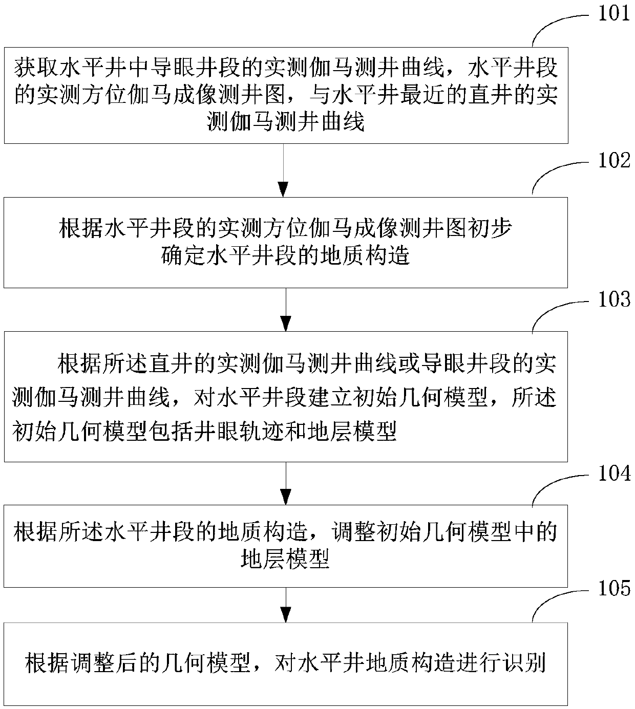
[0028] figure 1 It is a flow chart of the horizontal well geological structure identification method in the embodiment of the present invention, such as figure 1 As shown, the horizontal well geological structure identification method of the embodiment of the present invention includes:
[0029] Step 101, obtaining the measured gamma logging curve of the pilot hole section in the horizontal well, the measured azimuth gamma imaging logging map of the horizontal well section, and the measured gamma logging curve of the vertical well closest to the horizontal well;
[...
PUM
 Abstract
Description
Claims
Application Information
 - R&D
- Intellectual Property
- Life Sciences
- Materials
- Tech Scout
- Unparalleled Data Quality
- Higher Quality Content
- 60% Fewer Hallucinations
Browse by: Latest US Patents, China's latest patents, Technical Efficacy Thesaurus, Application Domain, Technology Topic, Popular Technical Reports.
© 2025 PatSnap. All rights reserved.Legal|Privacy policy|Modern Slavery Act Transparency Statement|Sitemap|About US| Contact US: help@patsnap.com


