Method for planning paths of unmanned aerial vehicles on basis of Q(lambda) algorithms

A path planning, UAV technology, applied in navigation calculation tools, vehicle position/route/altitude control, non-electric variable control and other directions, can solve problems such as difficulty in obtaining, large amount of computer information storage, and difficulty in determining rules.

Active Publication Date: 2019-04-19
NANJING UNIV OF POSTS & TELECOMM
View PDF5 Cites 41 Cited by
  • Summary
  • Abstract
  • Description
  • Claims
  • Application Information

AI Technical Summary

Problems solved by technology

[0004] The current local path planning technology has problems such as the algorithm is easy to fall into local minimum or local oscillation, the time cost of the algorithm is large, the computer information storage is large, and the rules are difficult to determine.
The behavior-based UAV path planning method

Method used


Image

  • Method for planning paths of unmanned aerial vehicles on basis of Q(lambda) algorithms
  • Method for planning paths of unmanned aerial vehicles on basis of Q(lambda) algorithms
  • Method for planning paths of unmanned aerial vehicles on basis of Q(lambda) algorithms

Examples


Embodiment Construction

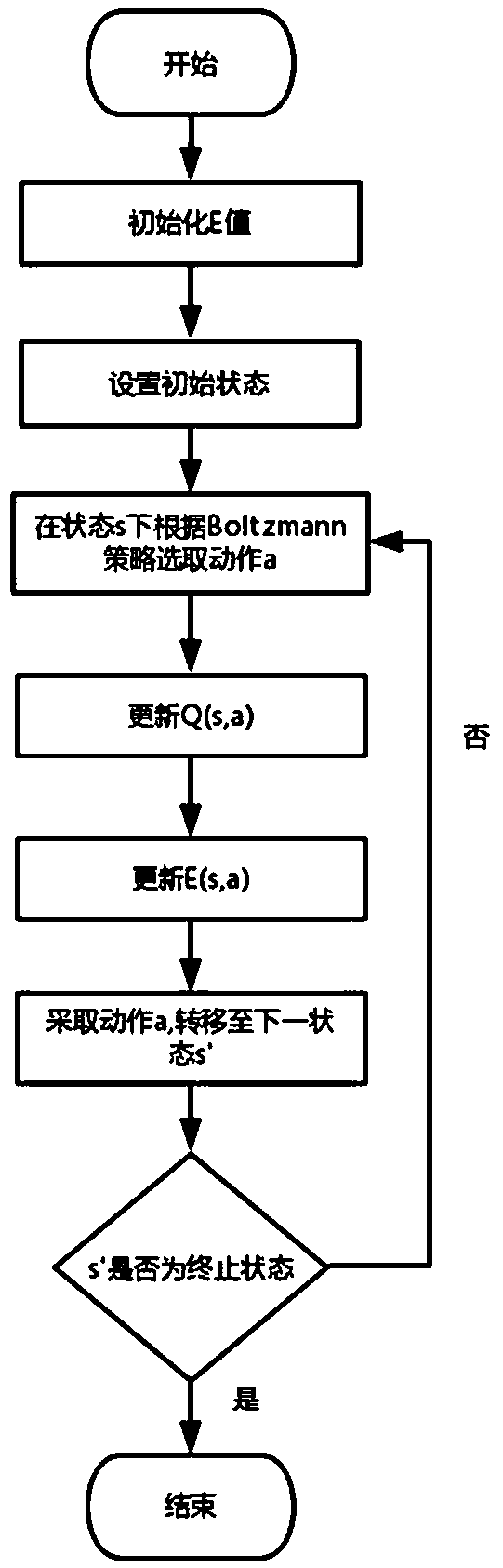
[0067] The present invention will be further explained below in conjunction with the accompanying drawings.

[0068] For the convenience of description, simply define the main variables in the algorithm:

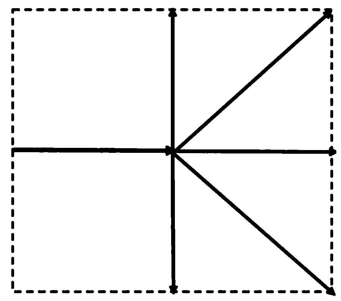
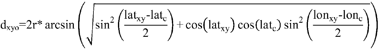
[0069] The latitude and longitude coordinates of the starting point of the UAV are S=(lon S ,lat S ), the longitude and latitude coordinates of the target point are T=(lon T ,lat T ), the size of the grid space is m*n, and the point coordinates in the grid space are (x, y). The Markov model is represented by a quadruple , S is the state space of the drone, A is the action space of the drone, R is the reward function, and P is the state transition probability matrix.

[0070] The present invention proposes a UAV path planning method based on the Q(λ) algorithm, including an environment modeling step, a Markov decision process model initialization step, a Q(λ) algorithm iterative calculation step, and calculating the optimal value according to the state value function. pa...


PUM


Abstract

The invention provides a method for planning tasks of unmanned aerial vehicles on the basis of Q(lambda) algorithms. The method includes a step of carrying out environment modeling, a step of initializing Markov decision process models, a step of carrying out Q(lambda) algorithm iterative computation and a step of computing the optimal paths according to state value functions. The method particularly includes initializing grid spaces according to the minimum flight path section lengths of the unmanned aerial vehicles, mapping coordinates of the grid spaces to obtain airway points and representing circular and polygonal threat regions; building Markov decision models, to be more specific, representing flight action spaces of the unmanned aerial vehicles, designing state transition probability and constructing reward functions; carrying out iterative computation on the basis of constructed models by the aid of the Q(lambda) algorithms; computing each optimal path of the corresponding unmanned aerial vehicle according to the ultimate convergent state value functions. The unmanned aerial vehicles can safely avoid the threat regions via the optimal paths computed according to the ultimate convergent state value functions. The method has the advantages that the traditional Q learning algorithms and effectiveness tracking are combined with one another, accordingly, the value functionconvergence speeds can be increased, the value function convergence precision can be enhanced, and the unmanned aerial vehicles can be guided to avoid the threat regions and autonomously plan paths.

Description

technical field [0001] The invention relates to an unmanned aerial vehicle, specifically a path planning method for an unmanned aerial vehicle, belonging to the technical field of heuristic algorithms. Background technique [0002] UAV path planning is an important part of UAV mission planning and an important stage to realize autonomous mission execution of UAV. UAV path planning requires that in an environment with known, partially known or completely unknown information, it is planned to reach the target point from the starting point, which can bypass the threat area and obstacles, be safe, reliable and collision-free, and meet various requirements at the same time. A flight path with constraints. According to the acquisition of the battlefield environment information where the UAV is located, the path planning is divided into global path planning and local path planning. [0003] In practical applications, if the UAV can acquire global environmental knowledge, dynamic ...

Claims


Application Information

Patent Timeline
IPC IPC(8): G01C21/20G05D1/10
CPCG05D1/101G01C21/20
Inventor 张迎周竺殊荣高扬孙仪张灿
Owner NANJING UNIV OF POSTS & TELECOMM
Why Eureka
Try Eureka