

Multilayer parking lot positioning method based on high-precision map data
A technology of map data and positioning method, which is applied to geographic information databases, services based on specific environments, and directions such as indicating the various open spaces of parking lots. Insufficient positioning accuracy and the effect of improving positioning accuracy
- Summary
- Abstract
- Description
- Claims
- Application Information
AI Technical Summary
Problems solved by technology
Method used
Image

Examples
Embodiment 1
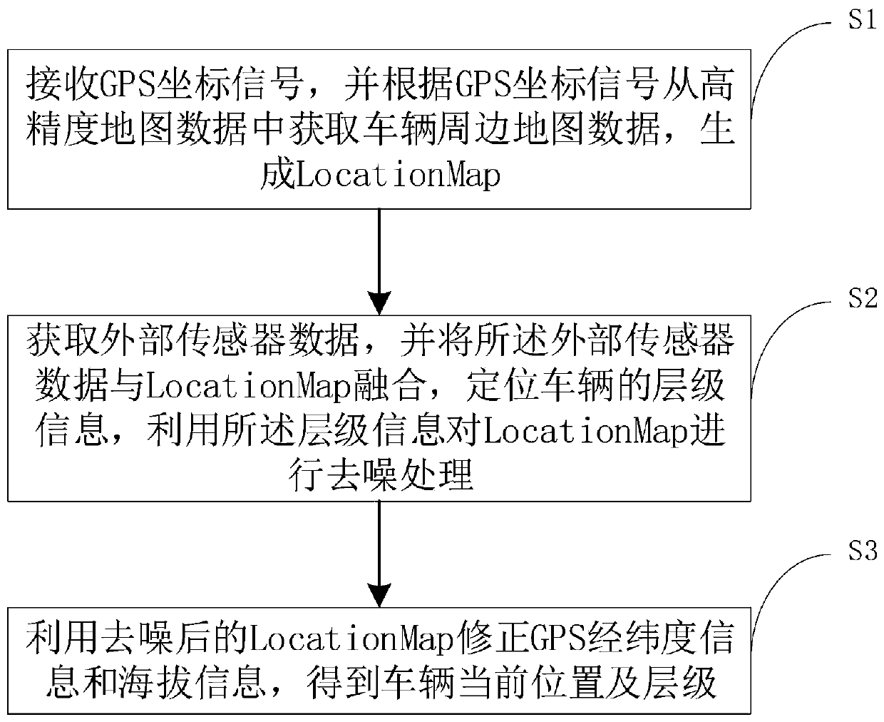
[0050] Such as figure 1 As shown, the embodiment of the present invention provides a multi-storey parking lot positioning method based on high-precision map data, including the following steps:
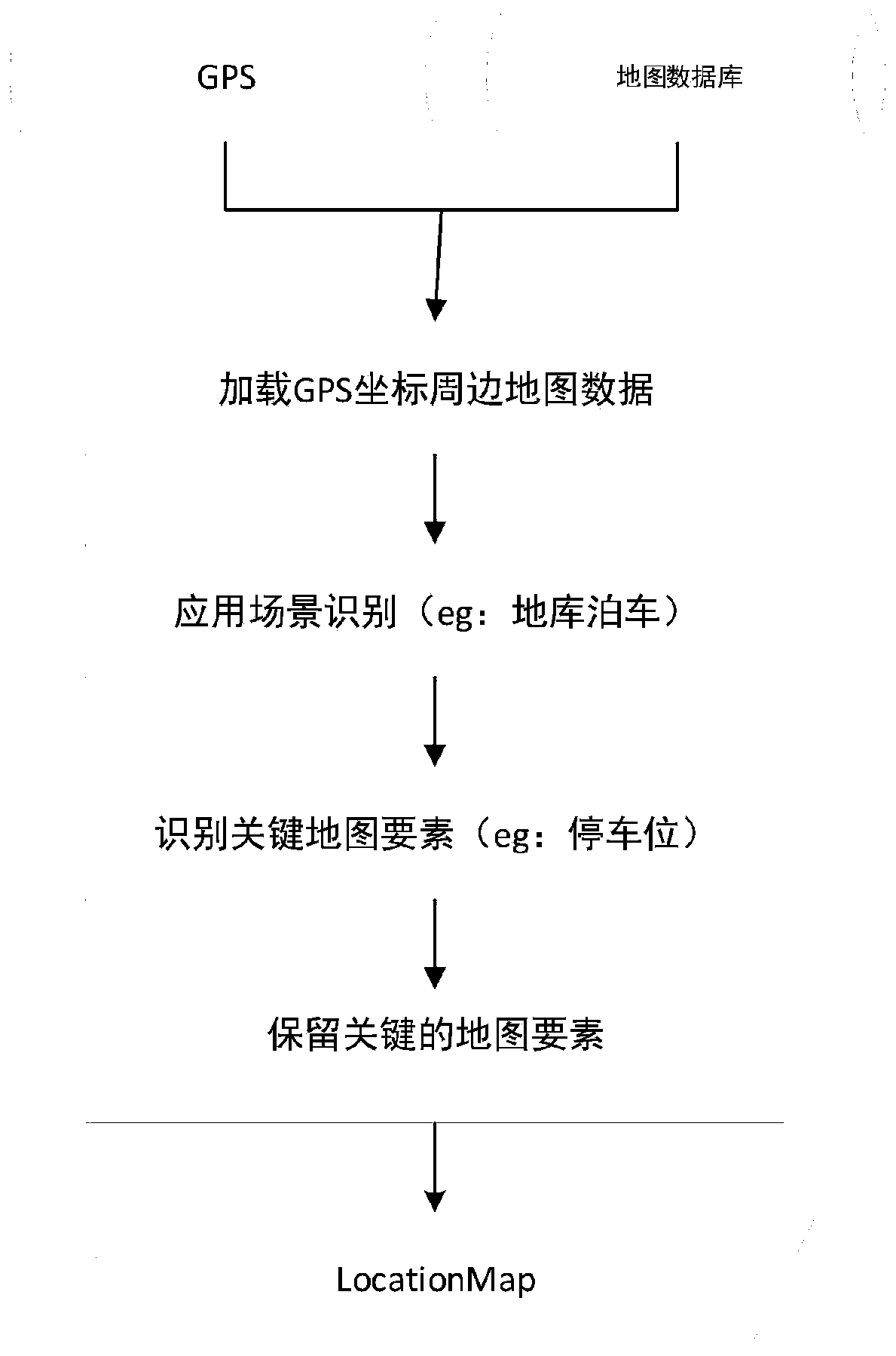
[0051] S1, receiving the GPS coordinate signal, and obtaining the map data around the vehicle from the high-precision map data according to the GPS coordinate signal, and generating a LocationMap; the LocationMap includes at least a preset range around the GPS coordinate position (for example, 100 meters centered on the GPS coordinate position , 50 meters, 30 meters) all parking space information and lane edge information;
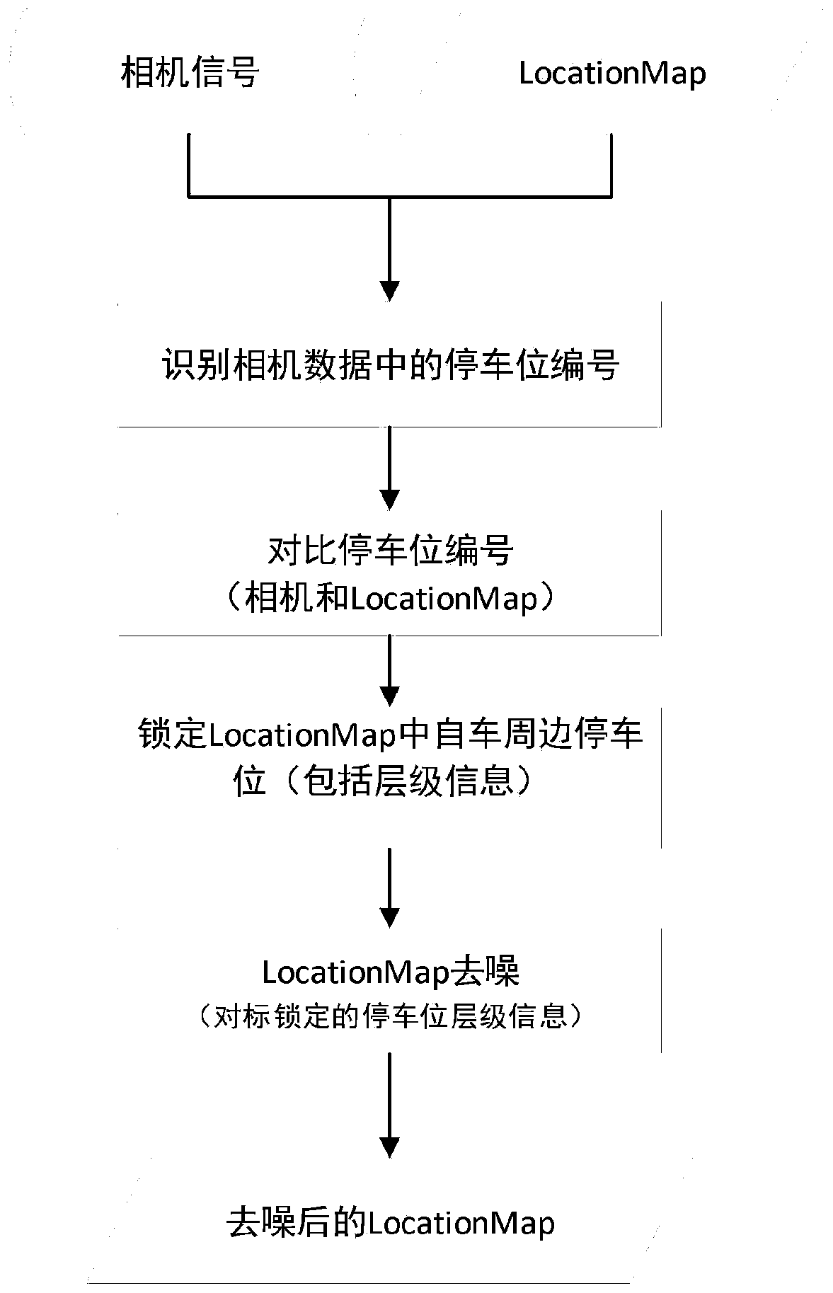
[0052]S2, acquiring external sensor data, and merging the external sensor data with LocationMap, locating the hierarchical information of the vehicle, and using the hierarchical information to perform denoising processing on LocationMap;
[0053] S3, using the denoised LocationMap to correct the GPS latitude and longitude information and altitude information to o...
Embodiment 2
[0072] Such as Figure 5 As shown, the embodiment of the present invention provides a multi-storey parking lot positioning system based on high-precision map data, including:
[0073] The LocationMap generation module is used to receive GPS coordinate signals, and obtain vehicle peripheral map data from high-precision map data according to the GPS coordinate signals to generate a LocationMap; the LocationMap includes at least all parking space information within a preset range around the GPS coordinate position and lane edge information;
[0074] The data fusion processing module acquires external sensor data, and fuses the external sensor data with the LocationMap, locates the hierarchical information of the vehicle, and uses the hierarchical information to perform denoising processing on the LocationMap;
[0075] The GPS correction and positioning module uses the denoised LocationMap to correct the GPS latitude and longitude information and altitude information to obtain th...
Embodiment 3
[0088] An embodiment of the present invention provides a multi-storey parking lot positioning device based on high-precision map data, including a processor and a memory;
[0089] The memory is a non-transitory computer readable storage medium for storing computer software programs;
[0090] The processor is used to read and execute the computer software program stored in the memory, so as to realize the positioning method of a multi-storey parking lot based on high-precision map data according to the first embodiment of the present invention.
[0091] It should be noted that the above logical instructions in the memory may be implemented in the form of software functional units and may be stored in a computer-readable storage medium when sold or used as an independent product. Based on this understanding, the technical solution of the embodiment of the present invention is essentially or the part that contributes to the prior art or the part of the technical solution can be e...
PUM
 Abstract
Description
Claims
Application Information