Method and device for identifying viaduct area in vehicle navigation, equipment and storage medium

A vehicle navigation and recognition method technology, applied in the field of non-transient computer-readable storage media, can solve the problems of inaccurate positioning of the starting point, wrong route judgment, inaccurate GPS, etc., so as to avoid manual switching of up and down elevated routes and improve accuracy , Improve the effect of user experience

Active Publication Date: 2019-12-27
APOLLO INTELLIGENT CONNECTIVITY (BEIJING) TECH CO LTD
View PDF14 Cites 8 Cited by
  • Summary
  • Abstract
  • Description
  • Claims
  • Application Information

AI Technical Summary

Problems solved by technology

However, due to the partial occlusion of the bridge, the GPS will be inaccurate or the up and down vertical elevations will easily lead to wrong route judgment. At this time, it is necessary to rely on manual switching of the navigation route, and when the navigation is started in the bridge area, the starting point cannot be accurately located at On the bridge or under the bridge, resulting in poor user experience

Method used


Image

  • Method and device for identifying viaduct area in vehicle navigation, equipment and storage medium
  • Method and device for identifying viaduct area in vehicle navigation, equipment and storage medium
  • Method and device for identifying viaduct area in vehicle navigation, equipment and storage medium

Examples


Embodiment Construction

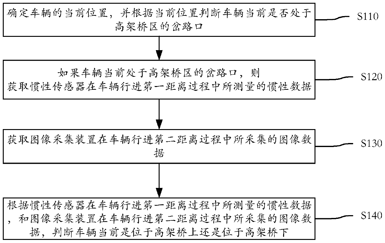
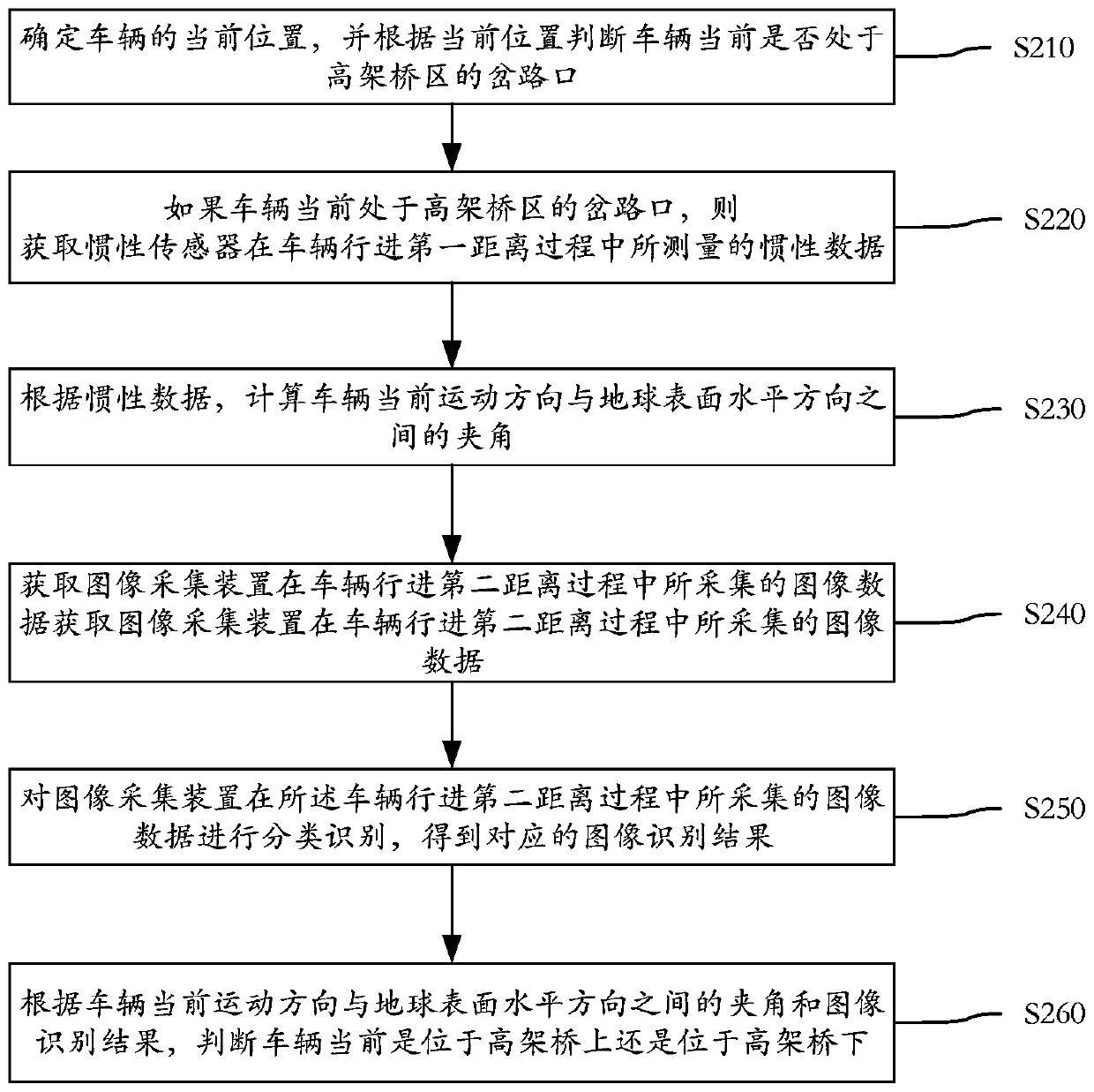
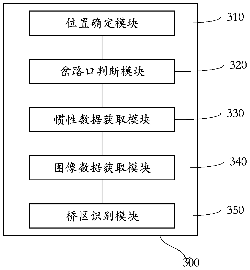
[0033] Exemplary embodiments of the present application are described below in conjunction with the accompanying drawings, which include various details of the embodiments of the present application to facilitate understanding, and they should be regarded as exemplary only. Accordingly, those of ordinary skill in the art will recognize that various changes and modifications of the embodiments described herein can be made without departing from the scope and spirit of the application. Also, descriptions of well-known functions and constructions are omitted in the following description for clarity and conciseness.

[0034] This application proposes a method, device, electronic device, and non-transitory computer-readable storage medium storing computer instructions for identifying viaduct areas in vehicle navigation. This application solves the problem of inaccurate GPS or It is an up and down vertical viaduct, which is prone to misjudgment of the route and needs to be switched ...


PUM


Abstract

The invention discloses a method and a device for identifying a viaduct area in vehicle navigation, electronic equipment and a storage medium, and relates to the technical field of positioning. Through the specific implementation scheme, the method comprises the following steps: determining the current position of a vehicle, and judging whether the vehicle is located at a turnout of the viaduct area currently or not according to the current position; acquiring inertia data measured by an inertia sensor in the process that the vehicle travels at a first distance when the vehicle is judged to becurrently located at the turnout of the viaduct area; acquiring image data acquired by an image acquisition device in the process that the vehicle travels at a second distance; and judging whether the vehicle is located on a viaduct or under the viaduct currently according to the inertia data measured by the inertia sensor in the process that the vehicle travels at the first distance and the image data acquired by the image acquisition device in the process that the vehicle travels at the second distance. Therefore, whether the vehicle is located above or below the viaduct at present can be accurately identified, and then a route is automatically planned, manual switching of getting on and off the viaduct is avoided, and the navigation accuracy is improved.

Description

technical field [0001] The present application relates to the field of positioning technology, and in particular to a method, device, electronic device, and non-transitory computer-readable storage medium storing computer instructions for identifying viaduct areas in vehicle navigation. Background technique [0002] With the advancement of science and technology and the development of mobile Internet technology, more and more people choose to use mobile phone navigation software APP (Application, application program) when driving a vehicle, which brings a lot of convenience to car owners who are not familiar with the route. These navigation software mainly use the GPS (Global Positioning System, Global Positioning System) module (or Beidou module) to obtain longitude and latitude information for positioning. The working process of navigation software is generally based on the starting point and destination for path planning. [0003] In the related technology, the driver of ...

Claims


Application Information

Patent Timeline
Patent Type & Authority Applications(China)
IPC IPC(8): G01C21/28G01C21/16G01S19/47
CPCG01C21/28G01C21/165G01S19/47
Inventor 李冰刘毅杨明生周志鹏
Owner APOLLO INTELLIGENT CONNECTIVITY (BEIJING) TECH CO LTD
Why Eureka
Try Eureka