Optical remote sensing image segmentation method based on multi-scale lightweight hole convolution

An optical remote sensing image and lightweight technology, which is applied in the field of image processing, can solve the problems of large network storage space, large amount of parameters, complex network parameters, etc., and achieve the effect of reducing the number of parameters, increasing the speed, and improving the segmentation accuracy

Active Publication Date: 2020-04-28
XIDIAN UNIV
View PDF3 Cites 6 Cited by
  • Summary
  • Abstract
  • Description
  • Claims
  • Application Information

AI Technical Summary

Problems solved by technology

However, in this type of method, because there is no efficient use of high-level features and low-level features, the image segmentation effect is not good.
Moreo

Method used


Image

  • Optical remote sensing image segmentation method based on multi-scale lightweight hole convolution
  • Optical remote sensing image segmentation method based on multi-scale lightweight hole convolution
  • Optical remote sensing image segmentation method based on multi-scale lightweight hole convolution

Examples


Embodiment Construction

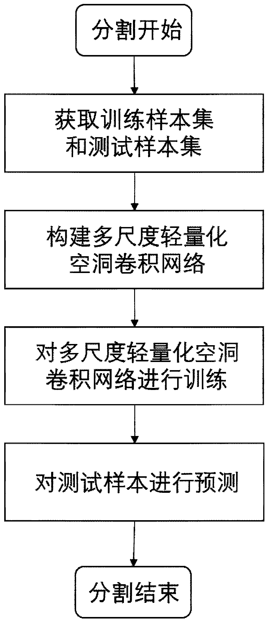
[0025] The embodiments and effects of the present invention will be further described below in conjunction with the accompanying drawings.

[0026] refer to figure 1 , the implementation steps of this embodiment are as follows:

[0027] Step 1, obtain training sample set T and test sample set V.

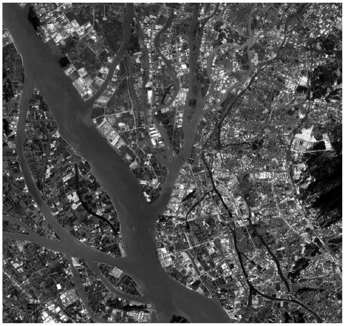
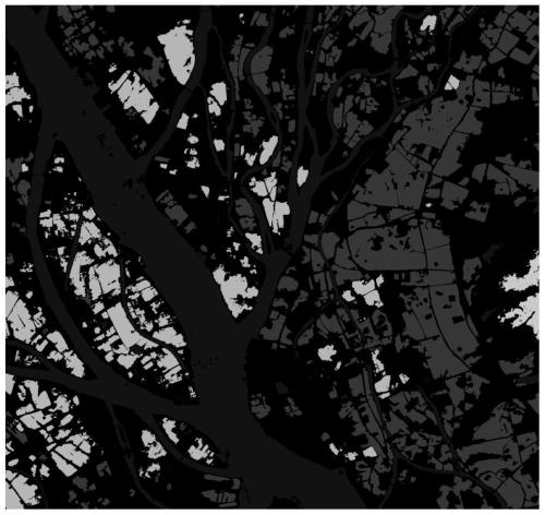
[0028] 1.1) Obtain the optical remote sensing image dataset GID for segmentation from the public website. The plot includes six categories: buildings, farmland, water, forest, grassland, and background;

[0029] 1.2) Cut the acquired optical remote sensing image data set GID, cut it into 512×512 pictures and save them locally, and save the optical remote sensing image data and class label data into two folders, Images and Labels, respectively . To facilitate subsequent training use;

[0030] In this experiment, 80% of the data in Images and the corresponding data in Labels are selected as the training sample set T, and the remaining 20% ​​of the Images data is used as the test s...


PUM


Abstract

The invention discloses an optical remote sensing image segmentation method based on multi-scale lightweight hole convolution, and mainly solves the problems of large storage space occupied by a network and poor image segmentation effect in the prior art. The method comprises the steps of acquiring optical remote sensing image data, and dividing a training sample set and a test sample set; constructing a multi-scale lightweight hole convolution network formed by cascading a feature extraction lower sampling sub-network, a bottom layer sub-network and an image recovery upper sampling sub-network; training the constructed multi-scale lightweight hole convolutional network by using the training sample set; and inputting the test sample set into the trained multi-scale lightweight hole convolutional network for testing to obtain a segmentation result of the optical remote sensing image. According to the method, the storage space occupied by the segmentation network is reduced, the segmentation precision of the optical remote sensing image is improved, and the method can be used for land planning management, vegetation resource investigation and environment monitoring.

Description

technical field [0001] The invention belongs to the technical field of image processing, in particular to an optical remote sensing image segmentation method, which can be used for land planning management, vegetation resource investigation and environmental monitoring. Background technique [0002] The segmentation of optical remote sensing images is one of the important research contents in the field of remote sensing. It refers to selectively locating the position and range of the object of interest in the image on the image taken by the optical remote sensing satellite that has been acquired. Different categories such as waters, buildings, forests, farmlands, grasslands, etc. [0003] At present, the optical remote sensing image segmentation methods include traditional image segmentation methods, image segmentation methods combined with specific tools, and image segmentation methods based on neural networks. in: [0004] Based on traditional image segmentation methods,...

Claims


Application Information

Patent Timeline
IPC IPC(8): G06T7/10
CPCG06T7/10G06T2207/10032G06T2207/20081G06T2207/20084
Inventor 侯彪项子娟焦李成马文萍马晶晶杨淑媛
Owner XIDIAN UNIV
Why Eureka
Try Eureka