Target object height centralized measurement and calculation method

A target and height technology, applied in the field of centralized measurement and calculation of target height, can solve the problems of difficult to obtain spectral features and texture features of ground objects, expensive lidar sensors, difficult analysis, etc., to achieve high measurement efficiency and reduced measurement. Time and flexibility

Pending Publication Date: 2020-07-17
PEKING UNIV SHENZHEN GRADUATE SCHOOL
View PDF0 Cites 2 Cited by
  • Summary
  • Abstract
  • Description
  • Claims
  • Application Information

AI Technical Summary

Problems solved by technology

Although this method can obtain the height information of the target object in the target area, the lidar sensor is expensive, the cost is high, and it is difficult to obtain information such as the spectral characteristics and texture characteristics of the ground object, which will cause certain difficulties for later analysis.

Method used


Image

  • Target object height centralized measurement and calculation method
  • Target object height centralized measurement and calculation method
  • Target object height centralized measurement and calculation method

Examples


Embodiment Construction

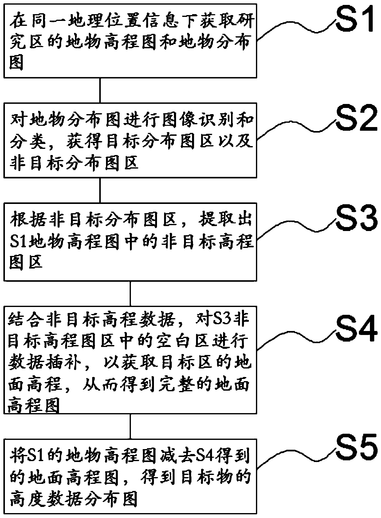
[0029] See figure 1 , a method for centralized measurement and calculation of target height, comprising the following steps:

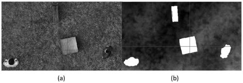
[0030] S1: Obtain the elevation map and distribution map of surface features in the research area under the same geographic location information;

[0031] The elevation map of ground features refers to the distribution map of height information including surface buildings, bridges and trees; the distribution map of ground features is a digital orthomap including the distribution of spectral and texture features of ground features. It should be noted that both must have the same geographic location information. The above two images come from a wide range of sources, including but not limited to 3D point clouds generated by lidar, 3D real-world models generated by oblique photography, and so on.

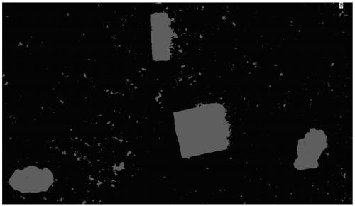
[0032] S2: Carry out image recognition and classification to the feature distribution map, and obtain the target distribution map area and the non-target dis...


PUM


Abstract

The invention relates to a centralized measurement and calculation method for the height of a target object. The method comprises the following steps: S1, acquiring a ground object elevation map and aground object distribution map of a research area under the same geographic position information; s2, performing image recognition and classification on the ground object distribution diagram to obtain a target distribution diagram area and a non-target distribution diagram area; s3, according to the non-target distribution map area, extracting a non-target elevation map area in the ground objectelevation map in S1; s4, in combination with the non-target elevation data, performing data interpolation on the blank area in the non-target elevation map area in S3 to obtain the ground elevation of the target area so as to obtain a complete ground elevation map; and S5, subtracting the ground elevation map obtained in the step S4 from the ground object elevation map obtained in the step S1 toobtain height data distribution of the target object. The measuring and calculating method provided by the invention relates to an image recognition and interpolation algorithm, so that the target object pertinence of the method is strong, the centralized measurement and calculation of the height information can be realized, the measuring and calculating efficiency is high, the precision is high,the application is wide, the flexibility is strong, and the dynamic target object height measurement and calculation of different scales can be realized.

Description

technical field [0001] The invention relates to a method for centralized measurement and calculation of the height of an object. Background technique [0002] At present, the height information survey of surface buildings, bridges and trees is an important part of the entire geographic information survey. It is the basis for scientific land use structure analysis and land production layout adjustment. scientific basis. Therefore, it is a very meaningful work to conduct centralized and accurate measurement of the height of the target object in geographic space. [0003] At present, the investigation of the height information of the target in geographic space mainly adopts the ground measurement method and the laser radar method, among which the ground measurement method mainly uses surveying and mapping tools to measure the height information of the target object manually. However, there are low measurement efficiency and high measurement cost, it is difficult to measure th...

Claims


Application Information

Patent Timeline
IPC IPC(8): G06T7/70G06T7/40G06T3/40G06T17/00G06K9/00
CPCG06T7/70G06T7/40G06T17/00G06T3/4023G06T2207/10028G06V20/176
Inventor 邱国玉毛鹏郝梦宇秦龙君赵文利熊博文罗婕纯一丁俊杰
Owner PEKING UNIV SHENZHEN GRADUATE SCHOOL
Why Eureka
Try Eureka