
Refined live-action three-dimensional modeling method based on air-ground fusion

A three-dimensional modeling and refinement technology, applied in the field of three-dimensional modeling, can solve the problems of lack of top-down angle, poor correction effect, and difficulty in identifying ground image control points, etc., to achieve the effect of improving correction effect, improving accuracy and accurate acquisition.

Pending Publication Date: 2020-08-14
深圳市中正测绘科技有限公司
View PDF4 Cites 11 Cited by
  • Summary
  • Abstract
  • Description
  • Claims
  • Application Information

AI Technical Summary

Problems solved by technology

However, due to the angle of view, ground close-up photography lacks a bird’s-eye view angle, and it is difficult to identify ground image control points. Therefore, the correction effect of ground image control points on ground close-up aerial triangulation results is poor, which affects the drone’s tilt aerial triangulation results and ground The data fusion effect of close-range aerial triangulation results reduces the accuracy of reality modeling

Method used


Image

  • Refined live-action three-dimensional modeling method based on air-ground fusion
  • Refined live-action three-dimensional modeling method based on air-ground fusion
  • Refined live-action three-dimensional modeling method based on air-ground fusion

Examples


Embodiment Construction

[0043] The present invention will be further described in detail below with reference to the accompanying drawings.

[0044] This specific embodiment is only an explanation of the present invention, and it does not limit the present invention. Those skilled in the art can make modifications without creative contribution to the present embodiment as required after reading this specification, but as long as the rights of the present invention are used All claims are protected by patent law.

[0045] In order to make the purposes, technical solutions and advantages of the embodiments of the present invention clearer, the technical solutions in the embodiments of the present invention will be clearly and completely described below with reference to the accompanying drawings in the embodiments of the present invention. Obviously, the described embodiments These are some embodiments of the present invention, but not all embodiments. Based on the embodiments of the present invention...


PUM


Abstract

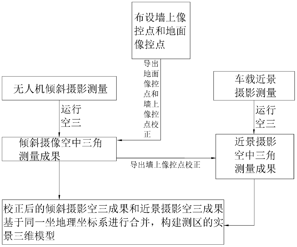
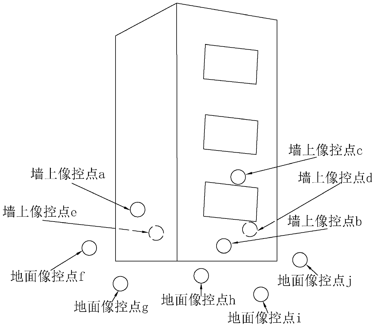
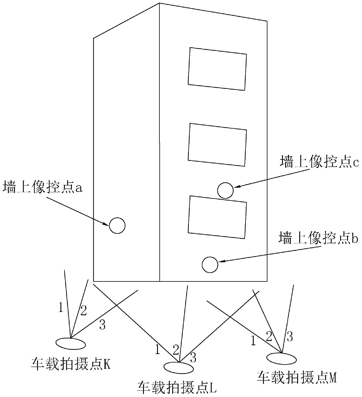
The invention aims to provide a refined live-action three-dimensional modeling method based on air-ground fusion. The method comprises the following steps: distributing wall image control points and ground image control points in a measurement region range, and enabling the wall image control points to be distributed at two sides of a road and to be away from the ground by a preset height; obliquephotogrammetry and close-range photogrammetry are carried out along the road section where the photo control points are distributed in the range of the measuring area, and aerial triangulation is carried out respectively; acquiring coordinates of a ground image control point and a wall image control point, and correcting an aerial triangulation result of oblique photography; coordinates of the image control points on the wall are derived from aerial triangulation results of oblique photography, and the aerial triangulation results of close-range photography are corrected; and combining the corrected oblique photography aerial triangulation result with the corrected close-range photography aerial triangulation result to construct a live-action three-dimensional model of the survey area. The problems that ground image control points are not easy to recognize in close-range photogrammetry, and modeling precision is affected are solved. The method has the effect of improving the live-action modeling precision.

Description

technical field [0001] The invention relates to the technical field of three-dimensional modeling, in particular to a refined real scene three-dimensional modeling method based on air-ground fusion. Background technique [0002] At present, with the upgrading of digital cities to smart cities and the transformation from simulated 3D models to real 3D models, the requirements for real 3D models are getting higher and higher. As the space carrier of the smart city, the real 3D model can not only truly reflect the urban features, but also provide richer geographic texture information and a more advanced and friendly user experience by embedding accurate geographic coordinate information, which is increasingly permeating the entire city. All aspects of life, especially urban architecture. [0003] The real 3D model can not only fully show the outline of urban buildings, but also make a large-scale topographic map based on the model, which is conducive to the evaluation of the b...

Claims


Application Information

Patent Timeline
IPC IPC(8): G06T17/05G06K17/00G06K9/46G01B11/24
CPCG06T17/05G06K17/0025G01B11/24G06V10/462Y02T10/40
Inventor 张强钟季廷吴少平吴俊杰
Owner 深圳市中正测绘科技有限公司
Learn More