

Urban land function recognition method based on remote sensing picture and interest point data
A technology of urban functions and identification methods, applied in neural learning methods, character and pattern recognition, instruments, etc., can solve the problems of people's activities and behaviors without considering the spatial relationship of ground objects, improve the ability of model similarity discrimination, and avoid manual selection. Bias and inefficiencies in features, effects of strong adaptive capacity
- Summary
- Abstract
- Description
- Claims
- Application Information
AI Technical Summary
Problems solved by technology
Method used
Image

Examples
Embodiment Construction
[0025] Below in conjunction with accompanying drawing and embodiment the present invention is described in further detail, it is necessary to point out that following embodiment is only used for further description of the present invention, can not be interpreted as the restriction to protection scope of the present invention, those skilled in the art According to the content of the invention above, making some non-essential improvements and adjustments to the present invention for specific implementation shall still belong to the protection scope of the present invention.
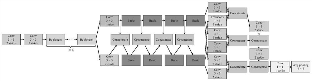
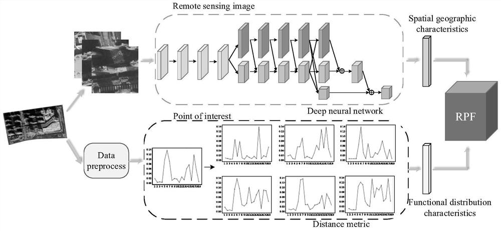
[0026] The urban land use function recognition method based on remote sensing images and POI data includes the following steps:
[0027] (1) Obtain the remote sensing image data and point-of-interest (POI) data of the functional area of the city to be studied through the interface of Google Earth and Baidu Map;
[0028] (2) Divide the remote sensing image data into training set and test set by 8:2, build...
PUM
 Abstract
Description
Claims
Application Information