

Generating Human-Centric Directions in Mapping Systems
a mapping system and human-centric technology, applied in the field of digital mapping systems, can solve problems such as literal us
- Summary
- Abstract
- Description
- Claims
- Application Information
AI Technical Summary
Benefits of technology
Problems solved by technology
Method used
Image

Examples
Embodiment Construction
[0016] Digital mapping techniques are disclosed that provide visually-oriented information to the user, such as driving directions, thereby improving the user experience.
[0017] General Overview
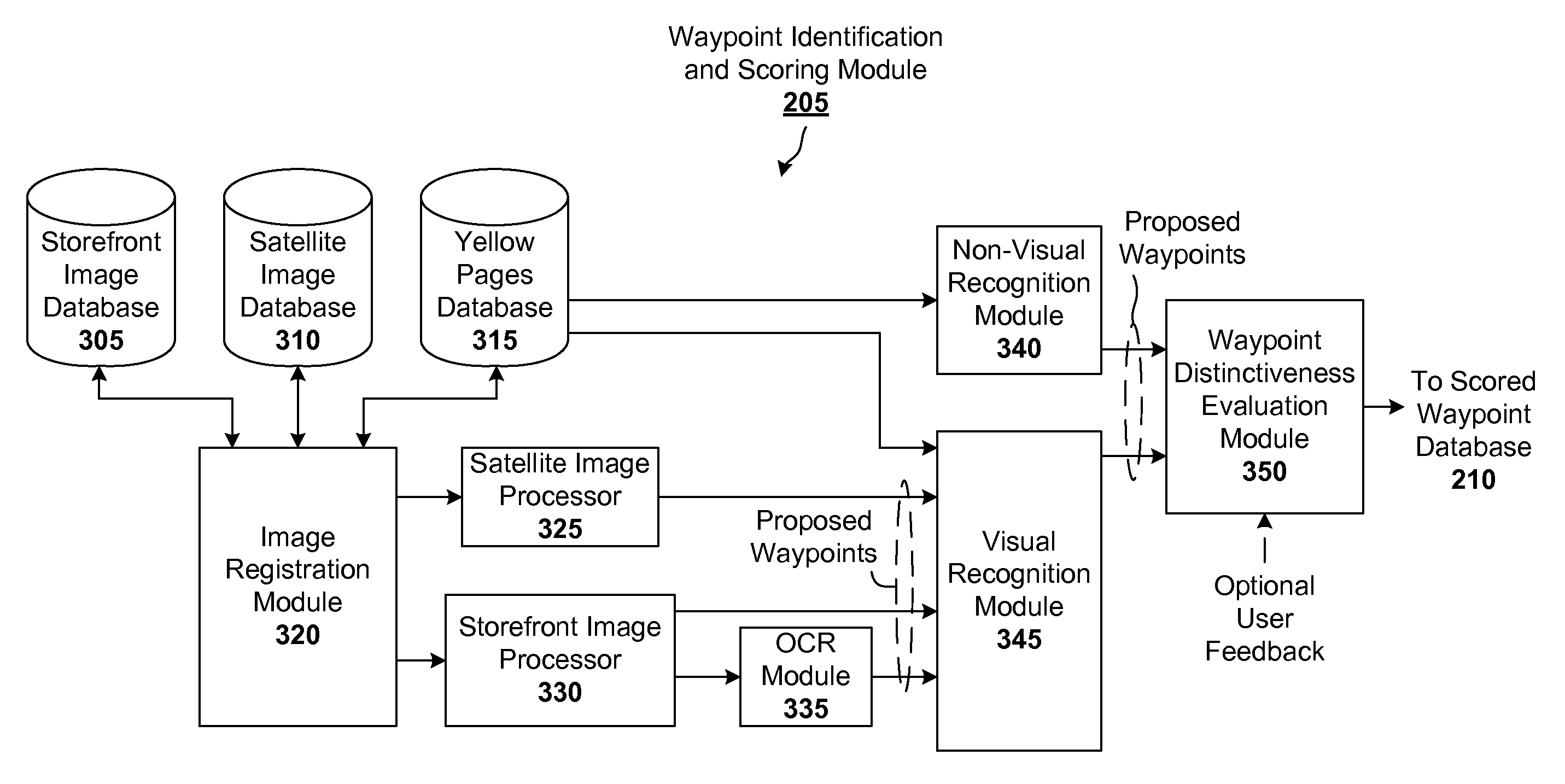
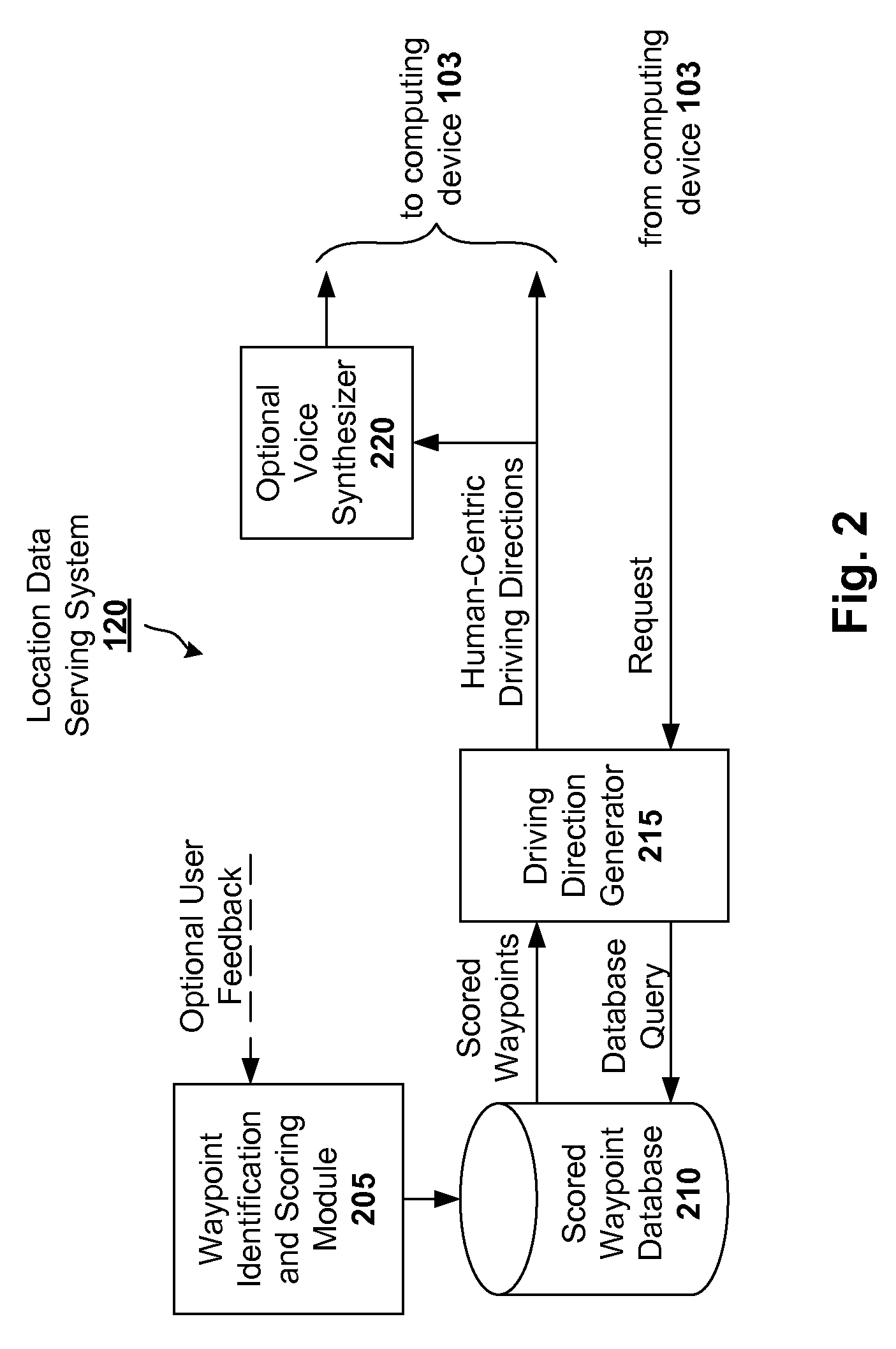
[0018] As previously explained, computer-generated driving directions are typically expressed in abstractions that are convenient for computers, such as “Stay on Main St. for 1.2 miles”, etc. In contrast, human-generated directions tend to be more visually-oriented, such as “Stay on Main St, you'll pass a big Sears on your left, then turn right at the Dunkin Donuts”. Through the use of satellite-based imagery and / or storefront images, a mapping system configured in accordance with an embodiment of the presenting invention can give more visually-oriented (and hence human-centric) directions.
[0019] For instance, satellite-based imagery (such as that provided by Google Earth or Digital Globe) can be used to identify salient buildings, structures, and / or areas for use as way points (e.g., a par...
PUM
 Abstract
Description
Claims
Application Information