Method and system for hybrid positioning using partial distance information

a technology of partial distance information and hybrid positioning, applied in direction finders using radio waves, instruments, wireless communication, etc., can solve the problems of easy damage to hardware, unreliable methods, and high cost of methods

Inactive Publication Date: 2008-05-29
WICHORUS LLC
View PDF3 Cites 89 Cited by
  • Summary
  • Abstract
  • Description
  • Claims
  • Application Information

AI Technical Summary

Problems solved by technology

However, such methods prove to be expensive because of the expensive sensors required.
Further, such method may be unreliable since, many a times, such hardware is fragile and can be damaged easily due to daily wear and tear.
Moreover, the existing positioning methods may not be applicable to cases where a base station is mobile.

Method used


Image

  • Method and system for hybrid positioning using partial distance information
  • Method and system for hybrid positioning using partial distance information
  • Method and system for hybrid positioning using partial distance information

Examples


Embodiment Construction

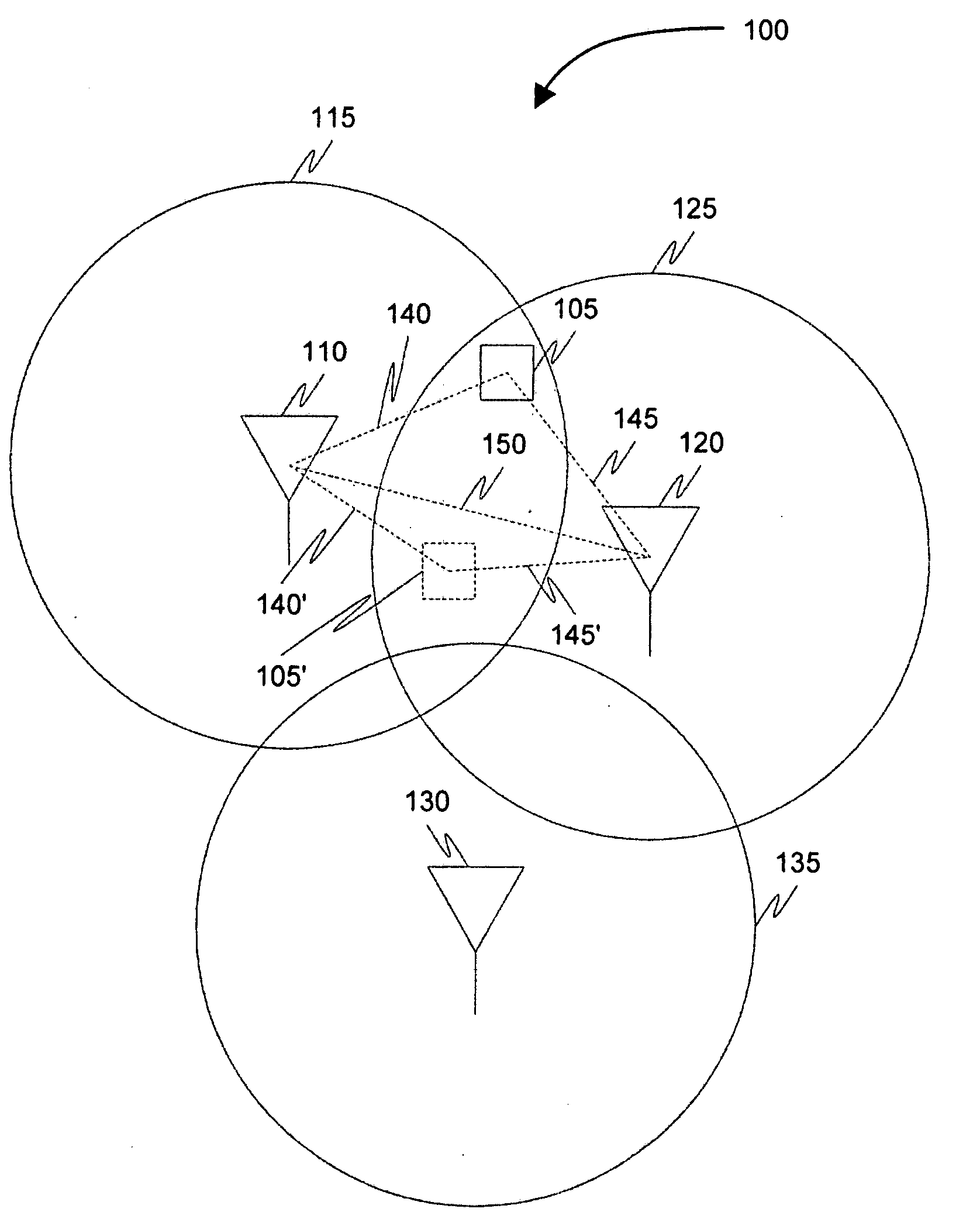
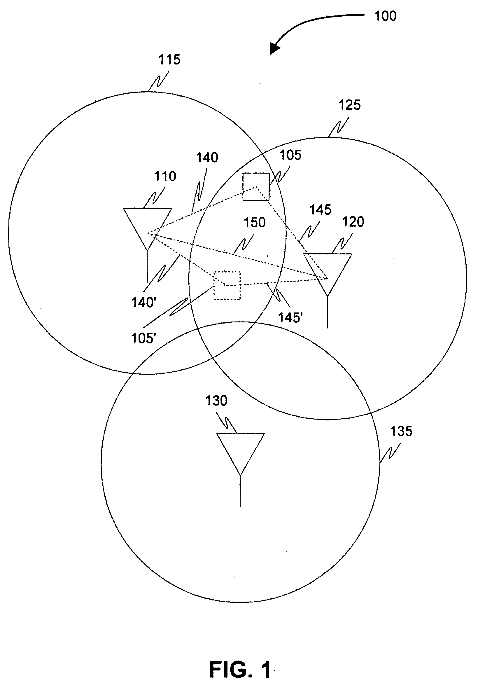
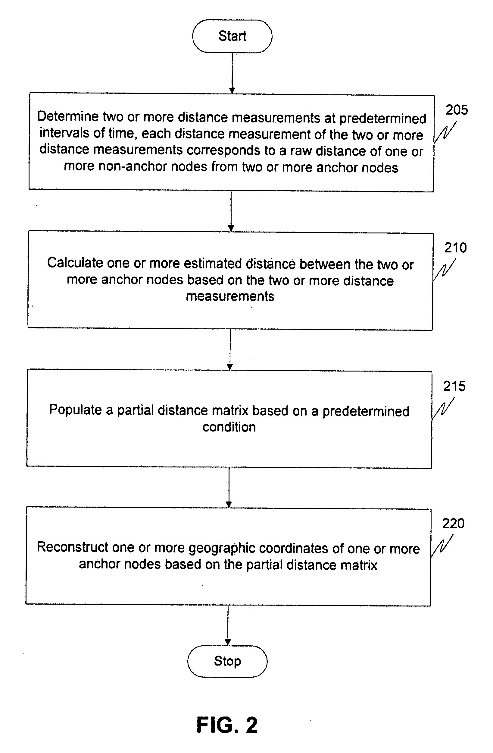
[0015]Before describing in detail embodiments that are in accordance with the present invention, it should be observed that the embodiments reside primarily in combinations of method steps and apparatus components related to method and system for determining geographic coordinates of an anchor node or a non-anchor node in one or more communication networks using partial distance information. Accordingly, the apparatus components and method steps have been represented where appropriate by conventional symbols in the drawings, showing only those specific details that are pertinent to understanding the embodiments of the present invention so as not to obscure the disclosure with details that will be readily apparent to those of ordinary skill in the art having the benefit of the description herein.

[0016]In this document, relational terms such as first and second, top and bottom, and the like may be used solely to distinguish one entity or action from another entity or action without ne...


PUM


Abstract

The present invention provides a method and system for positioning one or more anchor nodes or one or more non-anchor nodes in one or more communication networks. A non-anchor node may be in communication with two or more anchor nodes. The method comprises determining two or more distance measurements, corresponding to raw distances of the non-anchor node from the two or more anchor nodes, at predetermined intervals of time. An estimated distance is then calculated between the two or more anchor nodes based on the two or more distance measurements. Estimated distances between a plurality of anchor nodes in the one or more communication networks is calculated in a similar manner. A partial distance matrix is then populated using the estimated distance between the plurality of anchor nodes. A plurality of geographic coordinates of the plurality of anchor nodes is reconstructed based on the partial distance matrix. The plurality of geographic coordinates is reconstructed based on one or more of a geometric build-up algorithm, a shortest-path algorithm and a multidimensional scaling algorithm.

Description

RELATED APPLICATIONS[0001]Benefit is claimed under 35 U.S.C. 119(e) to U.S. Provisional Application Ser. No. 60 / 793,182, entitled “Method and system for hybrid positioning with partial information”, by Mustafa Ergen et al., filed Apr. 19, 2006, which is herein incorporated in its entirety by reference for all purposes.FIELD OF INVENTION[0002]The present invention relates, generally, to hybrid positioning using partial distance information, and more specifically, to a method and system for determining geographic coordinates of anchor or non-anchor nodes in one or more communication networks using partial distance information.BACKGROUND OF THE INVENTION[0003]A communication network, typically, supports two types of devices, herein referred to as anchor nodes and non-anchor nodes. For example, in a telecommunication network, a base station may act as an anchor nodes and a mobile station may act as a non-anchor node. Many a times, positional information of anchor nodes or non-anchor nod...

Claims


Application Information

Patent Timeline
Patent Type & Authority Applications(United States)
IPC IPC(8): H04Q7/36H04W64/00
CPCH04W64/00G01S5/0289
Inventor ERGEN, MUSTAFAJALIL, REHAN
Owner WICHORUS LLC
Why Eureka
Try Eureka