
Methods and systems for measuring atmospheric water content

Active Publication Date: 2008-07-31
THE BOEING CO
View PDF12 Cites 16 Cited by
  • Summary
  • Abstract
  • Description
  • Claims
  • Application Information

AI Technical Summary

Problems solved by technology

An important obstacle to improved forecasting is lack of data about water content in the troposphere.
An inability to track changes in water content in these and other areas contributes to inaccurate weather forecasts.
Existing methods for detecting and quantifying water vapor are inadequate because they can only be implemented on a local scale over land thereby leaving vast gaps in global meteorological continuity.
Although the existing atmospheric sensing systems listed below exhibit high resolution capabilities on a local scale, it is not practical to deploy such systems on a global scale because they are expensive to implement or maintain on a global scale and they lack adequate temporal and / or spatial resolution for realistic use on a global scale.
Currently, a primary source of water vapor measurements are ground-based humidity sensors and balloon-borne sensors called “radiosondes.” Radiosonde data have high quality, but have relatively poor spatial and temporal resolution.
However, the twice daily radiosonde deployments are primarily over land and are sparsely distributed due to cost considerations.
For these reasons, radiosonde data is too costly and localized to support high resolution global meteorology.
Although the ACARS system provides about 10,000 readings per day world wide at a cost about 100 times less than the recurring cost of radiosondes, the vast majority of ACARS readings are around airports and along common flight paths at established cruise flight levels which limits the spatial scope of this otherwise valuable data.
However, such systems are not economic to install and maintain, they do not penetrate cloud cover, and the lasers used are highly energized and are therefore not eye-safe.
However, upward-looking water vapor radiometers must be “tuned” to local conditions using independently obtained PWV data, and although they generally exhibit good temporal resolution in relatively clear atmospheric conditions, they provide only localized PWV over land.
Further, unless properly equipped, upward-looking radiometers are virtually useless in rain.
Although downward-looking radiometers generally exhibit good spatial resolution they exhibit poor temporal resolution and perform poorly over most land masses.
In either case, water vapor radiometers as a whole are not practical for global scale meteorology due to their cost, limited view, and performance characteristics.
Although this method can provide vertical resolution of several hundred meters to a kilometer in the lower troposphere, the system exhibits poor performance in the presence of cloud cover and infrared active gases such as tropospheric ozone.
However, unmanned aircraft are too costly for continuous global sensing, they lack adequate spatial and temporal resolution, and are typically only justified in specialized research applications.
Satellite data are unreliable because it is difficult for satellites to correctly resolve the altitude profile of moisture, especially when clouds are present.
Though this approach has been shown to be technically effective for improved weather forecasts in the northeastern US, the additional weight and drag and the need for FAA certification of each type of sensor package on each type of aircraft makes this solution costly, which has limited the expansion of existing systems to other regions.

Method used


Image

  • Methods and systems for measuring atmospheric water content
  • Methods and systems for measuring atmospheric water content
  • Methods and systems for measuring atmospheric water content

Examples


Embodiment Construction

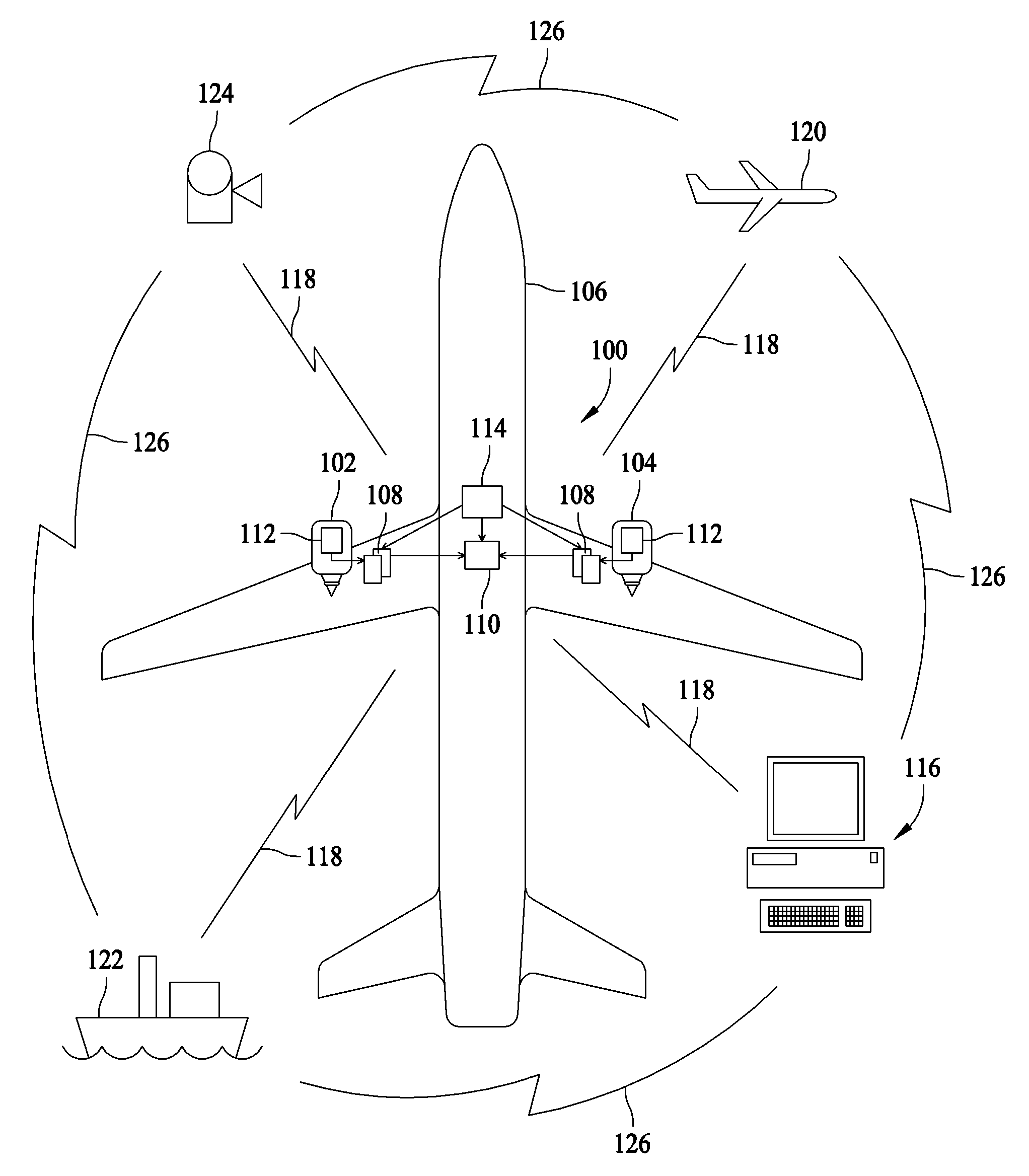
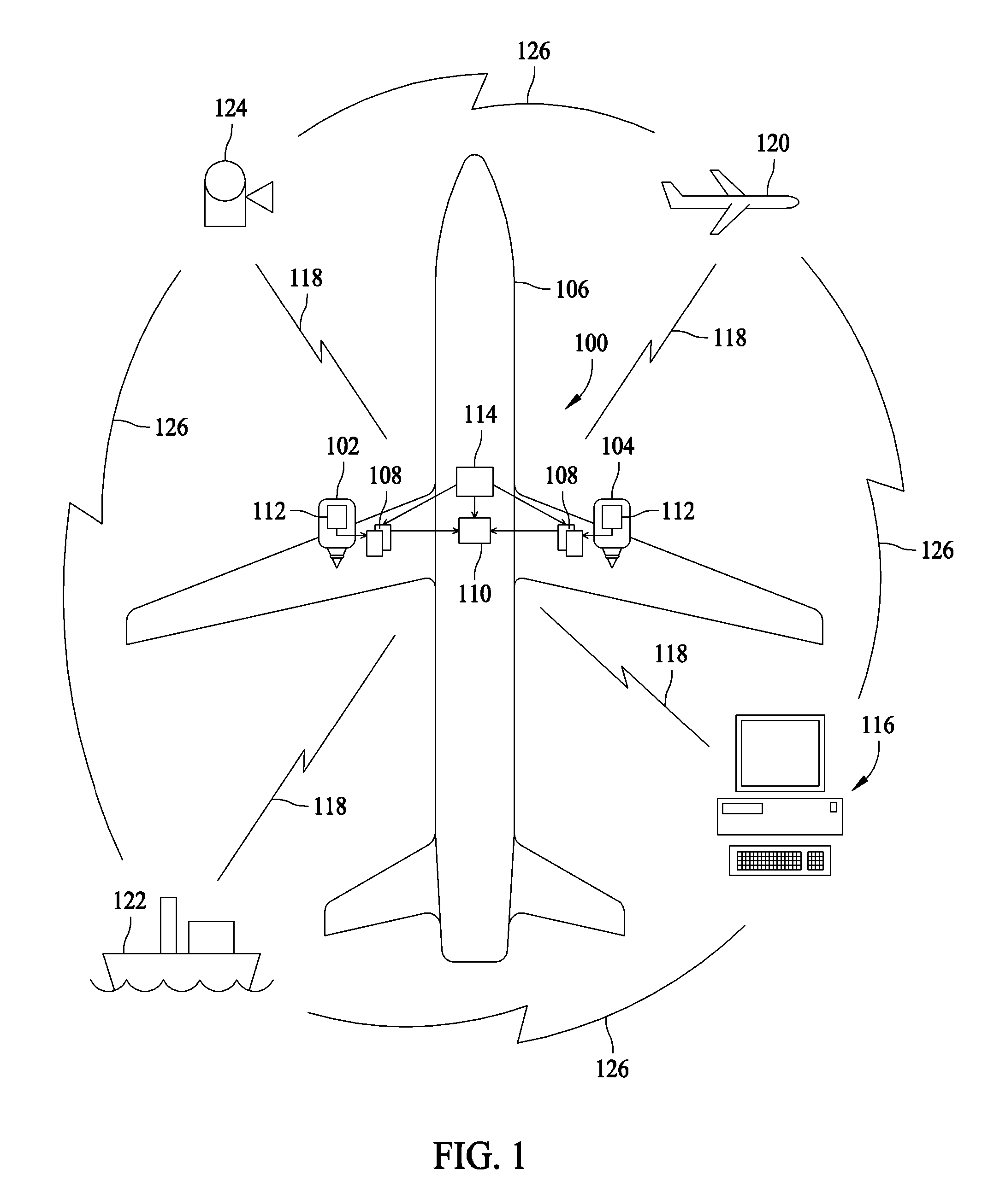
[0020]FIG. 1 is a block diagram of an exemplary embodiment of a system 100 for collecting weather related data and monitoring the performance of gas turbine engines 102, 104 mounted on an aircraft 106. Although two engines 102 and 104 are shown in FIG. 1, it should be noted that aircraft 106 could have additional engines mounted thereon. Accordingly, data collection for such additional engines would be accomplished in a manner substantially similar to that for engines 102 and 104. Therefore, only engines 102 and 104 and the associated equipment will be described herein. Furthermore, it should be noted that the system 100 is described in connection with an aircraft only by way of example. In addition to aeronautical applications, the present invention is applicable to other applications of gas turbine engines, including marine and industrial applications.

[0021]System 100 includes an electronic engine controller (EEC) 108, such as a full authority digital engine control (FADEC), altho...


PUM


Abstract

Methods and systems for measuring atmospheric water content, are provided. The method includes measuring a first air temperature and a first air pressure at a first location in a compressor, measuring a second air temperature and a second air pressure at a second location in the compressor, computing a ratio of specific heats from the first and second air temperatures and the first and second air pressures, and determining an atmospheric water content from the ratio of specific heats.

Description

BACKGROUND OF THE INVENTION[0001]This invention relates generally to methods and systems for measuring atmospheric conditions and more particularly, to methods and systems for collecting atmospheric weather data using an aircraft.[0002]An important obstacle to improved forecasting is lack of data about water content in the troposphere. Water content of an air mass can change rapidly during storms, over moist soil, or over bodies of water such as oceans. An inability to track changes in water content in these and other areas contributes to inaccurate weather forecasts.[0003]Existing methods for detecting and quantifying water vapor are inadequate because they can only be implemented on a local scale over land thereby leaving vast gaps in global meteorological continuity. The largest gaps occur over oceans where most atmospheric conditions originate. Although the existing atmospheric sensing systems listed below exhibit high resolution capabilities on a local scale, it is not practica...

Claims


Application Information

Patent Timeline
IPC IPC(8): G01N7/00
CPCG01N25/58G01W1/10G01W1/08
Inventor SPINELLI, CHARLES B.TILLOTSON, BRIAN J.ROSS, TAMAIRA E.
Owner THE BOEING CO
Learn More