Method for large scale, non-reverting and distributed spatial estimation

a spatial estimation and large-scale technology, applied in the field of large-scale spatial field estimation, can solve the problems of mainly bringing computational costs, difficult to create large-scale consistent, integrated, and regarded as a computationally expensive techniqu

Inactive Publication Date: 2013-09-26
SYDNEY THE UNIV OF
View PDF1 Cites 13 Cited by
  • Summary
  • Abstract
  • Description
  • Claims
  • Application Information

AI Technical Summary

Benefits of technology

[0021]In another aspect the invention provides a non-transient computer program product comprising computer readable instructions, the instructions comprising: instructions for receiving and storing input data; instructions for defining an information representation of the input data, the information representation comprising an information matrix Y and vector y, ...

Problems solved by technology

Some of the challenges posed by this task include dealing with the issues of uncertainty, incompleteness and handling potentially large measurement data sets.
One of the problems with implementing a system using automated vehicles is the difficulty of creating large scale consistent, integrated maps which can provide information for completely automated vehicles so that they are able to safely trav...

Method used


Image

  • Method for large scale, non-reverting and distributed spatial estimation
  • Method for large scale, non-reverting and distributed spatial estimation
  • Method for large scale, non-reverting and distributed spatial estimation

Examples


Embodiment Construction

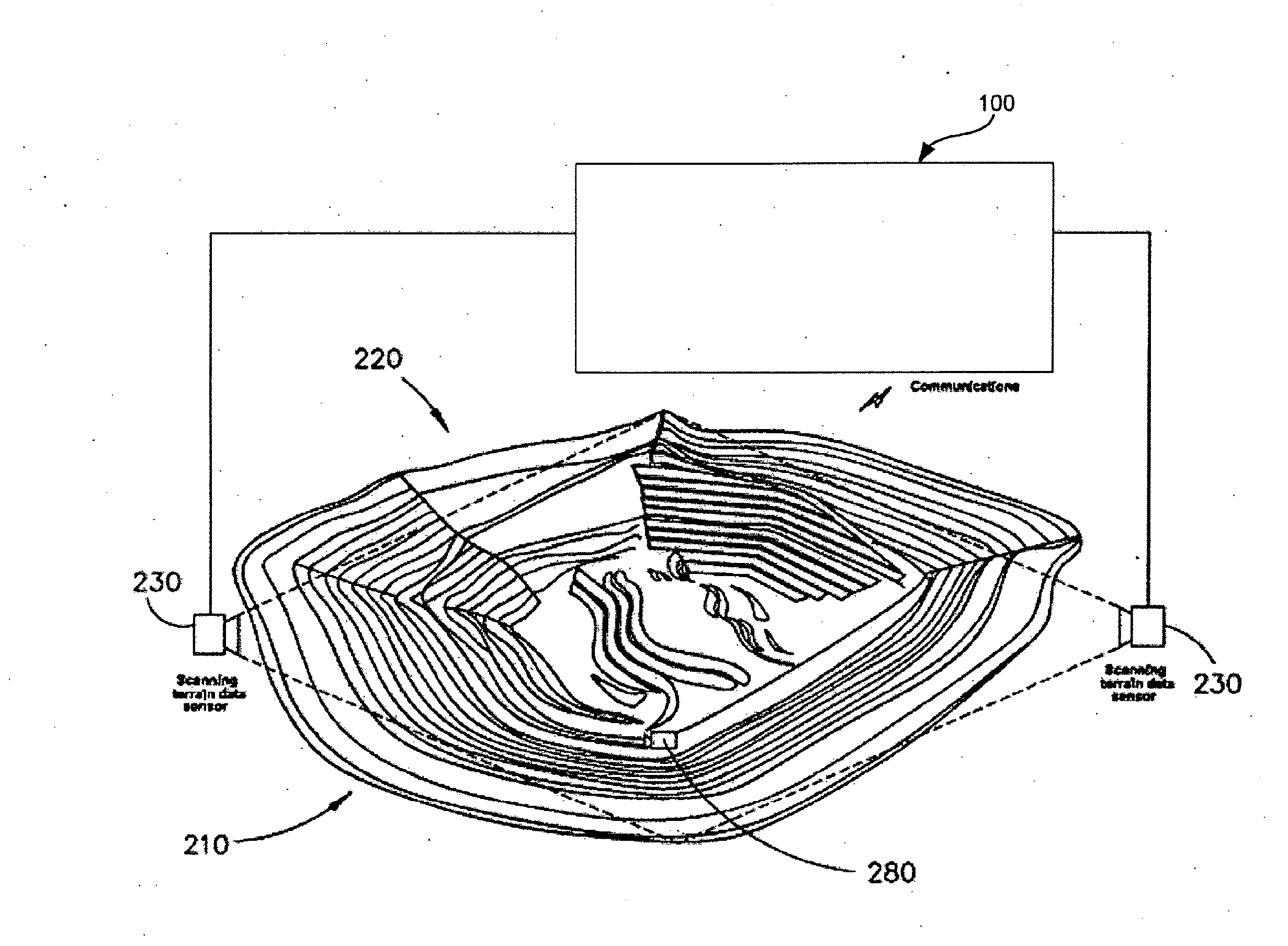
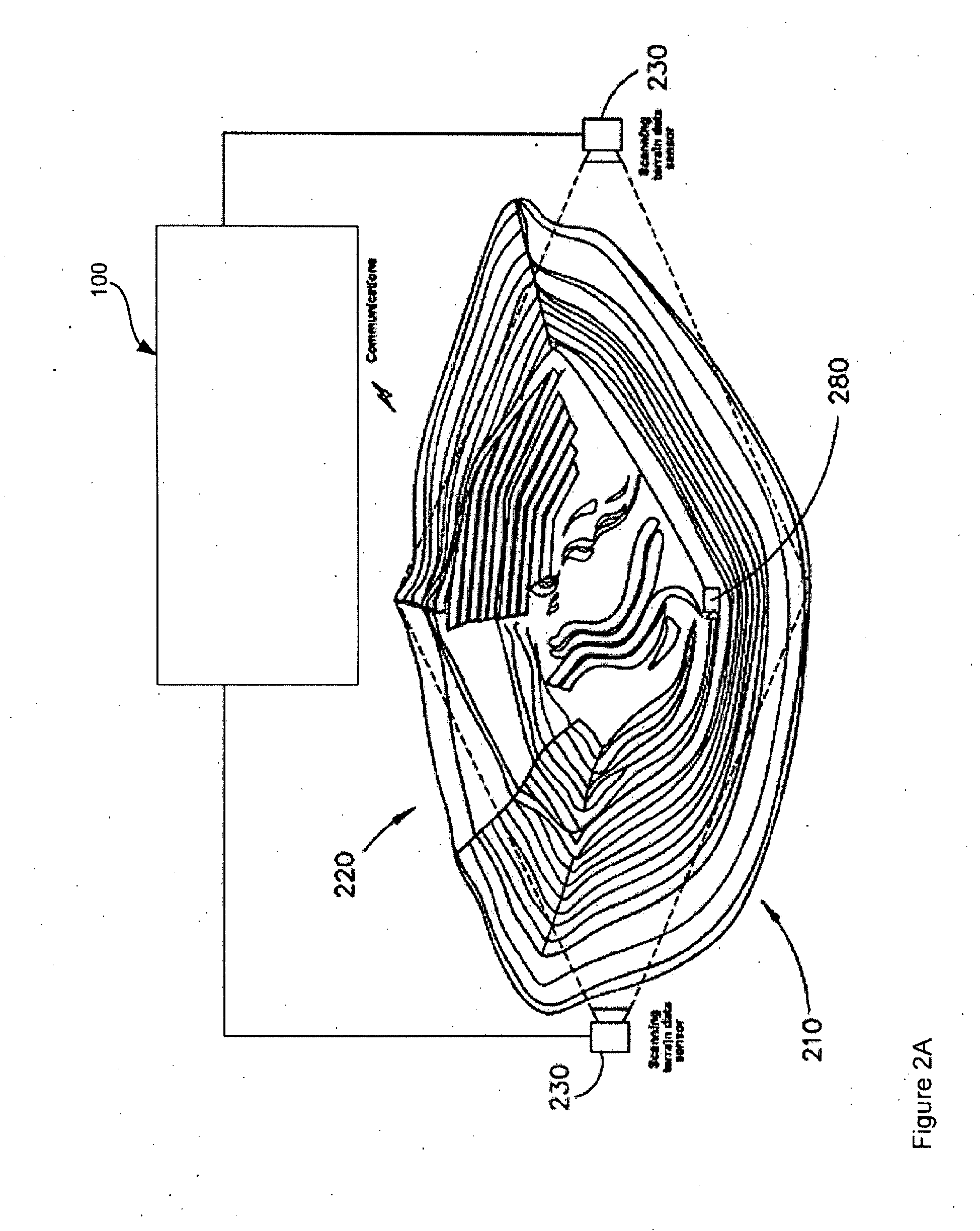
[0062]In mining broad top-level maps may be required and in addition there may be a requirement for fast ‘local space fusion’. A top-level map means a broad scale, high quality, globally consistent map, which may be built from as much sensor data as possible. Local space fusion means allowing local units e.g. vehicles or mobile sensor devices to quickly sense and update local maps, optionally in real-time, and then share these updates through local links to picture compilation nodes. Providing a hierarchy to the mine picture compilation system allows this blend of fast, local operation as well as broad scale, quality terrain mapping.

[0063]The distributed system described herein facilitates the creation of both top level maps and local space fusion. Distributed sensing and estimation means that spatial field observations and measurements are fused locally and communicated through a distributed network. Thus many distributed sensor sources can be consistently fused into a single mine ...


PUM


Abstract

Described herein is a system and a method of spatial field estimation from input data from a domain of interest. The method comprises defining a spatial mesh of positions over the domain of interest (802) and defining a smoothness information model (804) which is defined with respect to the spatial mesh to form an information matrix Y1 and vector y1. The method further comprises defining an information representation of the input data, the information representation comprising an information matrix Yobs and vector y, both defined relative to the spatial mesh. The method further comprises through an additive function fusing (806) the smoothness information model with the information representation of the input data to form an information matrix Y and vector y. The method then comprises, in a computational system, solving for x in Yx=y (808), wherein x represents the spatial field estimation.

Description

FIELD OF THE INVENTION[0001]This invention generally relates to the field of large scale spatial field estimation. Examples of particular applications include, but are not limited to, mining, environmental sciences, hydrology, economics and robotics.BACKGROUND OF THE INVENTION[0002]In a large scale environment, like an open-cut mine, spatial modelling of geography and geology can have many uses in planning, analysis and operations within the environment. For example, an in-ground geological model of the ore body can be used to determine drilling, blasting and excavation operations, whilst a geographical model or terrain map can be used to monitor the status and progress of the mine. Furthermore, in the case of automated mining, a geographical model or terrain map can be used to guide robotic vehicles. A digital representation of the operating environment in the form of a spatial model is typically generated from sensor measurements which provide a sample of the actual environmental ...

Claims


Application Information

Patent Timeline
IPC IPC(8): G06T17/05
CPCG06T17/20G06T17/05
Inventor THOMPSON, PAULNETTLETON, ERICDURRANT-WHYTE, HUGH
Owner SYDNEY THE UNIV OF
Why Eureka
Try Eureka