
Geographic coordinate translation system

a technology of geographic coordinates and translation systems, applied in wave based measurement systems, instruments, data processing applications, etc., can solve the problems of difficult to remember geographic coordinates and user inability to always have access to paper and pencils

Inactive Publication Date: 2013-11-07
BOBIK CRAIG +1
View PDF4 Cites 4 Cited by
  • Summary
  • Abstract
  • Description
  • Claims
  • Application Information

AI Technical Summary

Benefits of technology

The patent describes a system that can translate a person's location into a word combination for easy communication. This can be done by a computer or a program product that causes the computer to perform the translation steps. The system can also include a user interface for allowing the user to input the word combination. Overall, this technology makes it easier to communicate geographic information in a more accessible way.

Problems solved by technology

However, geographic coordinates are difficult to remember and a user does not always have access to paper and pencil.

Method used


Image

  • Geographic coordinate translation system
  • Geographic coordinate translation system
  • Geographic coordinate translation system

Examples


Embodiment Construction

[0012]The following detailed description is of the best currently contemplated modes of carrying out exemplary embodiments of the invention. The description is not to be taken in a limiting sense, but is made merely for the purpose of illustrating the general principles of the invention, since the scope of the invention is best defined by the appended claims.

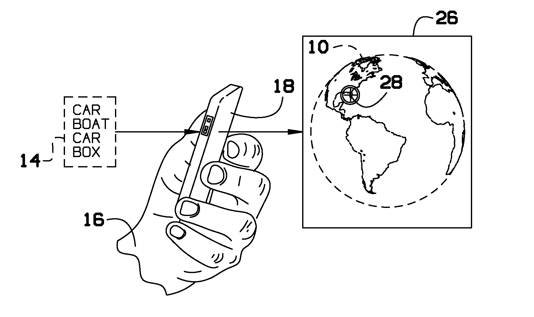
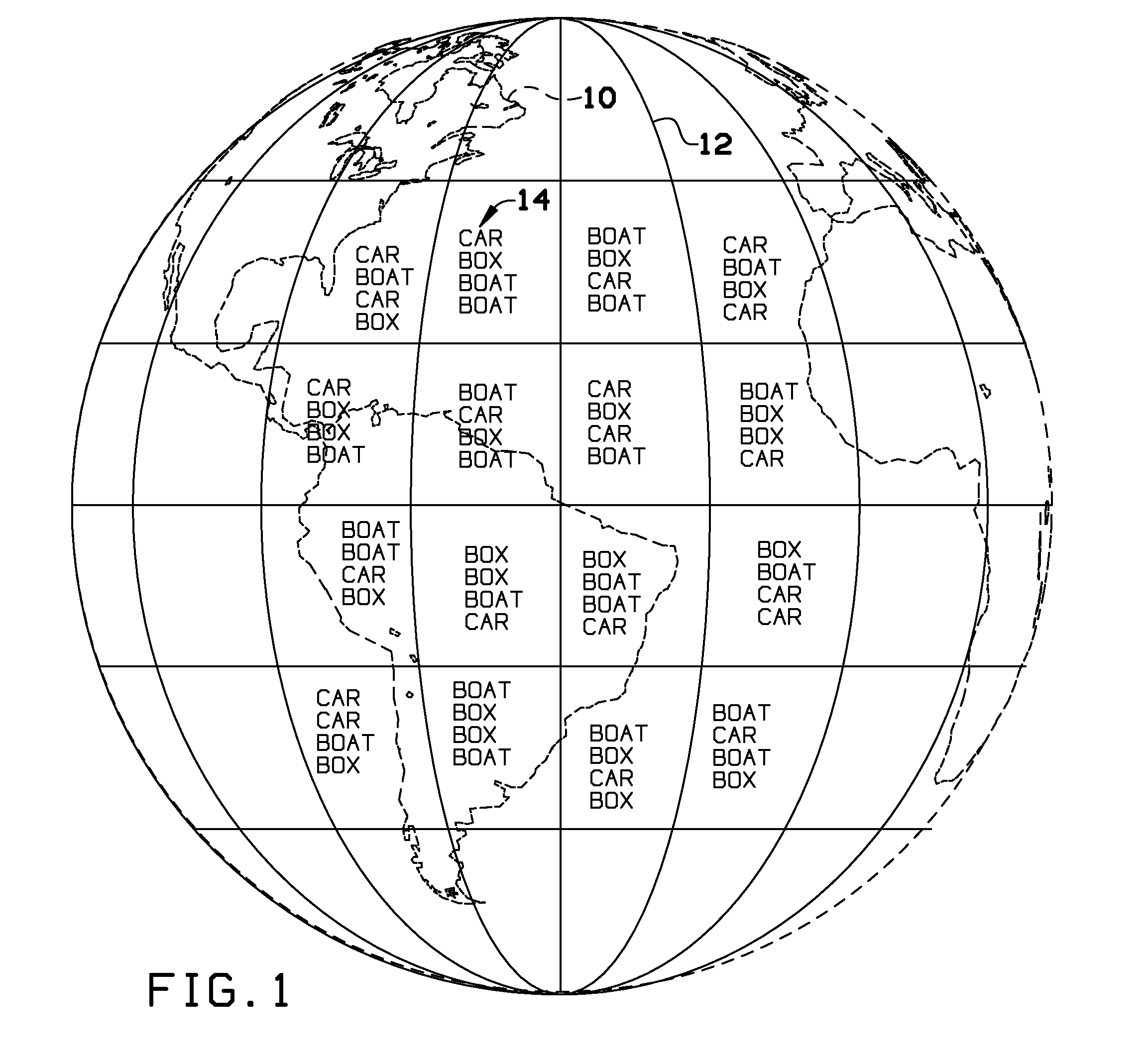
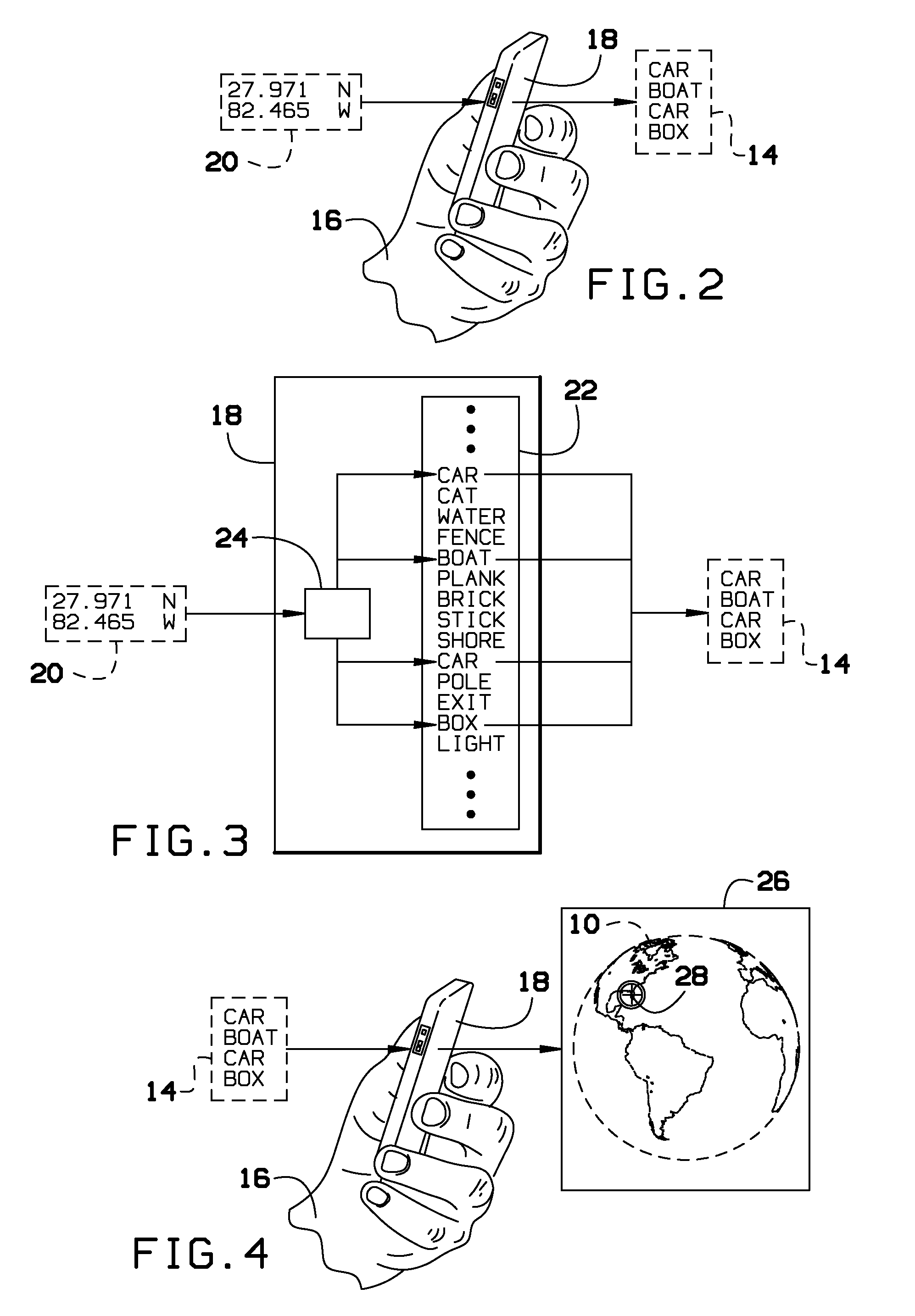
[0013]Broadly, an embodiment of the present invention provides a system for translating geographic coordinates into an easy to memorize word combination. The present invention may include a program implemented on a computer. The program directs the computer to translate inputted geographic coordinates into a word combination as well as translating the word combination back into the geographic coordinates. A user may use a computing device to determine the coordinates of a location, the program may translate the coordinates to the word combination, and then the user may memorize the word combination displayed by the mobile comput...


PUM


Abstract

A system for translating geographic coordinates into an easy to memorize word combination. The present invention may include a program implemented on a computer. The program directs the computer to translate inputted geographic coordinates into a word combination as well as translating the word combination back into the geographic coordinates. A user may use a mobile computing device to determine the coordinates of a location, the program may translate the coordinates to the word combination, and then the user may memorize the word combination displayed by the mobile computing device for later use.

Description

BACKGROUND OF THE INVENTION[0001]The present invention relates to translating geographic coordinates and, more particularly, to translating the geographic coordinates into words.[0002]The Global Positioning System (GPS) is a space-based satellite navigation system that provides location and time information in all weather conditions, anywhere on or near the Earth where there is an unobstructed line of sight to four or more GPS satellites. GPS devices may be used for recreational purposes. For example, if a user finds an ideal camping area, fishing area, hunting area or the like, a user may use the GPS device to figure out the coordinates of the location so that user may revisit the area. However, geographic coordinates are difficult to remember and a user does not always have access to paper and pencil.[0003]As can be seen, there is a need for a system that facilitates easy memorization of the geographic coordinates.SUMMARY OF THE INVENTION[0004]In one aspect of the present inventio...

Claims


Application Information

Patent Timeline
IPC IPC(8): G06F17/30
CPCG06F17/30386G01S19/45G06Q10/10G06Q50/10G06F16/24
Inventor BOBIK, CRAIGRIVERA, VANESSA
Owner BOBIK CRAIG
Learn More