Method and system for navigating an agricultural vehicle on a land area

a technology for agricultural vehicles and land areas, applied in the field of vehicles, can solve the problems of inability to use, inability to obtain required positioning information, and inability to detect so as to/or its direction of movement, improve the recognition of the vehicle in an image, and facilitate the orientation of the vehicl

Inactive Publication Date: 2017-03-23
LELY PATENT
View PDF3 Cites 39 Cited by
  • Summary
  • Abstract
  • Description
  • Claims
  • Application Information

AI Technical Summary

Benefits of technology

The present inventors describe how adding markings can make vehicles look better at images taken through cameras for improved identification purposes. These marks include circles, squares, ellipses, etc., which helps guide them towards their destination effectively without getting stuck during digging operations. This makes these systems easier than traditional methods because they don't require any extra equipment beyond what was already installed.

Problems solved by technology

The technical problem addressed in this patent text is the need for an improved method and system for navigating agricultural vehicles on a land area, which overcomes the disadvantages of current methods such as GNSS, including limited position accuracy and the inability to account for obstacles on the land area.

Method used


Image

  • Method and system for navigating an agricultural vehicle on a land area
  • Method and system for navigating an agricultural vehicle on a land area
  • Method and system for navigating an agricultural vehicle on a land area

Examples


Embodiment Construction

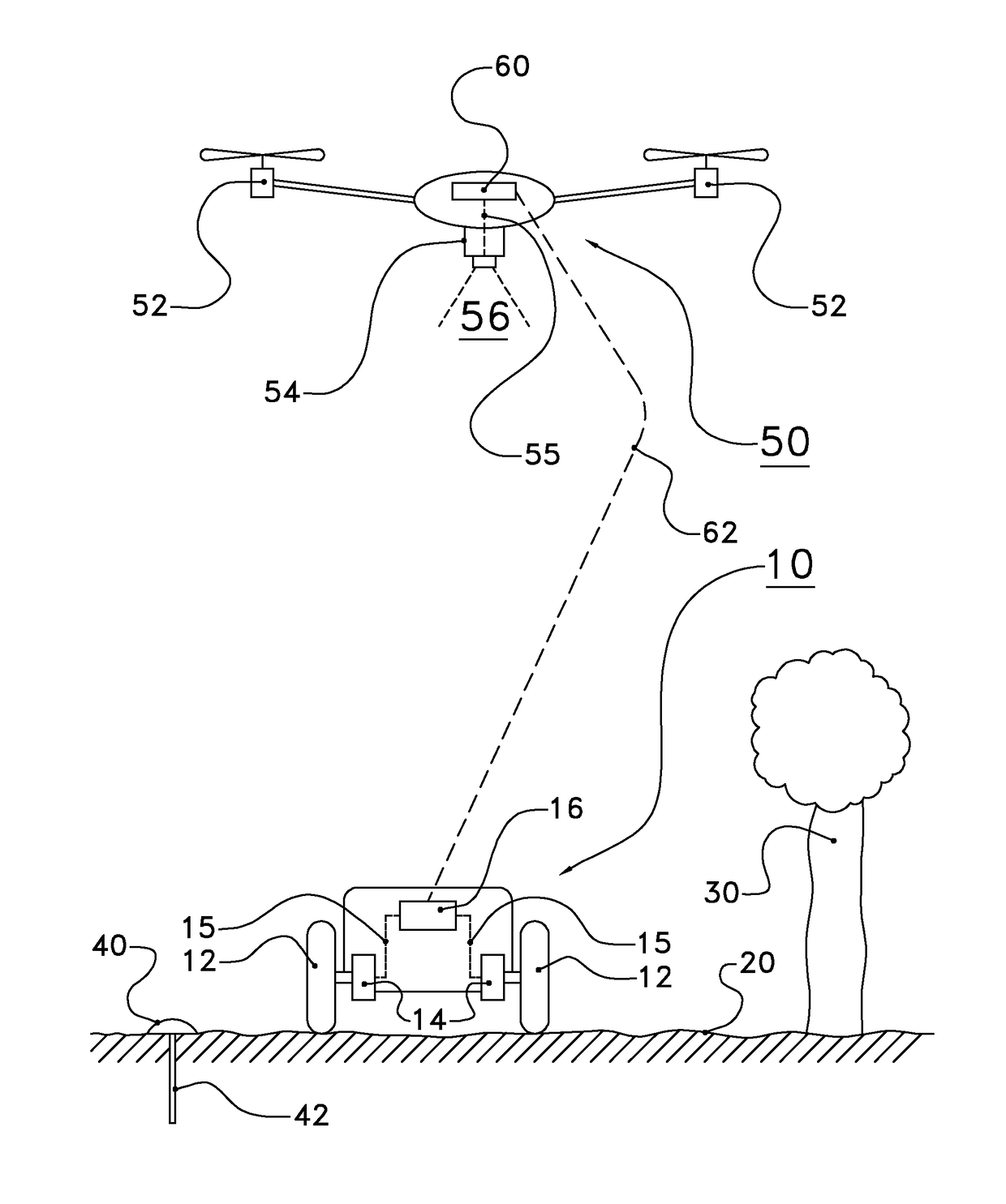
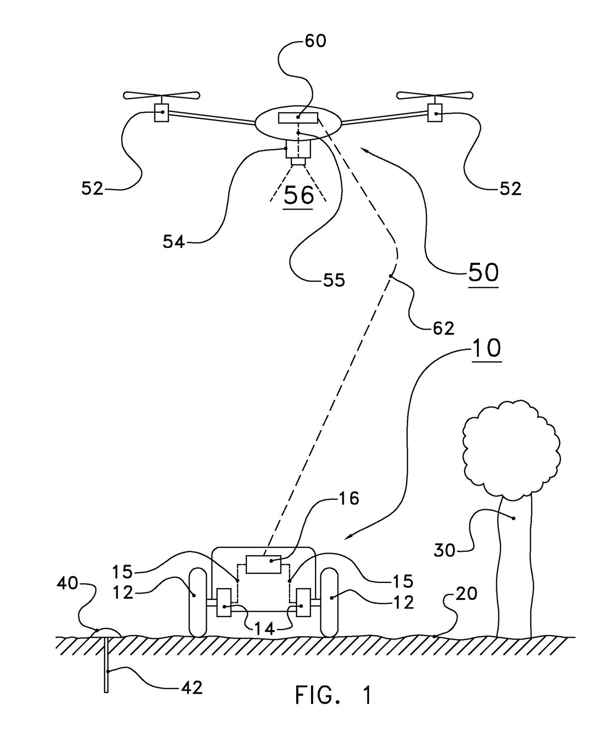
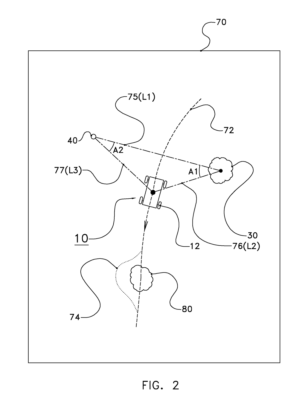
[0052]FIG. 1 depicts a vehicle 10 on a land area 20. On the land area 20, or next to the land area 20, a tree 30 grows. The tree 30 may be considered a landmark. The land area 20, or an area next to the land area 20, further may comprise one or more other landmarks 40, which may have different shapes, features, and colors. In FIG. 1, the landmark 40 is partly spherical, and fixed to the ground at a predetermined position, e.g. by a pole 42 driven in the ground and fixed to the landmark 40.

[0053]The vehicle 10 is e.g. a tractor, a combine harvester or other agricultural vehicle that is to be guided over the land area 20. The vehicle 10 has wheels 12 which are driven by a motor to move the vehicle across the land area 20. Furthermore, the wheels 12 can be steered to choose a particular direction of movement of the vehicle 10. The functions of propulsion and steering for each wheel are indicated by wheel control member 14, although in some embodiments a single wheel control member 14 m...


PUM


Abstract

In a system and method of navigating an agricultural vehicle on a land area, at least part of the land area is imaged in real-time from above to provide a sequence of images showing the vehicle and at least one landmark. Positions of the vehicle on the land area are identified from the sequence of images by image processing, to provide vehicle data based on the identification of the positions of the vehicle. Furthermore, a position of the at least one landmark on the land area is identified from the sequence of images by image processing, to provide landmark data based on the identification of the position of the at least one landmark. A path of the vehicle across the land area is controlled based on the vehicle data and the landmark data.

Description


Claims


Application Information

Patent Timeline
Owner LELY PATENT
Why Eureka
Try Eureka