
Star Tracker-Aided Airborne or Spacecraft Terrestrial Landmark Navigation System

a technology of terrestrial landmarks and satellite trackers, applied in the field of terrestrial matching navigation systems, can solve problems such as inaccurate location solutions provided by such systems

Active Publication Date: 2018-03-22
CHARLES STARK DRAPER LABORATORY
View PDF3 Cites 11 Cited by
  • Summary
  • Abstract
  • Description
  • Claims
  • Application Information

AI Technical Summary

Problems solved by technology

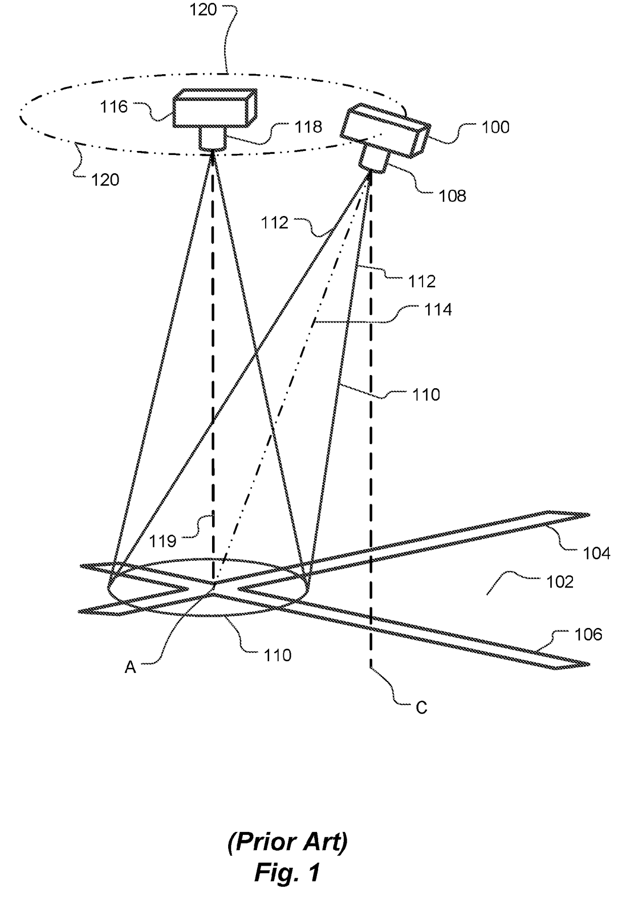
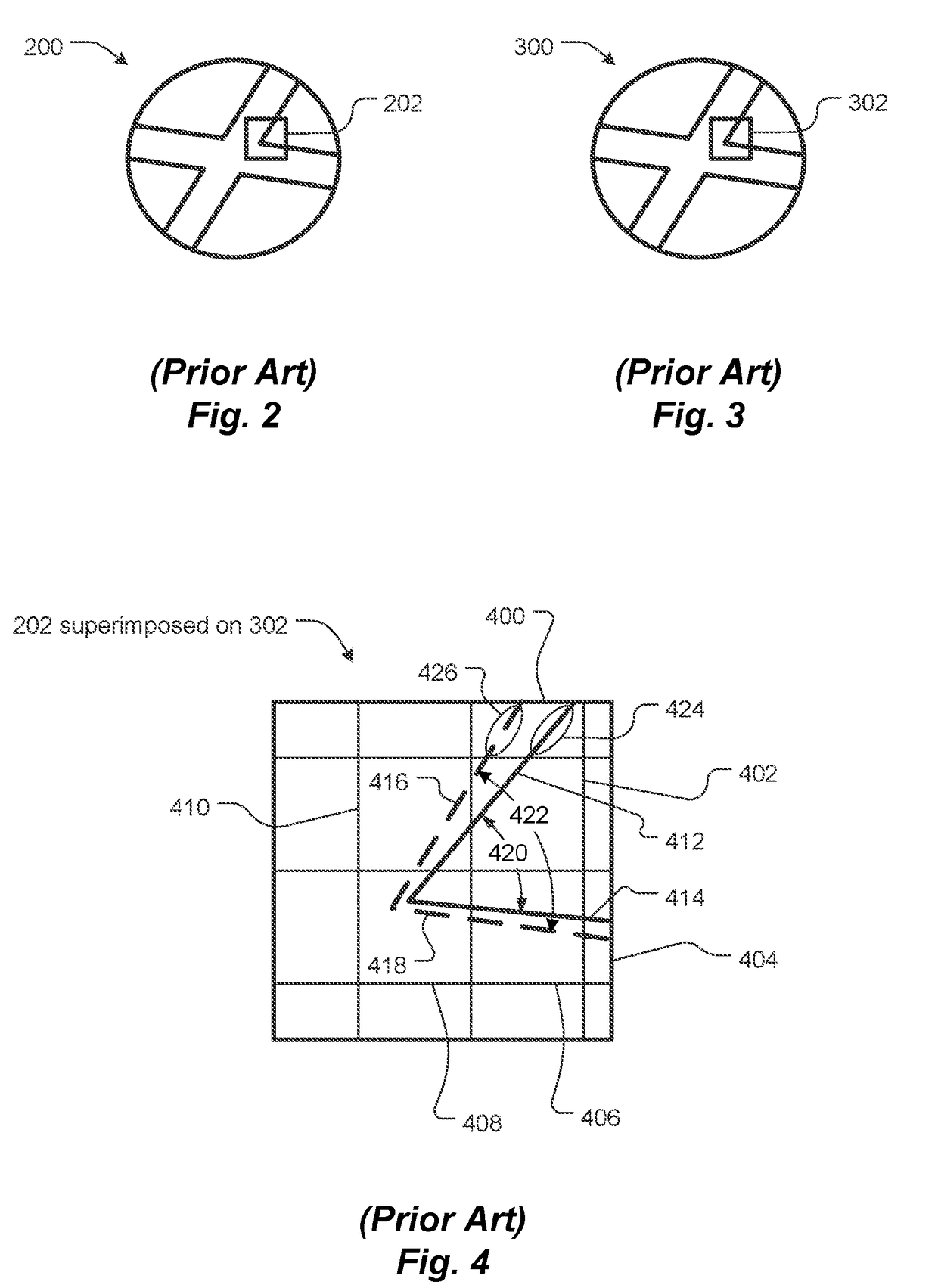
However, location solutions provided by such systems are inaccurate due to attitude ambiguities in imaging equipment.

Method used


Image

  • Star Tracker-Aided Airborne or Spacecraft Terrestrial Landmark Navigation System
  • Star Tracker-Aided Airborne or Spacecraft Terrestrial Landmark Navigation System
  • Star Tracker-Aided Airborne or Spacecraft Terrestrial Landmark Navigation System

Examples


Embodiment Construction

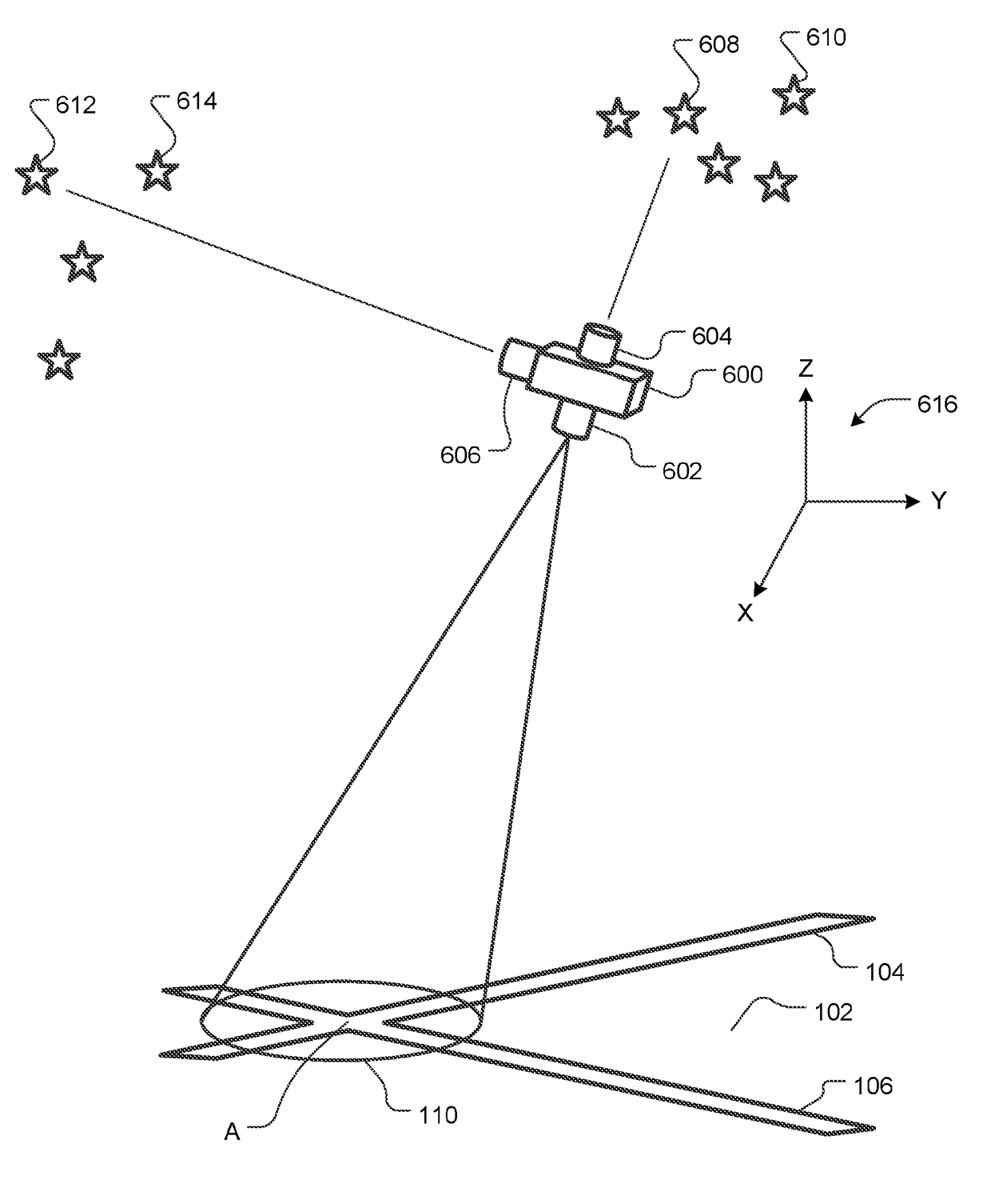
[0003]An embodiment of the present invention provides a location determining system. The system includes a database that stores terrain landmark data. The terrain landmark data is stored in association with geographic location information about the terrain landmark data. The system also includes an imager. The imager is configured to aim downward toward terrain below the imager. The imager is also configured to generate terrain data representing a surface aspect of the terrain. The imager may include an optical camera, a radar, a LIDAR or other imager.

[0004]A matching engine compares the terrain data to the terrain landmark data and determines an estimated location of the imager, based on: (a) a match between the terrain data and the terrain landmark data and (b) the geographic location information associated with the terrain landmark data.

[0005]The system also includes a star tracker. The star tracker is configured to measure attitude of the imager. A navigation filter calculates a...


PUM


Abstract

Methods and apparatus automatically determine a location, such as of an aircraft or spacecraft, by matching images of terrain below the craft, as captured by a camera, radar, etc. in the craft, with known or predicted terrain landmark data stored in an electronic data store. A star tracker measures attitude of the camera. Optionally, a rangefinder measures altitude of the camera above the terrain. A navigation filter uses the attitude, and optionally the altitude, to resolve attitude, and optionally altitude, ambiguities and thereby avoid location solution errors common in prior art terrain matching navigation systems.

Description

TECHNICAL FIELD[0001]The present invention relates to terrain matching navigation systems and, more particularly, to such navigation systems that measure and take into account attitude of a terrain imager when calculating a location.BACKGROUND ART[0002]Known navigation techniques and systems compare images of terrain taken from aircraft to data previously stored in databases of terrain imagery to find matches and, therefore, ascertain their locations. For example, some cruise missiles use a terrain contour matching system referred to as TERCOM. However, location solutions provided by such systems are inaccurate due to attitude ambiguities in imaging equipment.SUMMARY OF EMBODIMENTS[0003]An embodiment of the present invention provides a location determining system. The system includes a database that stores terrain landmark data. The terrain landmark data is stored in association with geographic location information about the terrain landmark data. The system also includes an imager....

Claims


Application Information

Patent Timeline
Patent Type & Authority Applications(United States)
IPC IPC(8): G01C21/36G01C21/00G06K9/00G01C21/02G01C21/30G06V20/13G06V20/17
CPCG01C21/3602G01C21/005G06F17/30247G01C21/025G01C21/30G06K9/0063G06F16/583G06V20/13G06V20/10G06V20/17
Inventor LAINE, JUHA-PEKKA J.BLASCHE, GREGORY P.JAMULA, MATTHEW T.BOHN, PAUL A.DAWSON, ROBIN MARK ADRIANLANE, BENJAMIN F.HOKE, ERIC T.MEISER, DANIEL M.KINAST, JOSEPH M.SMITH, STEPHEN P.
Owner CHARLES STARK DRAPER LABORATORY
Learn More