Method, apparatus, and computer program product for verifying and/or updating road map geometry based on received probe data

a technology of road map and probe data, applied in the field of map generation and revision, can solve the problems of mapping services, difficulty in keeping up with map feature changes, and relative frequency change,

Active Publication Date: 2018-05-03
HERE GLOBAL BV
View PDF2 Cites 11 Cited by
  • Summary
  • Abstract
  • Description
  • Claims
  • Application Information

AI Technical Summary

Benefits of technology

[0014]According to some embodiments, the difference between at least one of heading information and location information of the map-matched probe data points and the link segment includes a first component and a second component. The first component may be a location accuracy component, while the second component may be a true difference between map data associated with the link segment and a true location of a road segment associated with the link segment. Methods may include: calculating a first probability density of a combination of the first component and the second component; calculating a second probability density of the first component; and performing a Fourier analysis of the first probability density and the second probability density to obtain the probability density of the second component. Calculating the probability density of a combination of the first component and the second component may include calculating a probability density of the difference between the at least one of heading information and location information of the map-matched probe data points and of the link segment, where calculating the second probability density includes calculating a probability density based on measurement errors of the probe data points.

Problems solved by technology

However, map features such as roadways and routes along roadways change with relative frequency and mapping services may struggle to keep up with the map feature changes considering there are millions of miles of roads and thousands of road projects altering traffic routes on a constant basis.
Further, given the vast number of road segments in roadway networks for cities, countries, and continents, digital map geometries may sometimes be erroneous or contain anomalies.
Correcting digital map geometry anomalies with respect to road segment location can be a time consuming and costly undertaking.

Method used


Image

  • Method, apparatus, and computer program product for verifying and/or updating road map geometry based on received probe data
  • Method, apparatus, and computer program product for verifying and/or updating road map geometry based on received probe data
  • Method, apparatus, and computer program product for verifying and/or updating road map geometry based on received probe data

Examples


Embodiment Construction

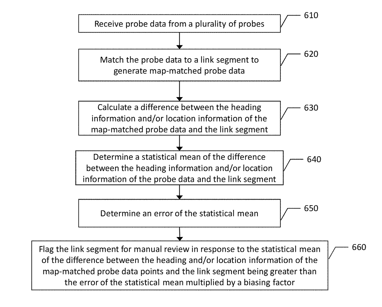
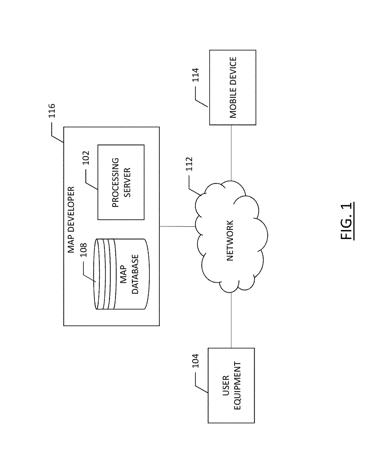
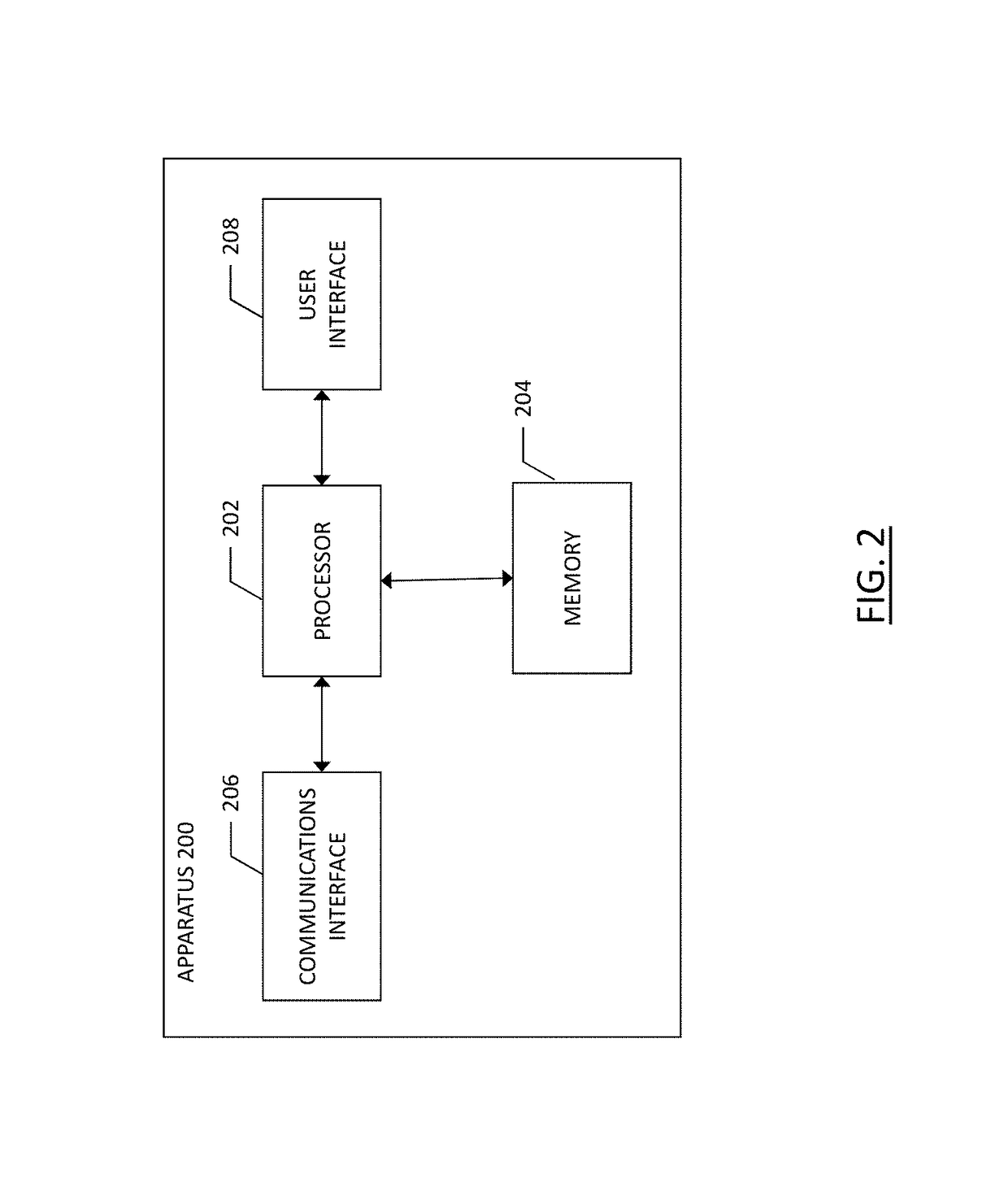
[0030]Some embodiments of the present invention will now be described more fully hereinafter with reference to the accompanying drawings, in which some, but not all, embodiments of the invention are shown. Indeed, various embodiments of the invention may be embodied in many different forms and should not be construed as limited to the embodiments set forth herein; rather, these embodiments are provided so that this disclosure will satisfy applicable legal requirements. Like reference numerals refer to like elements throughout. As used herein, the terms “data,”“content,”“information,” and similar terms may be used interchangeably to refer to data capable of being transmitted, received and / or stored in accordance with embodiments of the present invention. Thus, use of any such terms should not be taken to limit the spirit and scope of embodiments of the present invention.

[0031]A method, apparatus, and computer program product are provided herein in accordance with an example embodimen...


PUM


Abstract

A method is provided for verifying and/or updating map geometry based on a probe data. A method may include: receiving probe data from a plurality of probes within a region, where the probe data includes at least one of heading information and location information for each probe data point; matching the probe data to a link segment to generate map-matched probe data; calculating a difference between the at least one of heading information and location information of the map-matched probe data points and of the link segment; determining a statistical mean of the data; determining an error of the statistical mean of the data; and flagging the link segment for manual review in response to the statistical mean being greater than the error of the statistical mean multiplied by a biasing factor.

Description

TECHNOLOGICAL FIELD[0001]An example embodiment of the present invention relates to map generation and revision and, more particularly, to revising map geometry based on probe data collected including automatically and semi-automatically correcting map geometry anomalies.BACKGROUND[0002]Maps have been used for centuries for providing route geometry and geographical information. Conventional paper maps including static images of roadways and geographic features from a snapshot in history have given way to digital maps presented on computers and mobile devices. These digital maps can be updated and revised such that users have the most-current maps available to them each time they view a map hosted by a mapping service server. However, map features such as roadways and routes along roadways change with relative frequency and mapping services may struggle to keep up with the map feature changes considering there are millions of miles of roads and thousands of road projects altering traf...

Claims


Application Information

Patent Timeline
Patent Type & Authority Applications(United States)
IPC IPC(8): G06F17/30
CPCG06F17/30371G06F17/30241G06F17/30345G06F16/2365G06F16/23G06F16/29G01C21/3815G01C21/3841
Inventor GIURGIU, GAVRILAVERBUCH, ALEX
Owner HERE GLOBAL BV
Why Eureka
Try Eureka