Spatial data processing system and method

Active Publication Date: 2020-07-02
CMTE DEV LTD
View PDF0 Cites 3 Cited by
  • Summary
  • Abstract
  • Description
  • Claims
  • Application Information

AI Technical Summary

Benefits of technology

The invention is a system and method for storing and processing geographic and geometric datasets efficiently and manipulating them. The technical effect of the invention is to provide a more efficient way to handle large amounts of data related to maps and locations.

Problems solved by technology

Most software, and models in the form of data, information and knowledge models are too disconnected, and too disconnected to the physical world that they purport to be models of, to address ongoing needs (for example, the web is still based primarily upon a 2D print magazine model).
The greatest challenge is the synchronisation of computable models with what they are intended to model, whether in the past, present or future (prediction).

Method used


Image

  • Spatial data processing system and method
  • Spatial data processing system and method
  • Spatial data processing system and method

Examples


example class

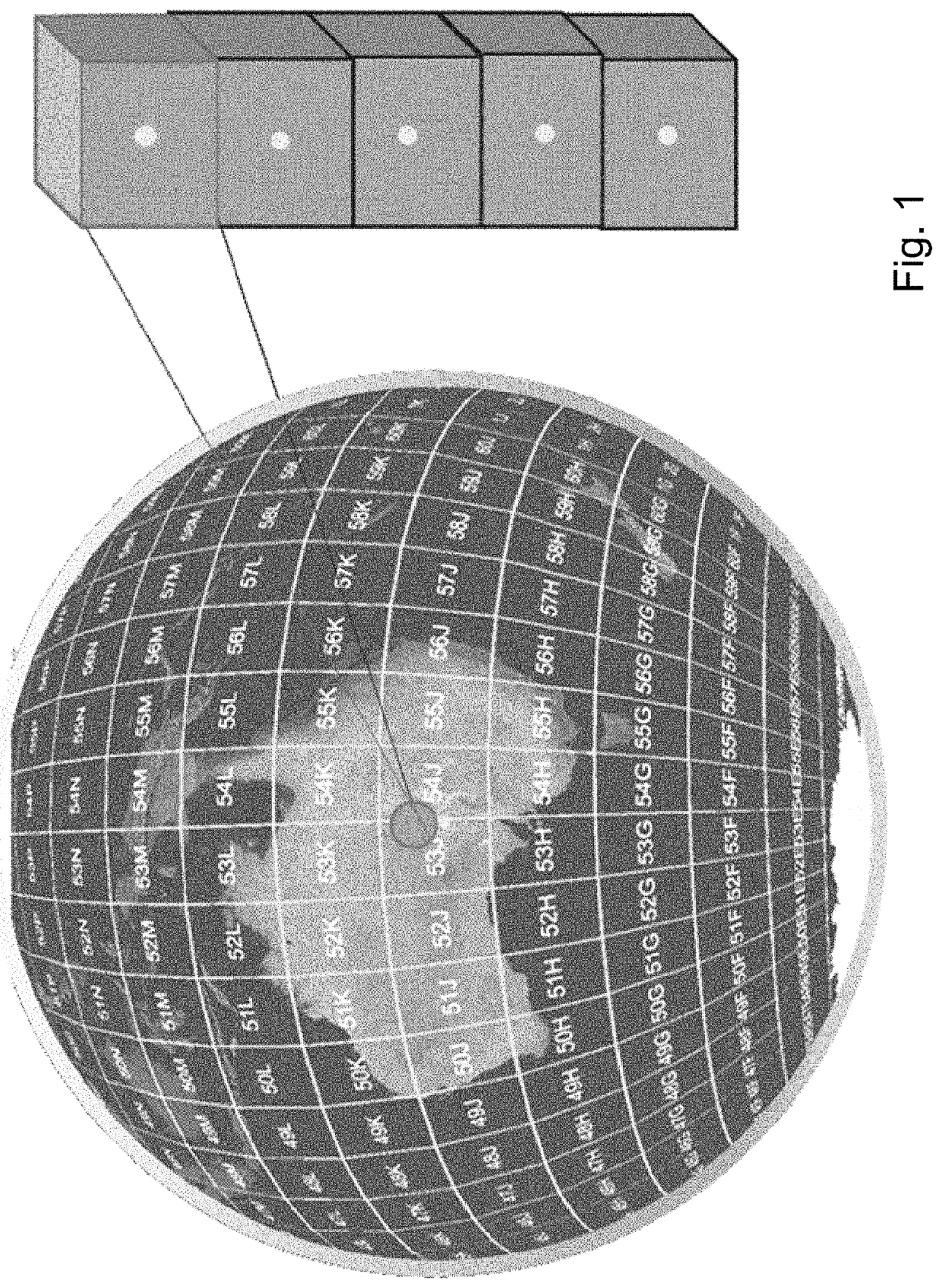
[0054 operations for the Geometry object type are shown 50 in FIG. 5. The z coordinate of a point typically, but not necessarily, represents altitude or elevation. The m coordinate represents a measurement. All Geometry classes described can be defined so that instances of Geometry are topologically closed, i.e. all represented geometries include their boundary as point sets. This does not affect their representation, and open version of the same classes may be used in other circumstances, such as topological representations. A Point value may include an m coordinate value. The m coordinate value allows the application environment to associate some measure with the point values.

[0055]Examples of draft table creation statements for some of these forms can be as follows:

 CREATE TABLE spatialObject (spatialObject_pk SERIAL primary key,SRSI smallint,originPointLatLongHeight GEOGRAPHY(POINTZ,4326) ,originPointXYZ GEOMETRY(POINTZ,4326),objectType TEXT,objectName TEXT,authourOwner TEXT,not...


PUM


Abstract

A system for handling 3 dimensional spatial information, the system including: a specialised application layer for the production of visual interactive applications associated with the 3 dimensional spatial information; a generic foundation client layer providing 3 dimensional spatial information interrogation routines, including a message passing interface; and a voxel server for interconnected to said generic foundation client via said message passing interface for the storage of 3 dimensional spatial information as a voxel data base.

Description

FIELD OF THE INVENTION[0001]The present invention relates to a system and method for the processing of spatialised data, and, in particular, discloses a system for dealing with voxel data structures.BACKGROUND OF THE INVENTION[0002]Any discussion of the background art throughout the specification should in no way be considered as an admission that such art is widely known or forms part of common general knowledge in the field.[0003]Most software, and models in the form of data, information and knowledge models are too disconnected, and too disconnected to the physical world that they purport to be models of, to address ongoing needs (for example, the web is still based primarily upon a 2D print magazine model). The greatest challenge is the synchronisation of computable models with what they are intended to model, whether in the past, present or future (prediction).[0004]It would be desirable to provide for the efficient storage and processing of geographic, spatial, geometric and m...

Claims


Application Information

Patent Timeline
IPC IPC(8): H04L29/06G06T17/05
CPCH04L69/26G06T17/05G06F16/23G06F16/29G06Q30/0283G06Q50/02G01V1/302G01V1/345G01V9/02G01V11/00G01V2210/60G01V2210/66G01V20/00
Inventor SENNERSTEN, CHARLOTTELINDLEY, CRAIG A.EVENS, BENGRACE, ALEXWISE, JULIAN
Owner CMTE DEV LTD
Why Eureka
Try Eureka