
Support request processing system using GPS data for locating a person requesting a support

a technology of support request and processing system, which is applied in the direction of vehicle position indication, navigation instruments, instruments, etc., can solve problems such as difficulty in rescuing peopl

Inactive Publication Date: 2003-09-02
MATSUSHITA ELECTRIC WORKS LTD
View PDF12 Cites 21 Cited by
  • Summary
  • Abstract
  • Description
  • Claims
  • Application Information

AI Technical Summary

Benefits of technology

Further, the mobile terminal may be programmed to transmit the time-series sets of the GPS data to the message center set by set to give one set of the GPS data at one time in descending time sequence. On the side of the message center, there is provided a check means which checks as to whether the current GPS data and those in the time-series sets is valid for calculation of the position of the mobile terminal. As soon as the GPS data is found to be valid, the check means transmits a stop signal to the mobile terminal, causing the mobile terminal to stop transmitting the remaining sets of the GPS data. Thus, it is possible to eliminate redundant procedures for prompt determination of the latest position of the mobile terminal.
In order to get a more comprehensive behavior of the person after requesting the support, the message center may transmits a follow-up request signal to the mobile terminal after a predetermined time from a first catch of calculating the position of the mobile terminal in reply to the support-request signal. In response to the follow-up request signal, the mobile terminal acts to acquire a fresh GPS data and transmit the fresh GPS data to the message center for updating the position of the mobile terminal, i.e., the person. Therefore, it is possible to update the latest position of the person still moving after requesting the support, assuring a reliable search for the person.
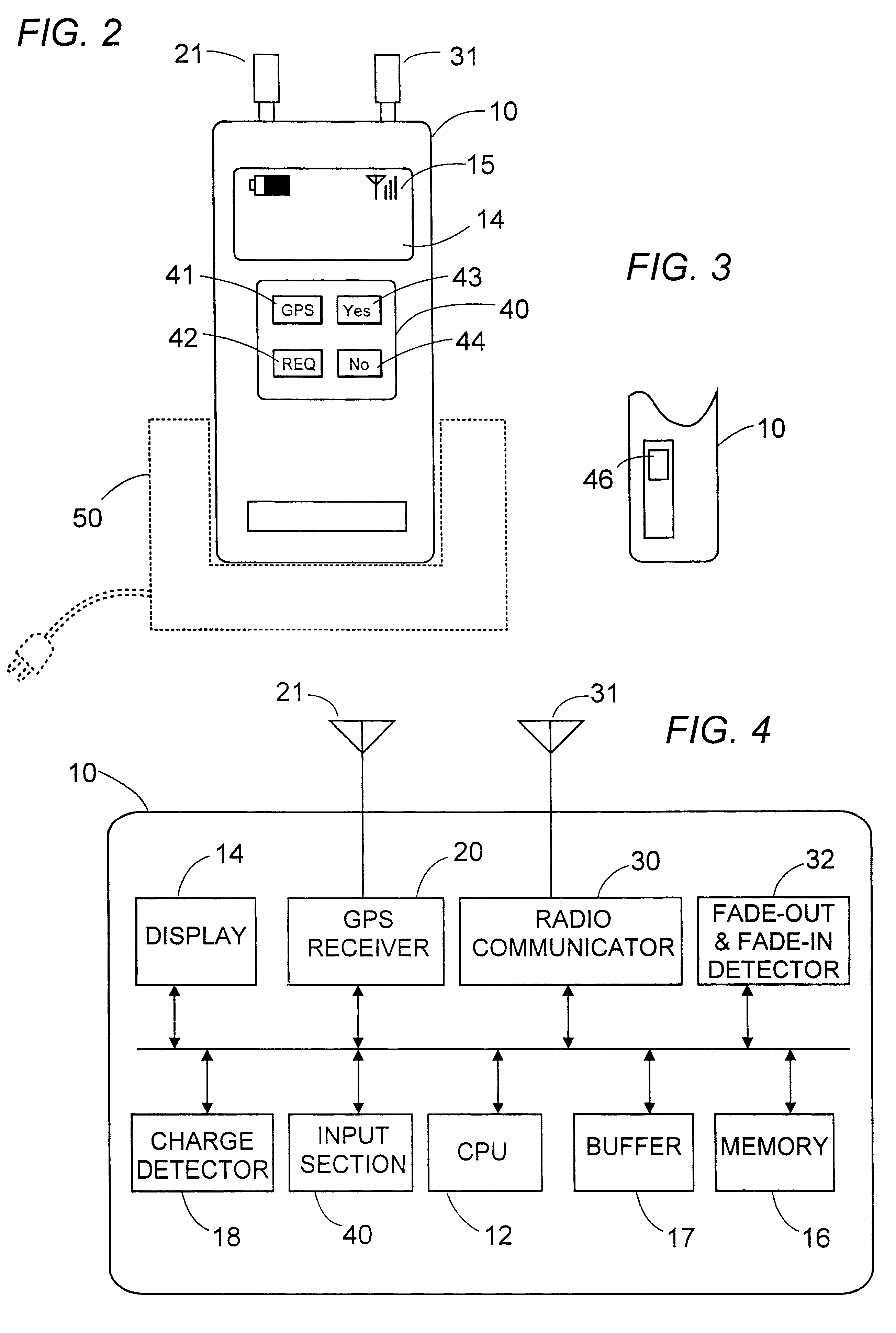
Additionally, the system may include a monitoring capability of logging the position of the person when the person is going out of an effective radio communication area with the message center such that the person can be located at the last position if it is required to search the person for any reason other than by the person's request. For this purpose, the mobile terminal may include a fade-out detecting means which detects whether the mobile terminal is moving closer to a border of the effective communication area based upon a received field intensity of a radio signal transmitted from a base station of the network, and generates a fade-out warning signal when the mobile terminal approaches to the border of the communication area. In response to the fade-out warning signal, the mobile terminal acquires a border GPS data indicative of the location near the border of the communication area and transmits the border GPS data as well as the fade-out warning signal together with the ID code to the message center. With this result, the message center can acknowledge the position of the person near the border of the communication area in relation to the personal information. The message center includes a storing means which, in response to the fade-out warning signal, stores the calculated position based upon the border GPS data with a tag indicating the presence of the fade-out warning signal. Therefore, when a search of the person is necessitated for any reason after the person moves out of the effective communication area, it is readily possible to retrieve the last position of the person near the border of the communication area, thereby facilitating to search for the missing person.
Further, the mobile terminal may have a revoke means which prohibits the radio transmitter from transmitting a further border GPS data in response to a further fade-out warning signal until an elapse of a predetermined time after the border GPS data is transmitted in response to the previous fade-out warning signal. Whereby, redundant operations of obtaining the duplicate positions of the person near the border of the communication area can be avoided.
In addition to or instead of the above capability of locating the person near the border of the effective communication area, the system may have a capability of recognizing the position of the person reentering the communication area. For this purpose, the mobile terminal is supplemented with a fade-in detecting means which detects whether the mobile terminal reenters the effective communication area based upon the received field intensity of the radio signal transmitted from the base station of the network, and generates a fade-in notice signal when the mobile terminal reenters the area. In response to the fade-in notice signal, the mobile terminal operates to acquire a border GPS data indicative of the position near the border of the area, and transmit the border GPS data as well as the fade-in notice signal together with the ID code to the message center. In this consequence, the message center can acknowledge the position of the person near the border of the communication area in relation to the personal information. Thus obtained position of the person is stored in the message center together with a tag indicating that the person reenters the area such that the person reentering the area can be immediately located. This is particularly advantageous in a situation where a search request by another person is accepted at the message center while the person is out of the communication area.

Problems solved by technology

Thus decentralized GPS system, however, is still insufficient in that when the person is in a dead-area such as a building where the GPS data from the GPS satellites is not available but the radio communication with the message center is available, the support-request signal cannot be accompanied with a valid GPS data so that the message center fails to determine the position of the person, making it difficult to rescue the person.

Method used


Image

  • Support request processing system using GPS data for locating a person requesting a support
  • Support request processing system using GPS data for locating a person requesting a support
  • Support request processing system using GPS data for locating a person requesting a support

Examples


Embodiment Construction

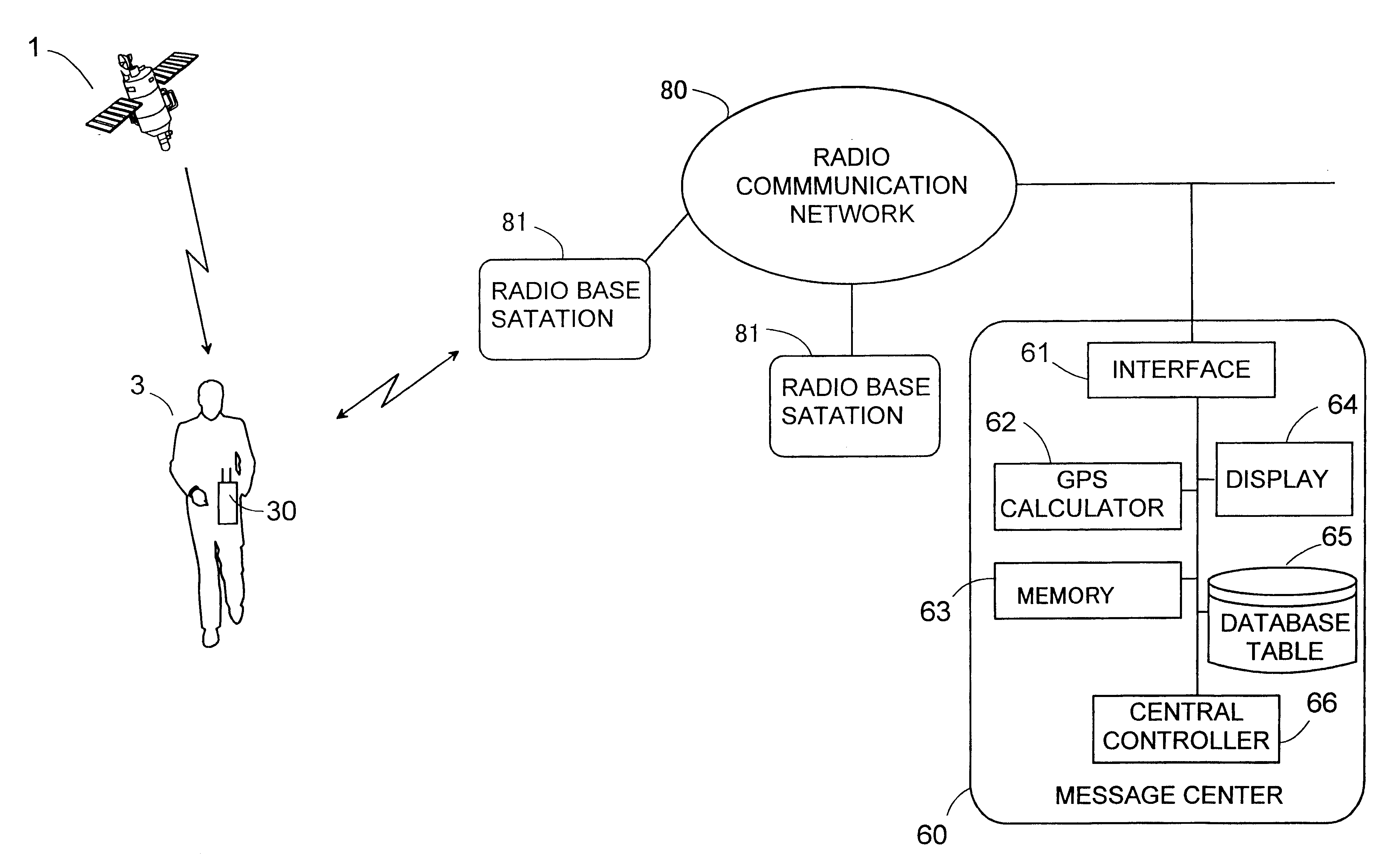
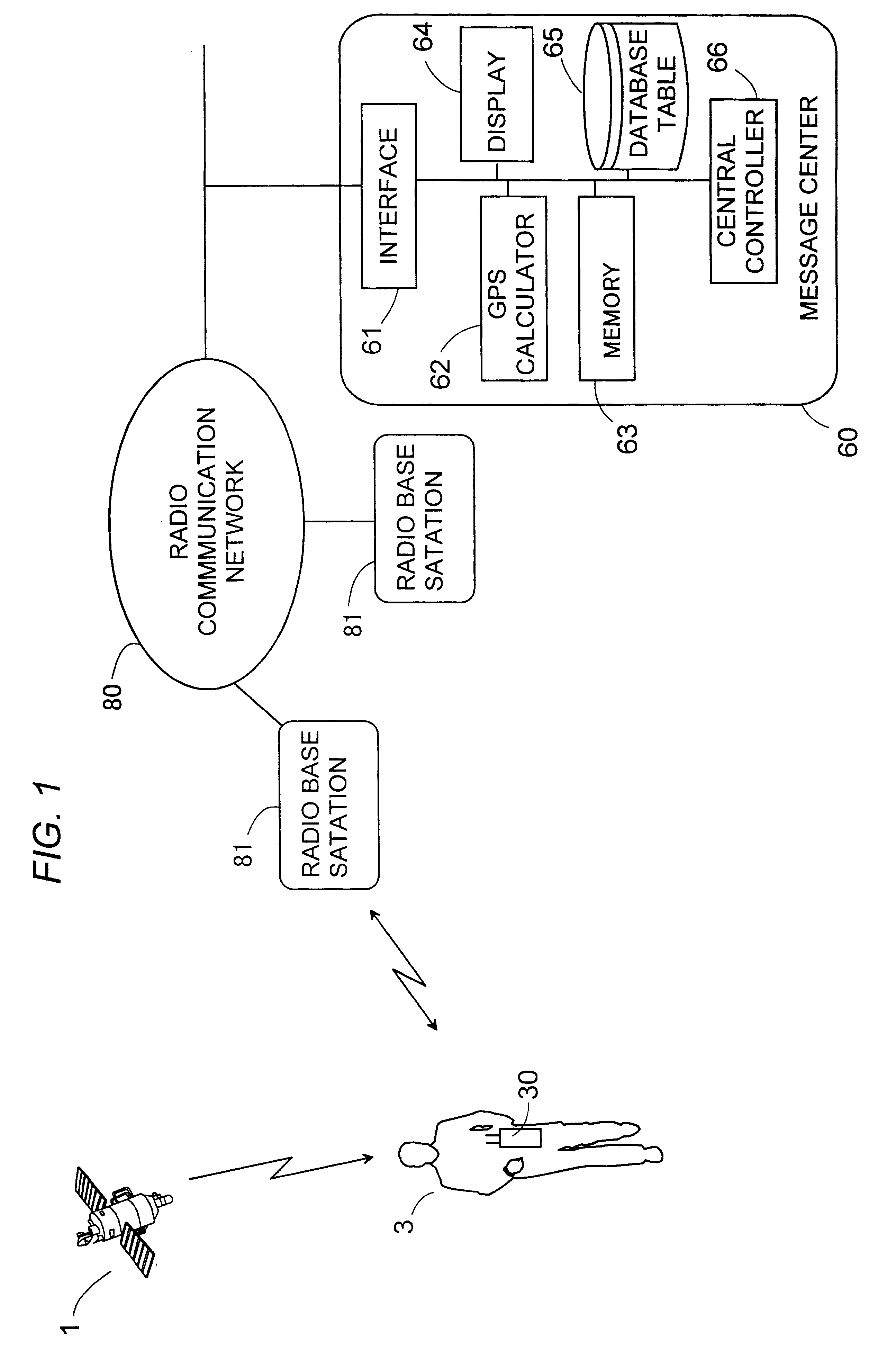
Referring now to FIG. 1, there is shown a support request processing system using GPS data from GPS satellites for locating a person requesting a support. The system utilizes a global positioning system (GPS) to locate the person in trouble and give a warning message, prompting to take a suitable support or rescue. The system is particularly intended to supervise the person 3 who possibly moves into building or the like place where the GPS satellites 1 cannot be reached. The system includes a mobile terminal 10 adapted to be carried by a person and capable of acquiring GPS data from the GPS satellites 1, and a message center 60 receiving the GPS data from the mobile terminal 10 to calculate a position of the mobile terminal 60, i.e., the person 3 carrying the same. The mobile terminal 10 has a capability of issuing a support-request signal which is transmitted to the message center 60 over a public radio communication network 70 having a plurality of radio base stations 71. The netw...


PUM


Abstract

A system using GPS data for locating a person requesting a support. The system includes a mobile terminal carried by a person to acquire the GPS data from GPS satellites and transmits the same upon a request by the person to a message center where the GPS data is processed to calculate the person(s position. The mobile terminal simply acquires the GPS data which is invalid for calculation of the position if the request is made where the GPS satellite is not available. For successfully locating the person's position, the mobile terminal acquires the GPS data regularly at different times in accordance with a time schedule and stores the time-series sets of the GPS data which are transmitted together with a current GPS data acquired in response to the support request, thereby giving the latest available position of the person if the current GPS data is found invalid.

Description

1. Field of the InventionThe present invention is directed to a support-request processing system using GPS data for locating a person requesting a support, and more particularly to such a system using a decentralized Global Positioning System (GPS) to locate a person requesting the support.2. Description of the Prior ArtA decentralized GPS system such as disclosed in U.S. Pat. Nos. 5,119,102 and 5,379,224 has been proposed to reduce search of a person requesting an urgent support for rescue. The system utilizes a GPS terminal to be carried by a person, and a message center which is linked through a radio communication network to the GPS terminal and acts in response to a support-request signal from the person to give a warning message including a position of the person for prompting a suitable support. The GPS terminal is capable of acquiring GPS data from GPS satellites and of transmitting the support-request signal together with the GPS data to the message center. The GPS data is...

Claims


Application Information

Patent Timeline
Patent Type & Authority Patents(United States)
IPC IPC(8): G01S1/02G01S1/00G01S5/14G01S5/00G08B25/01G01C21/00G01S19/07G01S19/17G08B25/10G08G1/13H04W4/02H04W60/02H04W64/00
CPCG01S1/022G01S5/0036G01S19/17G08B25/016G01S2205/006G01S2205/008
Inventor HONDA, KAZUHIROMISE, TOSHIROTAKEHARA, KIYOTAKAOYA, AKIRA
Owner MATSUSHITA ELECTRIC WORKS LTD
Learn More