Method of collecting parking availability information for a geographic database for use with a navigation system

Active Publication Date: 2009-05-26
HERE GLOBAL BV
View PDF28 Cites 114 Cited by
  • Summary
  • Abstract
  • Description
  • Claims
  • Application Information

AI Technical Summary

Problems solved by technology

Providing parking availability information provides challenges.
However, real-time parking availability information has some limitations.
If the communications are lost or interrupted,

Method used


Image

  • Method of collecting parking availability information for a geographic database for use with a navigation system
  • Method of collecting parking availability information for a geographic database for use with a navigation system
  • Method of collecting parking availability information for a geographic database for use with a navigation system

Examples


Embodiment Construction

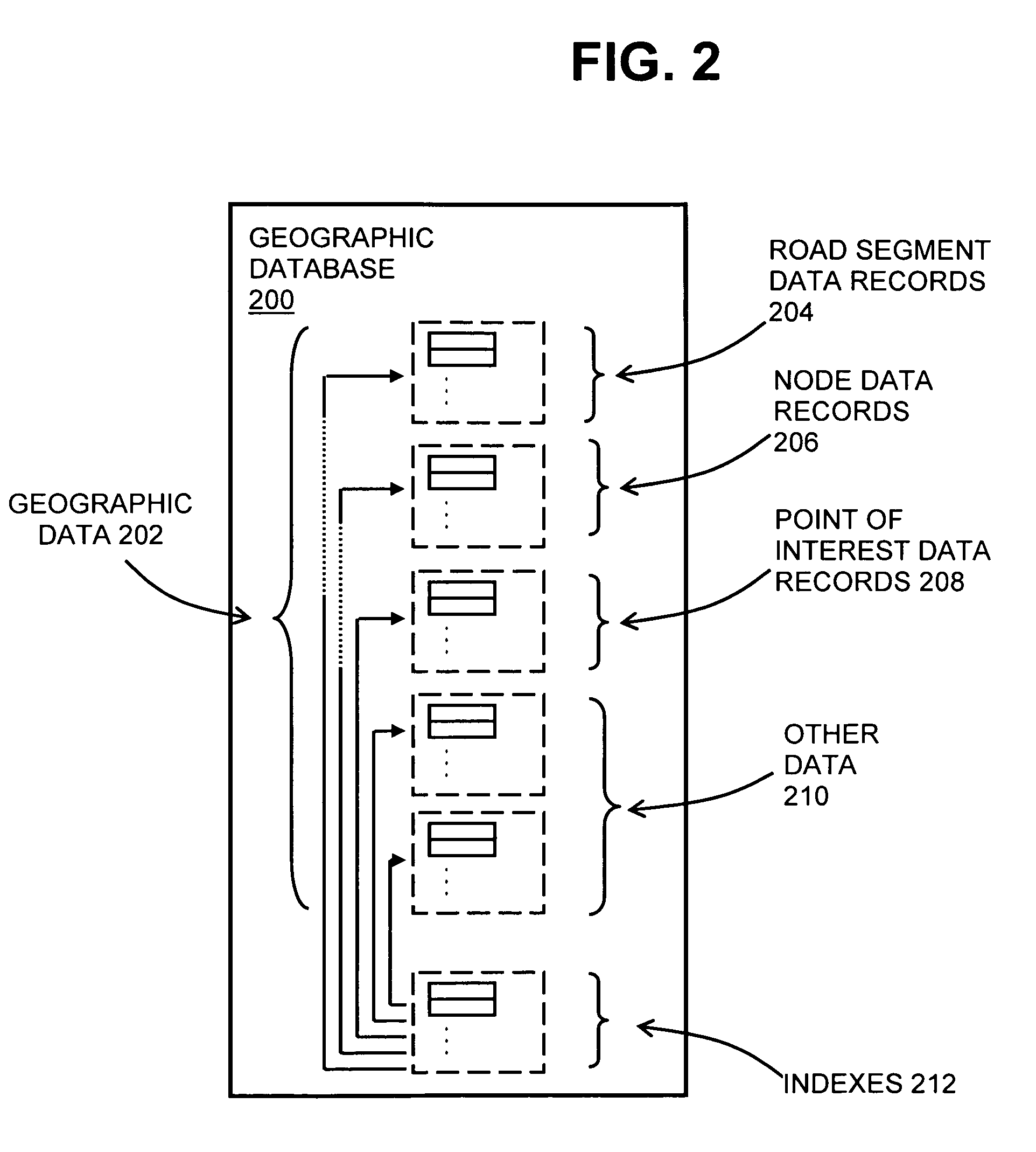
I. Geographic Map Database

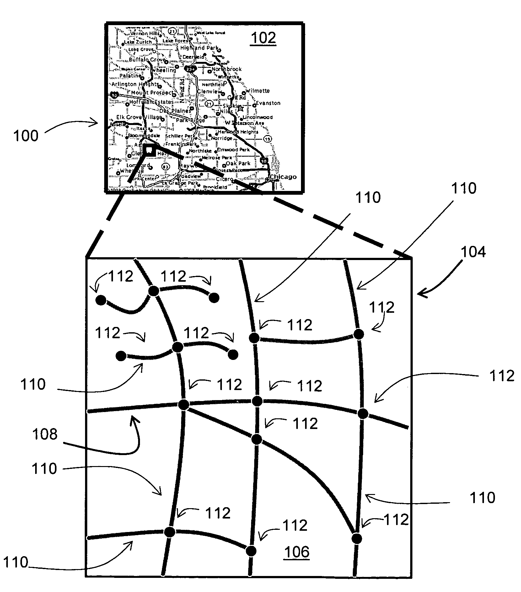
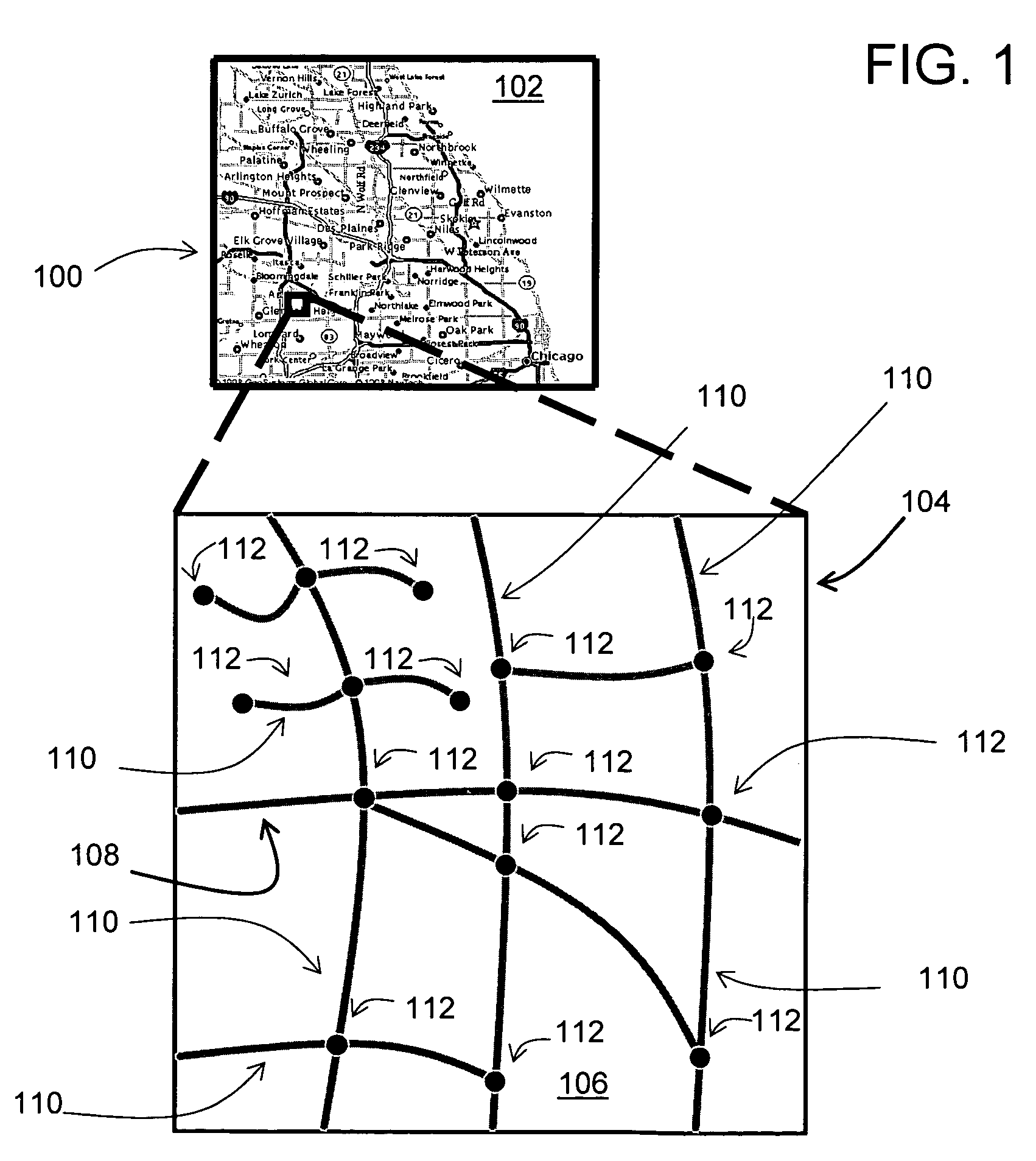
[0022]FIG. 1 illustrates a map 100 of a geographic region 102. The geographic region 102 may correspond to a metropolitan or rural area, a state, a country, or combinations thereof, or any other area. Located in the geographic region 102 are physical geographic features, such as roads, points of interest (including businesses, municipal facilities, etc.), lakes, rivers, railroads, municipalities, etc.

[0023]FIG. 1 also includes an enlarged map 104 of a portion 106 of the geographic region 102. The enlarged map 104 illustrates part of a road network 108 in the geographic region 102. The road network 108 includes, among other things, roads and intersections located in the geographic region 102. As shown in the portion 106, each road in the geographic region 102 is composed of one or more road segments 110. A road segment 110 represents a portion of the road. Each road segment 110 is shown to have associated with it two nodes 112; one node represents the point ...


PUM


Abstract

A method of obtaining data for a geographic database for use with a navigation system includes collecting data indicating parking availability at a parking facility at a plurality of times and analyzing the data indicating parking availability. Based on the analyzing, the method derives historic parking data for the parking facility. The historic parking data indicates past parking availability at the parking facility at predetermined times. The historic parking data is stored in the geographic database. The historic parking data may indicate past parking availability for predetermined time intervals, days of the week, weather conditions and events.

Description

REFERENCE TO RELATED APPLICATIONS[0001]The present application is related to the co-pending application entitled “METHOD OF OPERATING A NAVIGATION SYSTEM TO PROVIDE PARKING AVAILABILITY INFORMATION” filed on the same date herewith, application Ser. No. 11 / 342,334, the entire disclosure of which is incorporated by reference herein.BACKGROUND OF THE INVENTION[0002]The present invention relates to a method and system for collecting information for a geographic database, and more particularly to a method and system for collecting historic parking availability information for a geographic database for use with a navigation system.[0003]Vehicle navigation systems are available that provide end users with various navigation-related functions and features. For example, some navigation systems are able to determine an optimum route to travel along a road network from an origin location to a destination location in a geographic region. Using input from the end user, and optionally from equipm...

Claims


Application Information

Patent Timeline
IPC IPC(8): B60Q1/48G06K9/00
CPCG01C21/20G01C21/26G08G1/143G08G1/147G08G1/096827G08G1/096838G06F16/245
Inventor KAPLAN, LAWRENCE M.HAYES, JR., HOWARD R.DEVRIES, STEVENLINDSAY, MATTHEW G.
Owner HERE GLOBAL BV
Why Eureka
Try Eureka