Method and system using delivery trucks to collect address location data

a technology of address location and delivery truck, which is applied in the direction of vehicle position indication, navigation instruments, instruments, etc., can solve the problems of significant task of collecting information for a geographic database, relatively time-consuming and therefore relatively expensiv

Inactive Publication Date: 2005-03-24
HERE GLOBAL BV
View PDF15 Cites 60 Cited by
  • Summary
  • Abstract
  • Description
  • Claims
  • Application Information

AI Technical Summary

Problems solved by technology

Collecting information for a geographic database is a significant task....

Method used


Image

  • Method and system using delivery trucks to collect address location data
  • Method and system using delivery trucks to collect address location data
  • Method and system using delivery trucks to collect address location data

Examples


first embodiment

[0019] I. First Embodiment

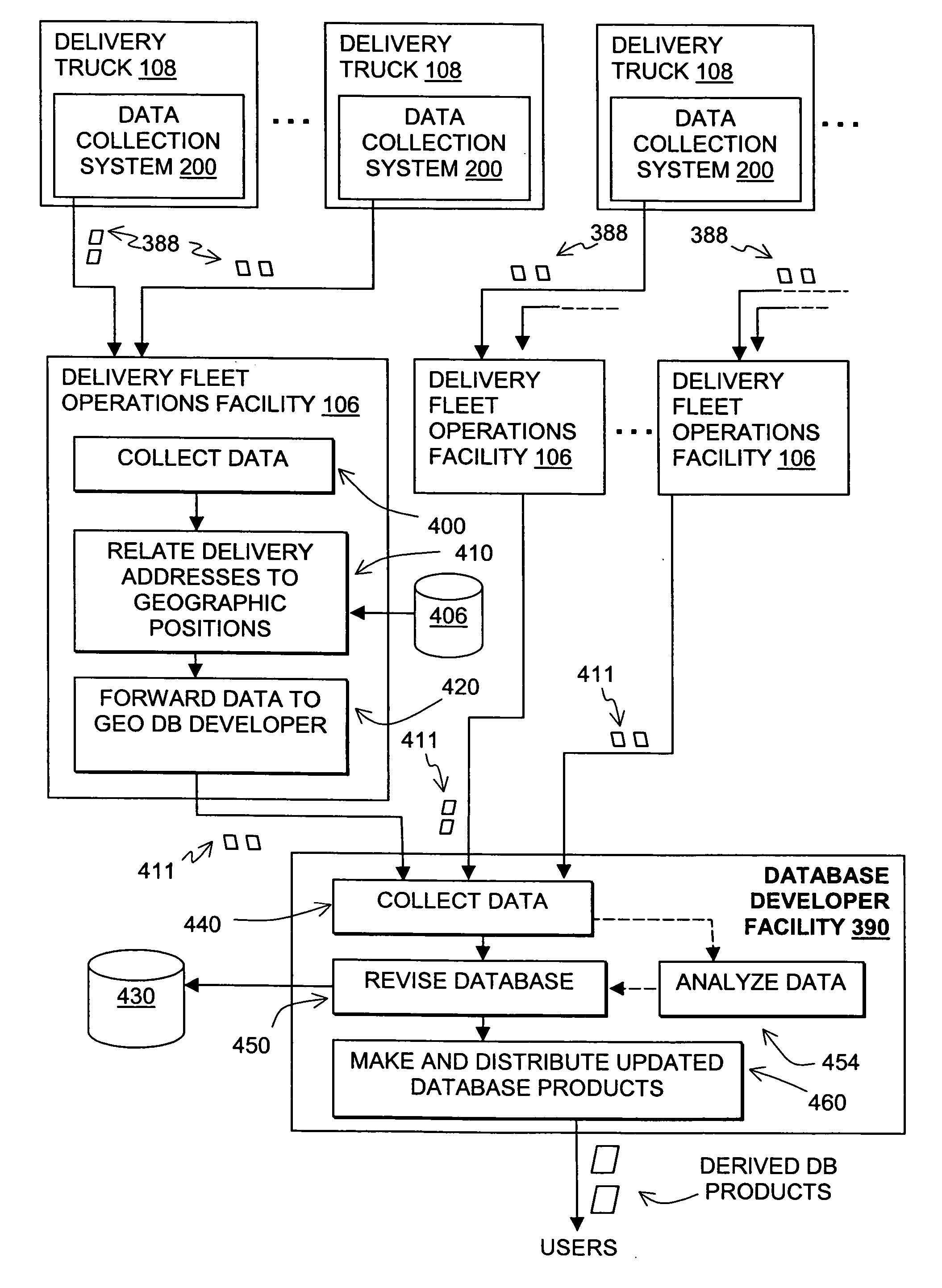
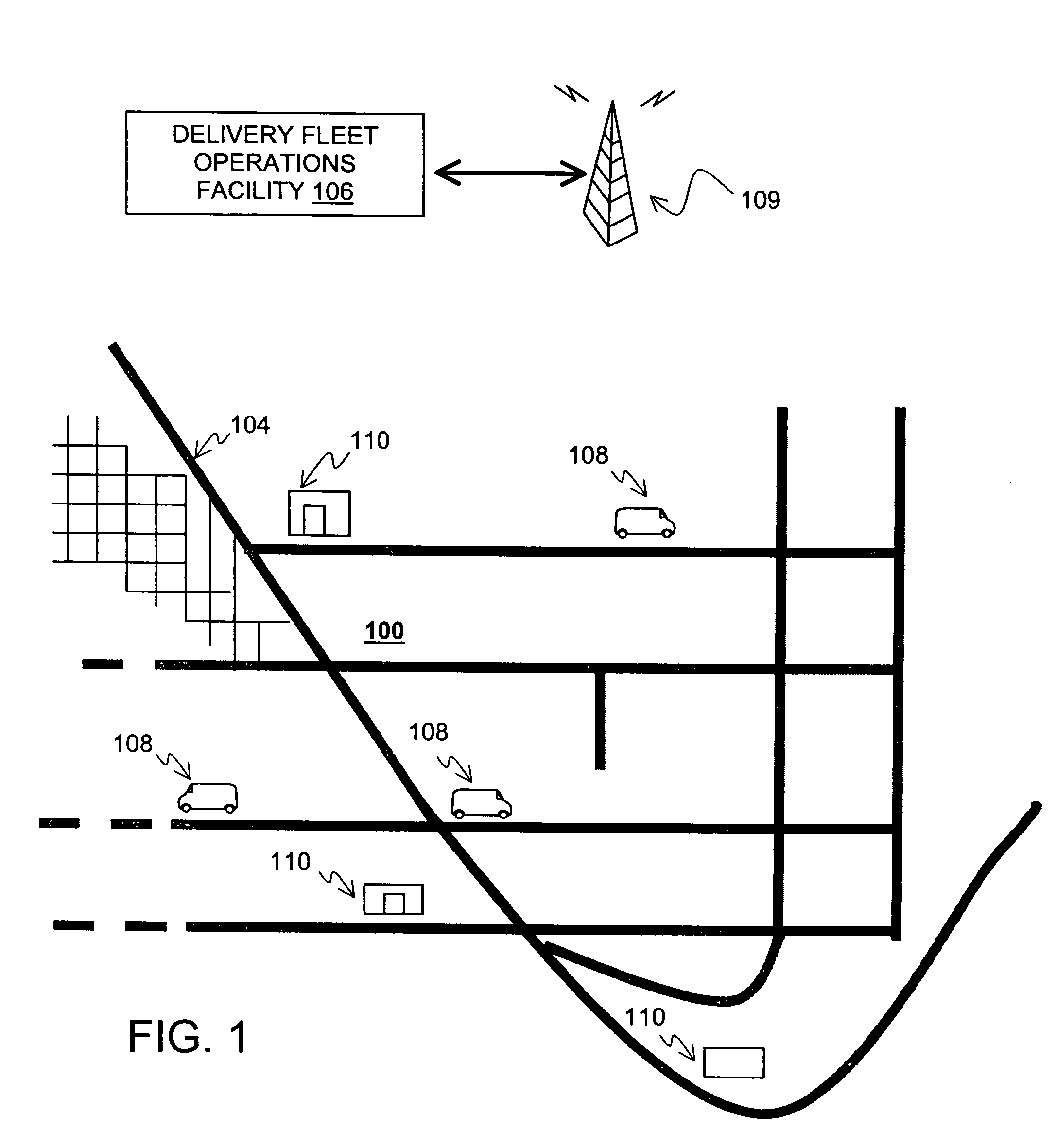
[0020] Referring to FIG. 1, there is an illustration of a geographic area 100. Located in the geographic area 100 is a road network 104. A fleet of delivery trucks 108 travels on the road network 104 to deliver items to buildings 110 located in the geographic area 100. The items may include packages, letters, or other goods. A delivery fleet operations facility 106 uses a wireless communications system 109 to exchange data with each delivery truck 108.

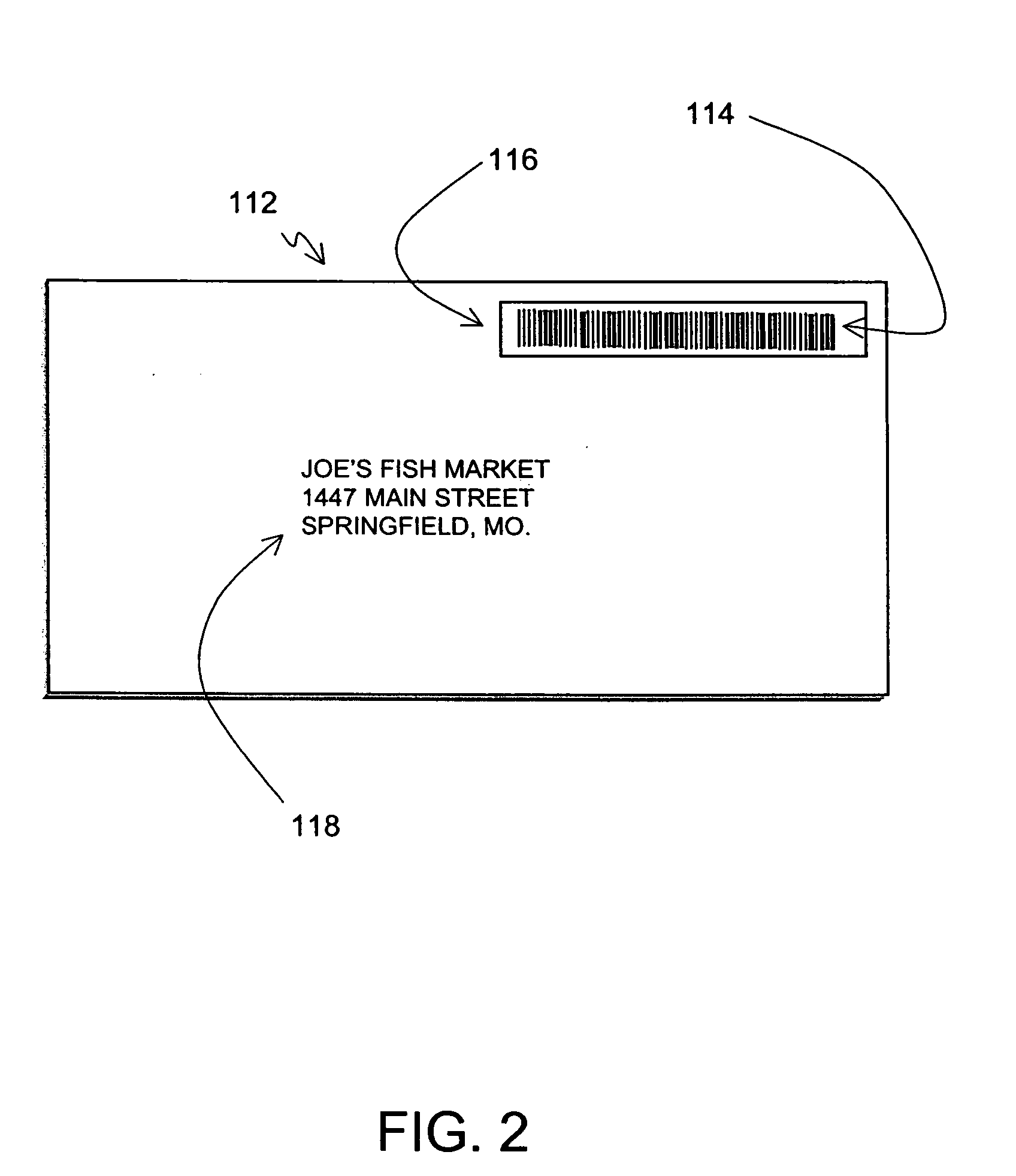
[0021] Each item to be delivered by the delivery trucks 108 is directly or indirectly associated with an address to which the item is to be delivered. The address associated with an item refers to a physical location in the geographic area 100. An address may be a street address. An address may also be a named location, such as “City Hall,”“Empire State Building,”“One Magnificent Mile,” etc.

[0022]FIG. 2 shows an example of a delivery item 112. The delivery item 112 is one of the items to be delivered by the ...


PUM


Abstract

A system and method are disclosed for collecting data that relate addresses to map-referenced locations. A fleet of delivery trucks delivers items to locations throughout a geographic region. Each item to be delivered includes a tracking code. An electronic code reader device is used to record the tracking code of an item when the item is being delivered. A position determining device, such as a GPS unit, is used to determine a geographic position associated with the delivery of each item. Data indicating the tracking code of an item and the corresponding geographic position associated with the delivery are stored. Then, using data that indicate an address associated with each tracking code, each address is associated with a geographic position. This information is used to revise a geographic database, e.g., to relate addresses to map-referenced locations.

Description

BACKGROUND OF THE INVENTION [0001] The present invention relates to collecting geographic data and more particularly, the present invention relates to a process and system that collects address location information using delivery trucks. [0002] Collecting information for a geographic database is a significant task. Not only is the initial collection of data a significant undertaking, but a geographic database needs to be updated on a regular basis. For example, new streets are constructed, street names change, traffic lights are installed, and turn restrictions are added to existing roads. Also, new levels of detail may be added about geographic features that are already represented in an existing geographic database. For example, an existing geographic database for roads may be enhanced with information about lane widths, shoulder sizes, lane barriers, address ranges, sidewalks, bicycles paths, etc. Thus, there exists a need to continue to collect information for a geographic datab...

Claims


Application Information

Patent Timeline
IPC IPC(8): G01C21/00G09B29/00G06Q50/00G08G1/0969G08G1/13
CPCG08G1/0969
Inventor KHAN, M. SALAHUDDINALWAR, NARAYANAN
Owner HERE GLOBAL BV
Why Eureka
Try Eureka