Method and system for obtaining recurring delay data using navigation systems
a technology of navigation system and geographic database, applied in traffic control system, road vehicle traffic control, instruments, etc., can solve problems such as similar delay points, drivers may have to stop or reduce the speed of their vehicles, and collect information for a geographic database is a significant task
- Summary
- Abstract
- Description
- Claims
- Application Information
AI Technical Summary
Problems solved by technology
Method used
Image
Examples
Embodiment Construction
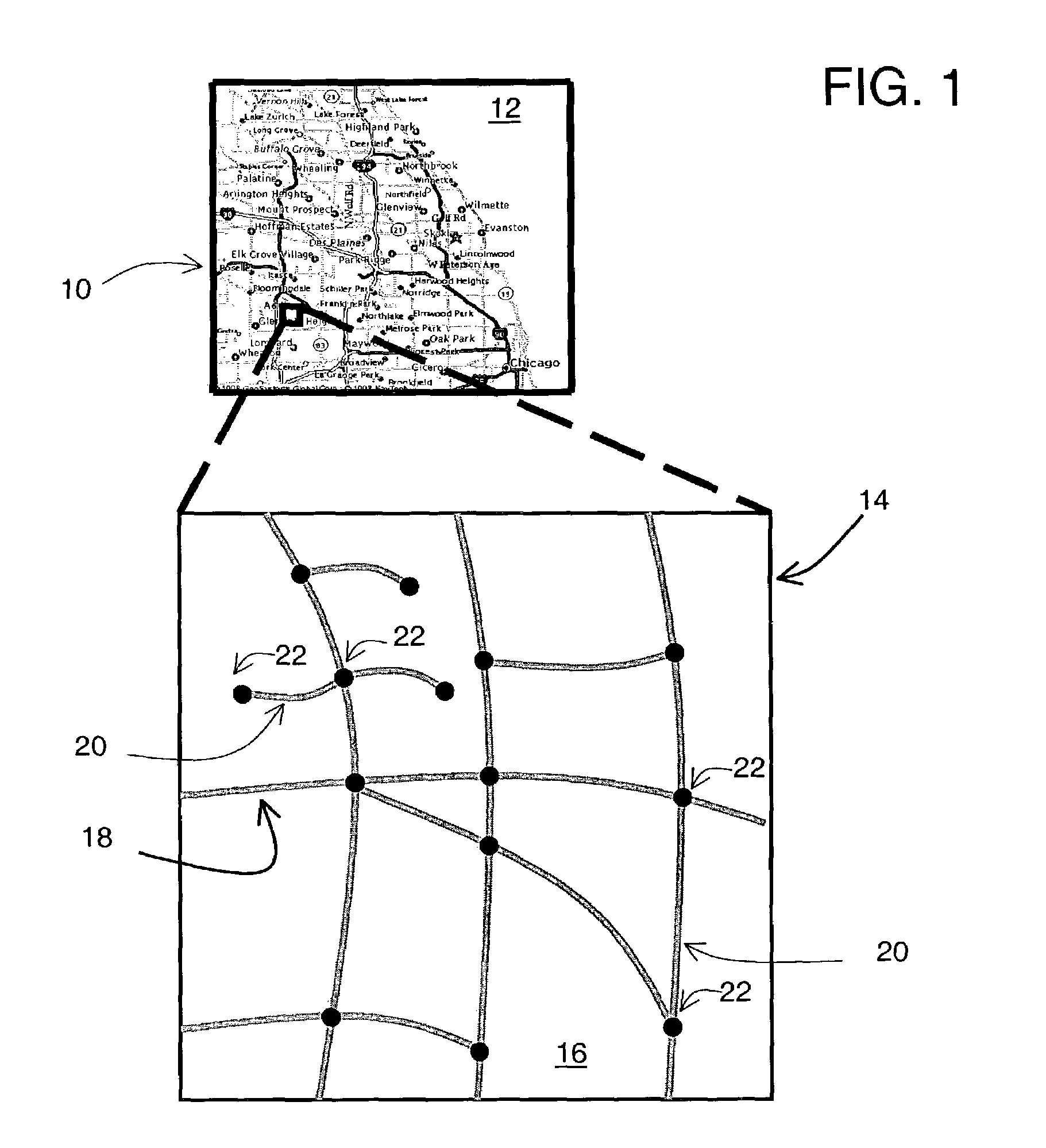
[0019]FIG. 1 shows a map 10 of a geographic region 12. The geographic region 12 may correspond to a metropolitan or rural area, a state, a country, or combinations thereof, or any other area of comparable size. Located in the geographic region 12 are physical geographic features, such as roads, points of interest (including businesses, municipal facilities, etc.), lakes, rivers, railroads, municipalities, etc.
[0020]FIG. 1 also includes an enlarged map 14 of a portion 16 of the geographic region 12. The enlarged map 14 illustrates part of the road network 18 in the geographic region 12. The road network 18 includes, among other things, roads and intersections located in the geographic region 12. As shown in the portion 16, each road in the geographic region 12 is composed of one or more road segments 20. A road segment 20 represents a portion of the road. Each road segment 20 is shown to have associated with it two nodes 22; one node represents the point at one ...
PUM
 Abstract
Description
Claims
Application Information
 - R&D
- Intellectual Property
- Life Sciences
- Materials
- Tech Scout
- Unparalleled Data Quality
- Higher Quality Content
- 60% Fewer Hallucinations
Browse by: Latest US Patents, China's latest patents, Technical Efficacy Thesaurus, Application Domain, Technology Topic, Popular Technical Reports.
© 2025 PatSnap. All rights reserved.Legal|Privacy policy|Modern Slavery Act Transparency Statement|Sitemap|About US| Contact US: help@patsnap.com


