

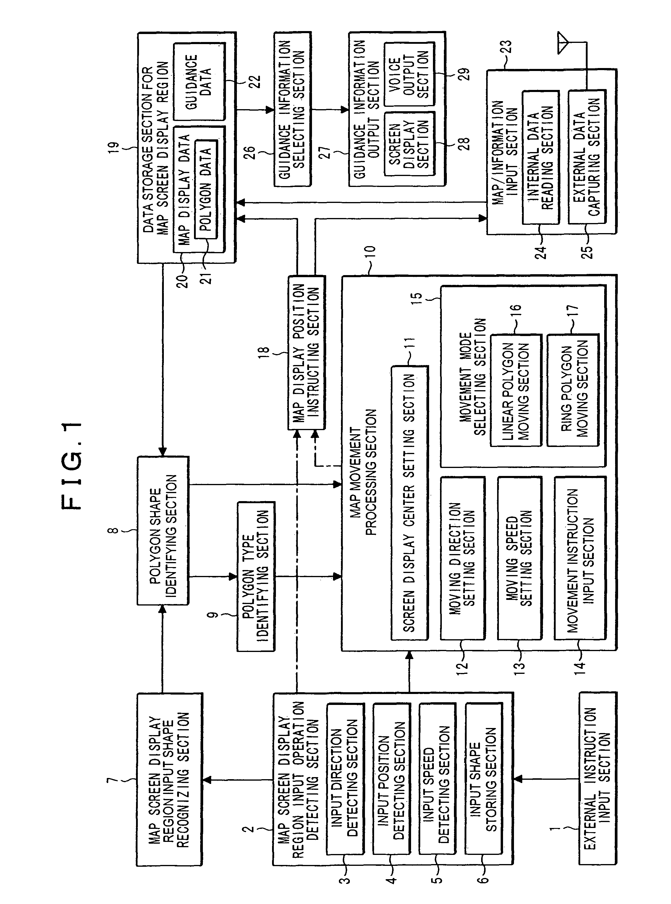
Map moving apparatus
a moving apparatus and map technology, applied in the field of map moving apparatus, can solve the problems of troublesome operation, difficult to grasp the entire image, and inability to provide user information regarding points, etc., and achieve the effect of improving safety during travel, convenient finding facilities or the like, and simple operation of users
- Summary
- Abstract
- Description
- Claims
- Application Information
AI Technical Summary
Benefits of technology
Problems solved by technology
Method used
Image

Examples
embodiment 1
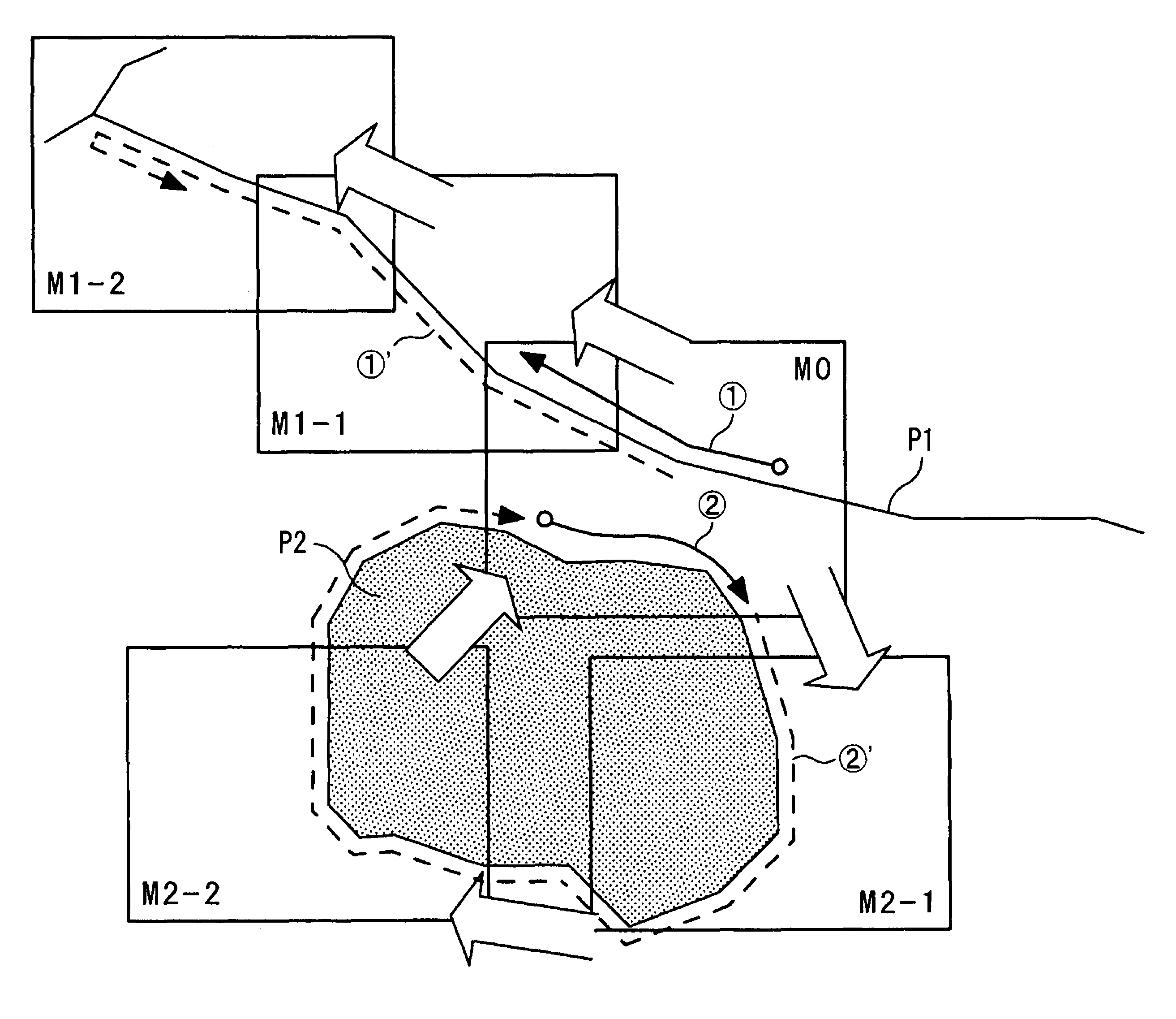
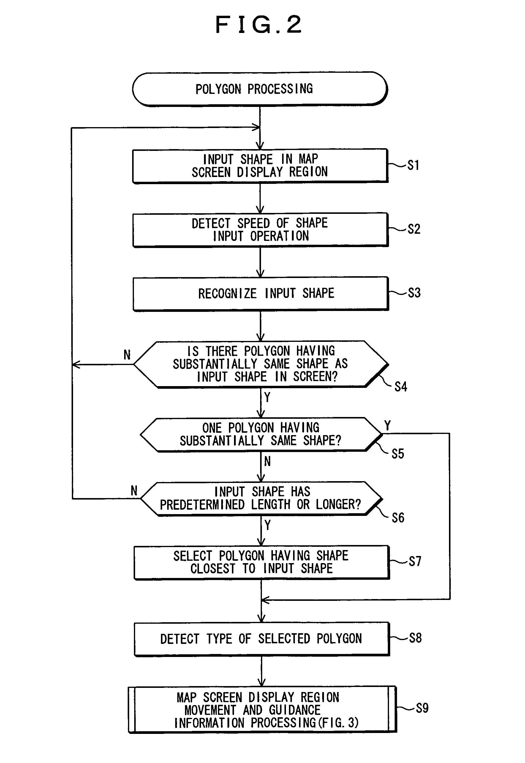
[0046]A description will first be made for a map moving method according to the present invention based on a specific example. FIG. 4 shows an example of the operation of the present invention. Rectangular shapes represent map display regions on a screen. Reference numerals (1) and (2) represent shapes that the user inputs, and P1 and P2 show polygons selected by the present invention based on the shapes (1), (2) that the user inputs.
[0047]A polygon comprises positional information of a polygonal shape formed by connecting a plurality of points expressed by coordinate values such as longitude and latitude, and it is the same as polygonal shape data that is generally used to display boundaries or the like of administrative districts on a map. A polygon is used to display a region showing land formations such as a mountain, river, lake, desert and reservoir, buildings such as a shopping mall, an airport and a school, and their regions, in map data for navigation use, and it has been c...
PUM
 Abstract
Description
Claims
Application Information