

Method and system for associating content with map zoom function
a technology of content and map, applied in the field of mapping on electronic devices, can solve the problems of physical limitation of zoom data available, limited zoom in,
- Summary
- Abstract
- Description
- Claims
- Application Information
AI Technical Summary
Benefits of technology
Problems solved by technology
Method used
Image

Examples
Embodiment Construction
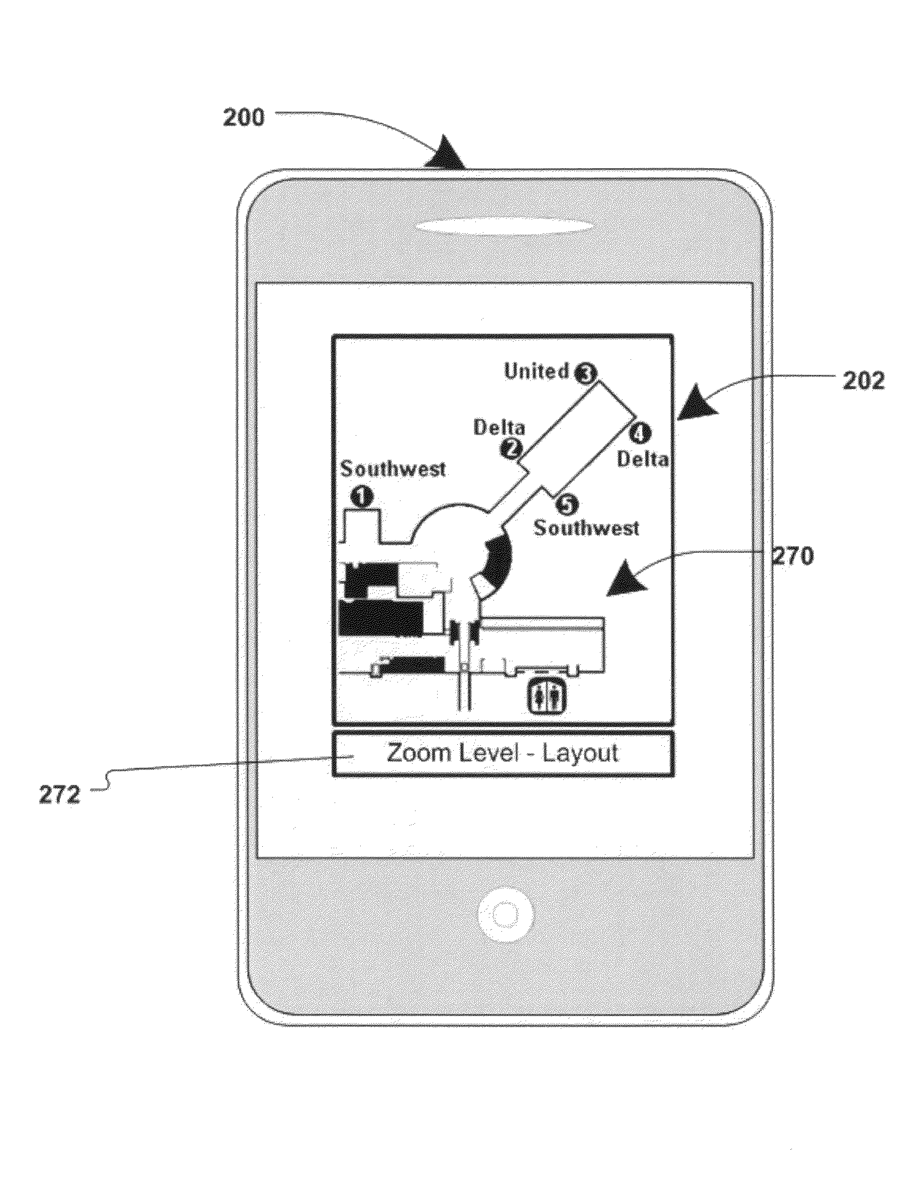
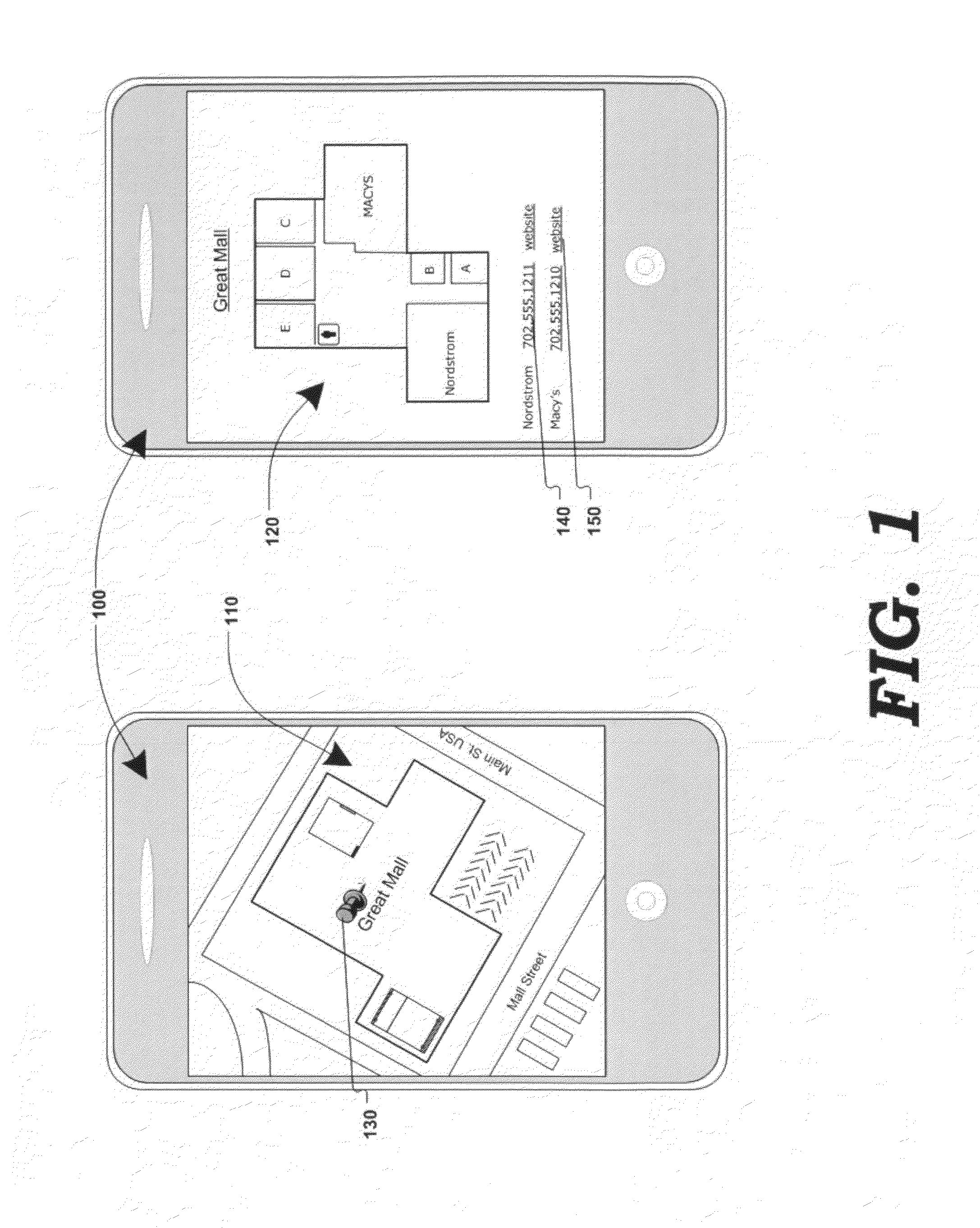
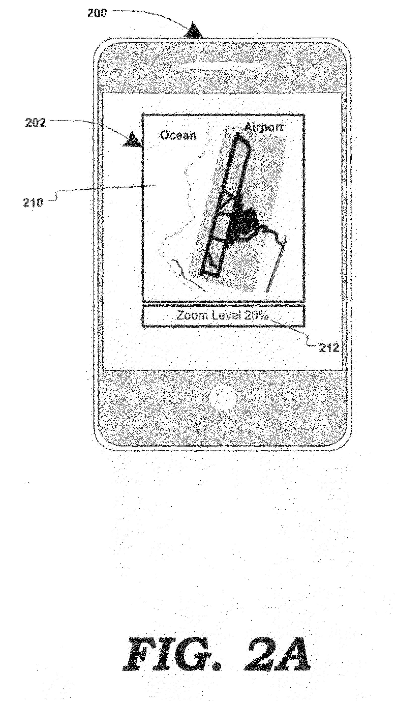
[0020]FIG. 1 is a generalized block diagram illustrating the transformation of a digital map into POI-related content, in response to a zoom-in function, according to one embodiment of the present invention. Electronic device 100 (e.g. a computer, cellular / smart phone, personal digital assistant, etc.) may display a digital map 110. Digital map 110 may be generated by a mapping service (e.g. Google Maps®, Yahoo! Maps®, Windows Live Search Maps®, etc.) and may be transmitted to electronic device 100 electronically (e.g. via the internet, wirelessly, using cellular communication, etc.)
[0021]Map 110 may be generated and displayed by computer code (e.g. using technologies such as AJAX, javascript, http requests, DHTML, XML, VML, Flash®, etc.) in a map-display application (e.g. a browser application.) Map 110 may be composed of graphical images, known as “map tiles”, that may be received by the client device 100 from the mapping service, and assembled and displayed as a map 110. Images (...
PUM
 Abstract
Description
Claims
Application Information