

Systems and methods for building axes, co-axes and paleo-geographic coordinates related to a stratified geological volume
a stratified geological volume and geophysical coordinate technology, applied in the field of stratified geological volumes modelled in the subsurface, can solve problems such as inaccurate rendering of models
- Summary
- Abstract
- Description
- Claims
- Application Information
AI Technical Summary
Benefits of technology
Problems solved by technology
Method used
Image

Examples
Embodiment Construction
[0027]For the sake of clarity and for the purpose of simplifying the presentation of embodiments of the invention, the following preliminary definitions are given, although other definitions may be used:
Geological-Time
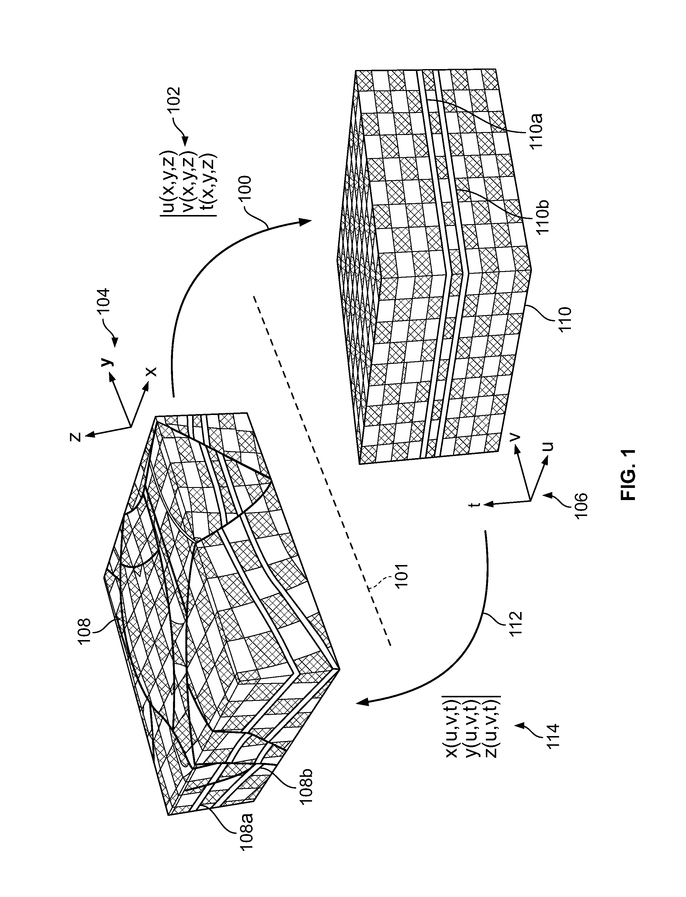
[0028]A particle of sediment in a geological terrain may be observed at a location in the subsurface. The location of the particle may be mathematically represented or modeled, e.g., by a vector, (x,y,z), in a three-dimensional (3D) space, such as the Cartesian coordinate system (of course, when modeling such particles, the position of many particles may be modeled together as for example using a cell). When modeled, a data structure such as a node or cell may represent particles. The time when the particle of sediment was originally deposited may be referred to as the “geological-time” and may be represented or modeled, e.g., as a geological-time function of the current location of the particle, t(x,y,z). When used herein, a “current” location for a particle (or data ...
PUM
 Abstract
Description
Claims
Application Information