Map information generating systems

A map information and generation system technology, applied in traffic control systems, maps/plans/charts, traffic control systems for road vehicles, etc., can solve problems such as disappearance of existing roads, changes in shape of existing roads, and deviation of driving trajectories

Inactive Publication Date: 2008-07-02
AISIN AW CO LTD
View PDF1 Cites 59 Cited by
  • Summary
  • Abstract
  • Description
  • Claims
  • Application Information

AI Technical Summary

Problems solved by technology

In addition, existing roads may disappear or the shape of existing roads may change.
In this case, there is a problem that the information related to the new road constructed after the map data possessed by the navigation device is not registered in the map information data
That is, even when driving on the same road many times, when driving on a road with multiple lanes, it is very unlikely that the driving trajectory will be exactly the same, and the deviation of the driving trajectory will also be caused by detection errors.

Method used


Image

  • Map information generating systems
  • Map information generating systems
  • Map information generating systems

Examples


Embodiment Construction

[0041] Hereinafter, the map information generating system of the present invention will be described in detail with reference to the drawings based on an embodiment thereof.

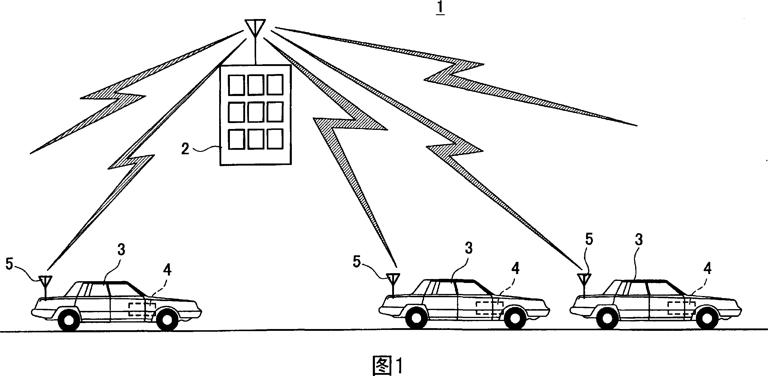
[0042] First, the schematic structure of the map information generation system 1 in this embodiment is demonstrated using FIG. 1. FIG. FIG. 1 is a schematic configuration diagram of a map information generating system 1 in this embodiment.

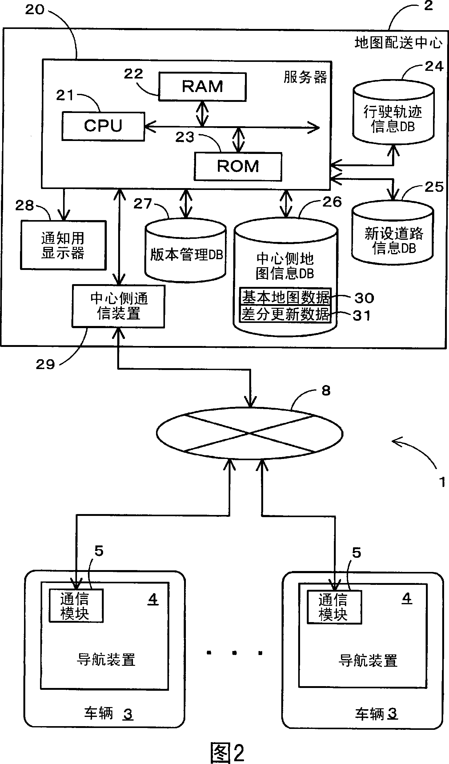
[0043] As shown in FIG. 1 , a map information generation system 1 in this embodiment basically includes a map distribution center 2 , a vehicle 3 as a probe vehicle, and a navigation device 4 installed on the vehicle 3 .

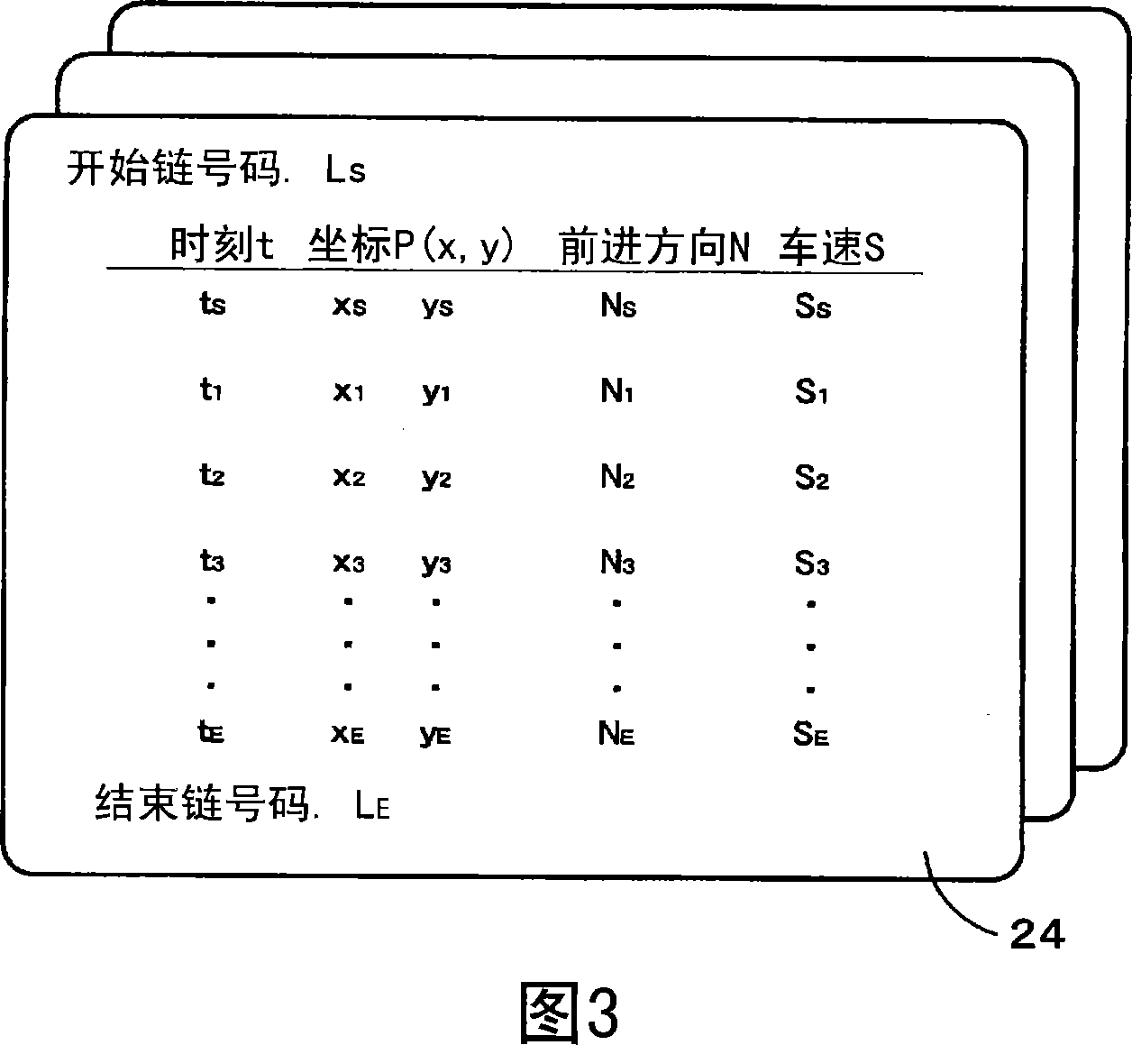
[0044] Here, the map distribution center 2 collects and stores travel track information as probe data sent by each vehicle 3 traveling across the country, and generates new road information on newly built roads based on the travel track information. Then, update data for updating the old-version map data to new-version map data including the new r...


PUM


Abstract

The invention provides a cartographic information generating system which is used for generating information about the new added roads to the cartographic information stored in a navigation device and etc.. The traveling locus information generated when vehicles (3) serving as probe cars travel along paths that are not included in navigation map data (53) provided in the navigation device (4) is transmitted to a map distribution center (2) as probe data. After receiving the traveling locus information from the navigation device (4) of each vehicle (3), the map distribution center (2) gathers together the received data, groups together traveling locus information relating to the same path, and then generates new road information relating to a single new road in each group.

Description

technical field [0001] The present invention relates to a map information generation system that adds new road information related to new roads to map information generated and stored in a navigation device. Background technique [0002] In recent years, many navigation devices that guide the driving of the vehicle so that the driver can easily reach the destination are mounted on the vehicle. Here, the navigation device refers to a device that detects the current position of the vehicle through a GPS receiver, acquires map data corresponding to the current position through a recording medium such as DVD-ROM or HDD, or through the Internet, and displays it. on the LCD display. Read the map data including the current position of the vehicle from the recording medium, display the map picture around the current position of the vehicle on the display device according to the map data, and simultaneously display the vehicle location mark (mark) and the map picture overlapping, ac...

Claims


Application Information

Patent Timeline
Patent Type & Authority Applications(China)
IPC IPC(8): G01C21/26G01C21/32G08G1/0969G09B29/00G09B29/10
Inventor 中村德裕
Owner AISIN AW CO LTD
Why Eureka
Try Eureka