Knowledge base supported spatial database design method
A database and knowledge base technology, applied in the field of spatial database design supported by the knowledge base, can solve the problems of consuming a lot of manpower, material and financial resources, not forming a database building process, affecting the wide application of basic geographic data information, etc., to ensure accurate performance, to achieve the effect of optimal design
- Summary
- Abstract
- Description
- Claims
- Application Information
AI Technical Summary
Problems solved by technology
Method used
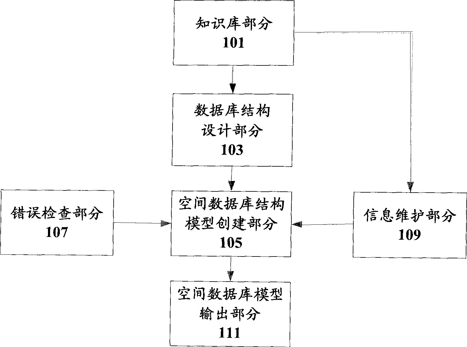
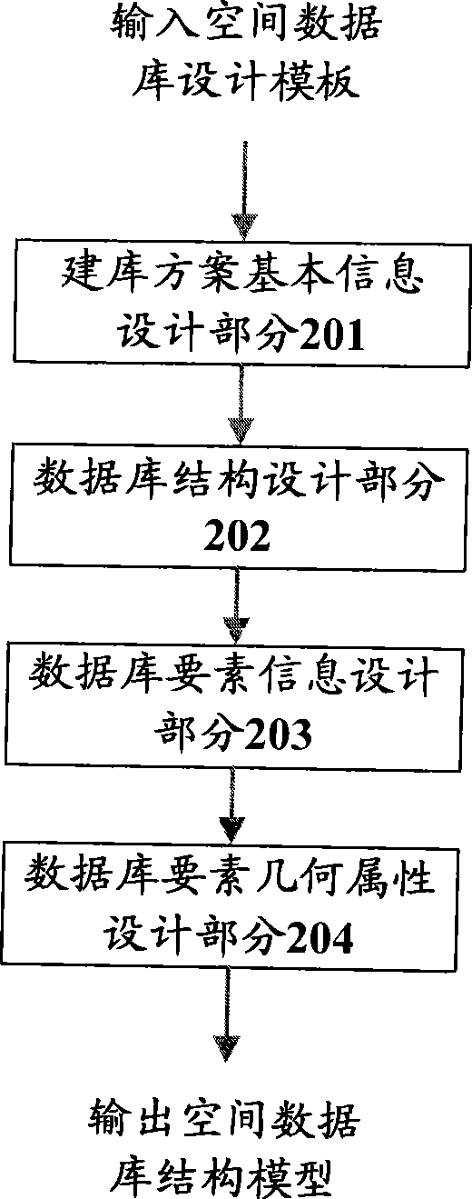
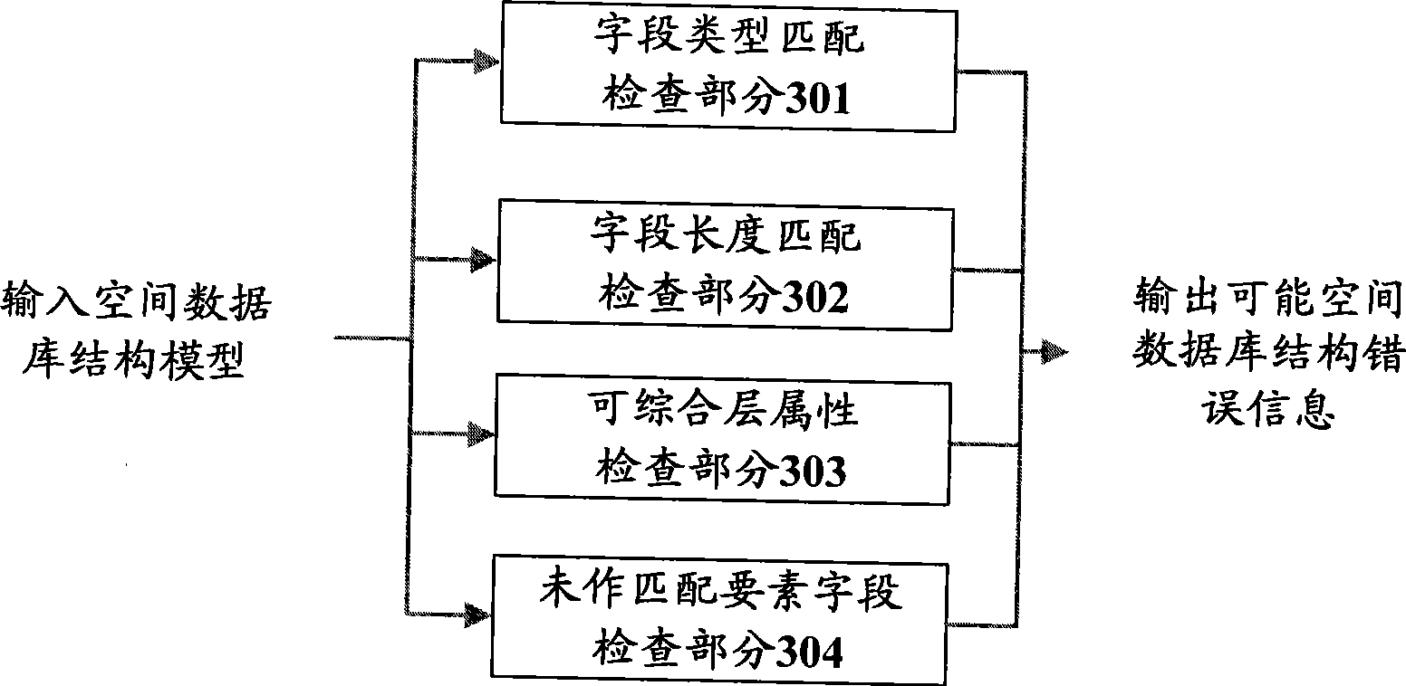
Image

Examples
Example Embodiment
[0052] Hereinafter, the present invention will be described more fully with reference to the accompanying drawings showing preferred embodiments of the present invention. It should be understood that the present invention can be implemented in other different forms and should not be limited to the embodiments described herein. In fact, the following embodiments are provided only to fully and completely convey the scope of the present invention to those of ordinary skill in the art.
[0053] In the following, detailed descriptions of well-known functions and configurations incorporated herein will be omitted because it may confuse the present invention.
[0054] First introduce some technical terms involved in the application.
[0055] (1) Spatial data
[0056] Spatial data refers to data used to represent the location, shape, size, and distribution characteristics of spatial entities. It can be used to describe targets from the real world. It has the characteristics of positioning...
PUM
 Abstract
Description
Claims
Application Information
 - R&D Engineer
- R&D Manager
- IP Professional
- Industry Leading Data Capabilities
- Powerful AI technology
- Patent DNA Extraction
Browse by: Latest US Patents, China's latest patents, Technical Efficacy Thesaurus, Application Domain, Technology Topic.
© 2024 PatSnap. All rights reserved.Legal|Privacy policy|Modern Slavery Act Transparency Statement|Sitemap