
Merging method of road network data and merging device

A road network and data technology, applied in the field of geographic information, can solve the problem of inapplicable separation of upper and lower lines, road merging, etc.

Active Publication Date: 2010-02-03
NAVINFO
View PDF0 Cites 27 Cited by
  • Summary
  • Abstract
  • Description
  • Claims
  • Application Information

AI Technical Summary

Problems solved by technology

Therefore, the integrated method of the existing technology is not suitable for the combination of the upper and lower line separation roads in the production of spatial data

Method used


Image

  • Merging method of road network data and merging device
  • Merging method of road network data and merging device
  • Merging method of road network data and merging device

Examples


Embodiment Construction

[0038] In order to make the technical problems, technical solutions and advantages to be solved by the embodiments of the present invention clearer, the following will describe in detail with reference to the drawings and specific embodiments.

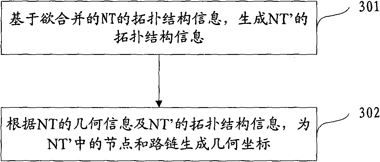
[0039] There is an intersection object in the road data, and multiple nodes (NODEs) belonging to the intersection are recorded in the intersection object. In the method of the embodiment of the present invention, the intersection objects are integrated into one point. image 3 It is a schematic flowchart of a method for merging road network data according to an embodiment of the present invention. In the method of this embodiment, we need to merge all intersection objects in a road network data NT and the upper and lower line separation roads associated with the intersection objects, and the road network data generated after the merger is NT'. like image 3 , the method includes the following steps:

[0040] Step 301: Based on the t...


PUM


Abstract

The invention provides a merging method of road network data and a merging device. The road network data comprises at least two intersection objects and upper separating roads and lower separating roads which are correlative with the intersection objects. The method comprises the following steps of: a. based on the topological structure information of the road network data NT to be merged, mapping a plurality of nodes which belong to one intersection in the NT into a node of the merged road network data NT', mapping a plurality of routes which are corresponding to the plurality of upper separating roads and lower separating roads belonging to the same practical road in the NT into one route of the NT', and generating the NT' topological structure information; and b. according to the geometry information of the NT and the topological structure information of the NT', generating geometry coordinate for the nodes and routs in the NT'. By using the technical scheme, the merging of the upper separating roads and the lower separating roads can be operated in the process of spatial data generation.

Description

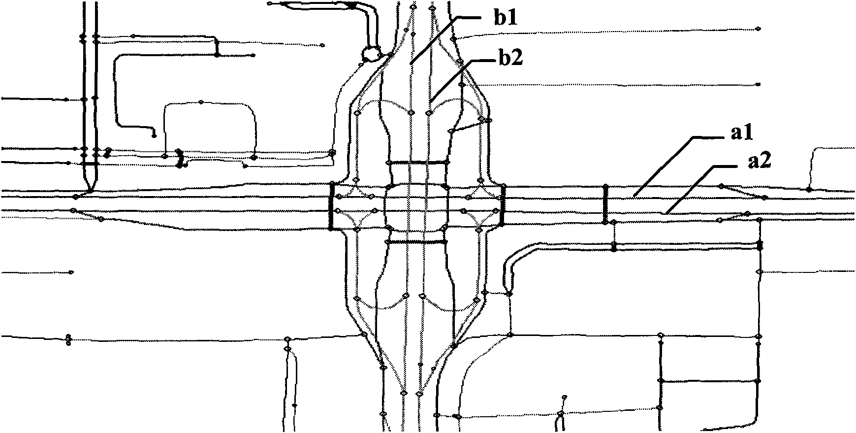
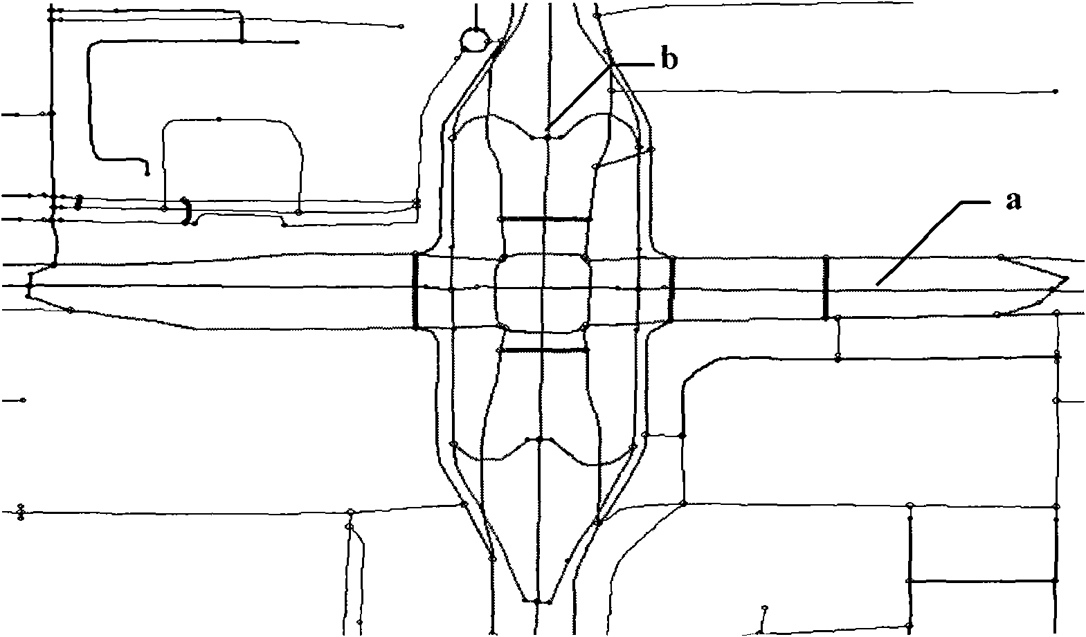
technical field [0001] The invention relates to the technical field of geographic information, in particular to a method and device for merging road network data. Background technique [0002] In the production of spatial data, it is often necessary to merge and synthesize roads, such as merging roads separated by upper and lower lines in road network data. like figure 1 , 2 The merging of roads is shown exemplarily. figure 1 It is a schematic diagram of the road network before the merger. figure 2 A schematic diagram of the merged road network. figure 1 The upper and lower lines in the separation road a1, a2, in figure 2 merged into road a; figure 1 The upper and lower lines in the separation road b1, b2 in figure 2 merged into road b. [0003] The methods of road synthesis in the prior art are mainly divided into geometric simplification, topological simplification or a combination of both. Among them, geometric simplification is mainly performed on a single ro...

Claims


Application Information

Patent Timeline
Patent Type & Authority Applications(China)
IPC IPC(8): G06F17/30G08G1/00
Inventor 张韵吴中恒
Owner NAVINFO
Learn More