Map display method, map display system, navigator and electronic map

An electronic map and display system technology is applied in the fields of navigators, electronic maps, map display methods, and map display systems to achieve the effect of convenient use.

Active Publication Date: 2010-02-03
NAVINFO
View PDF0 Cites 31 Cited by
  • Summary
  • Abstract
  • Description
  • Claims
  • Application Information

AI Technical Summary

Problems solved by technology

[0005] In the process of realizing the present invention, the inventor found that there are at least the following problems in the prior art: when the user uses the above zooming method to display the electronic map, it may be necessary to perform multiple zooming operations to achieve the desired zoom scale

Method used


Image

  • Map display method, map display system, navigator and electronic map
  • Map display method, map display system, navigator and electronic map
  • Map display method, map display system, navigator and electronic map

Examples


Embodiment Construction

[0062] The specific implementation manners of the present invention will be further described in detail below in conjunction with the accompanying drawings and embodiments.

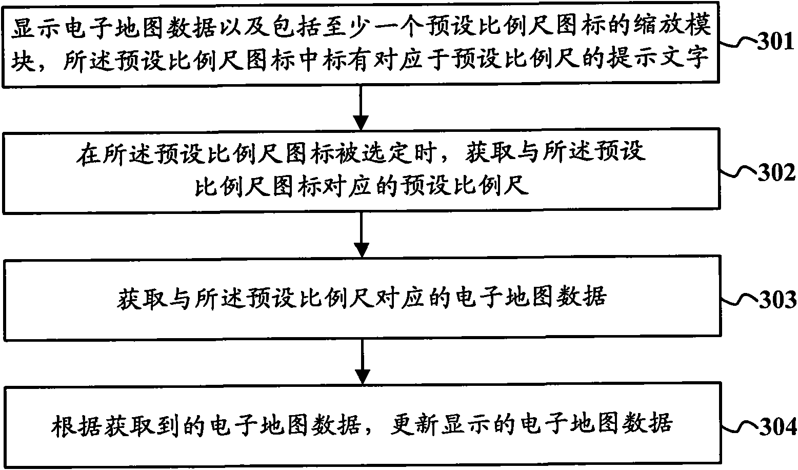
[0063] Such as image 3 Shown is a schematic flowchart of a map display method according to an embodiment of the present invention, and the map display method includes the following steps:

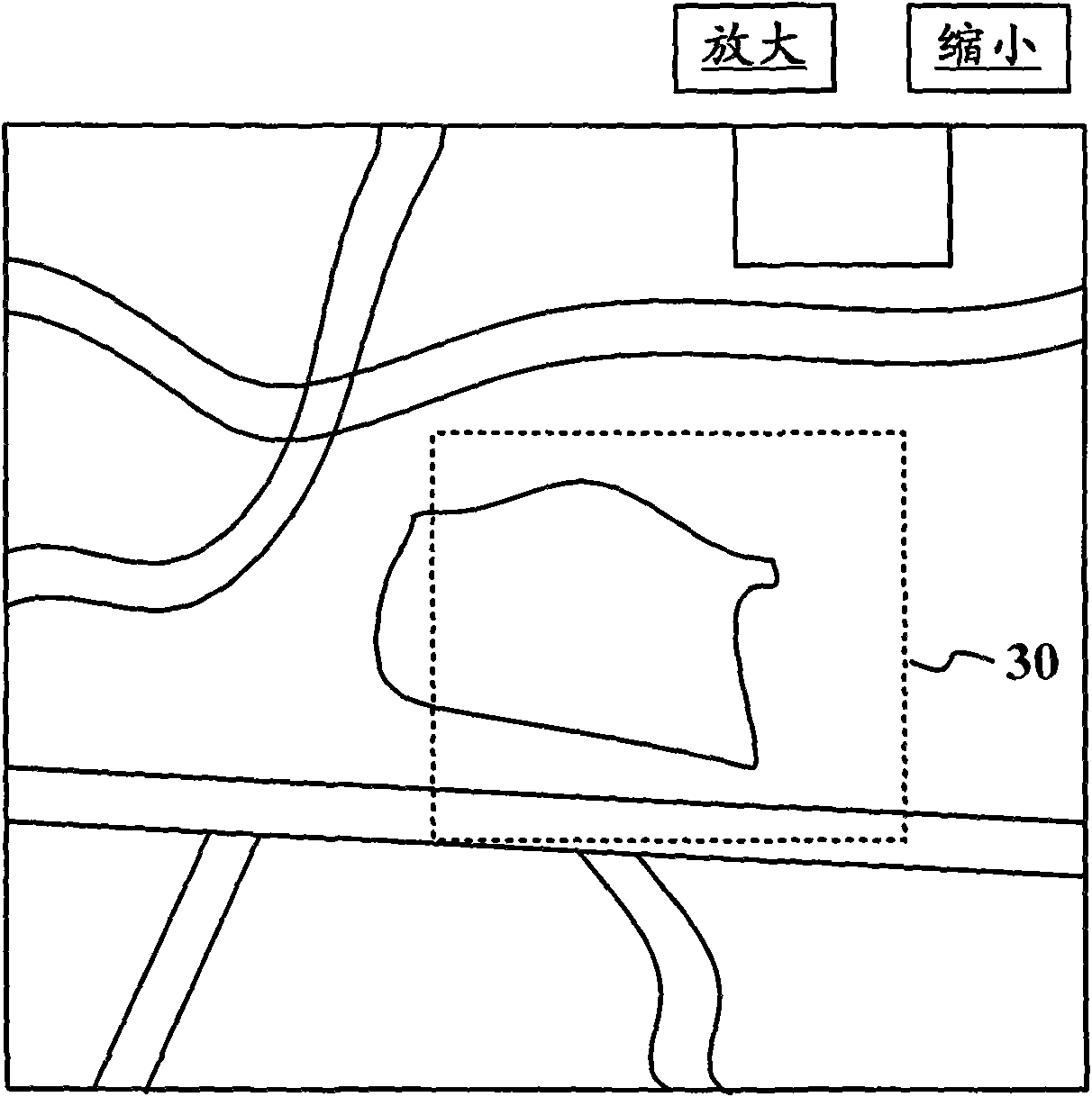
[0064] Step 301, displaying electronic map data and a zoom module including at least one preset scale icon, where a prompt text corresponding to the preset scale is marked in the preset scale icon;

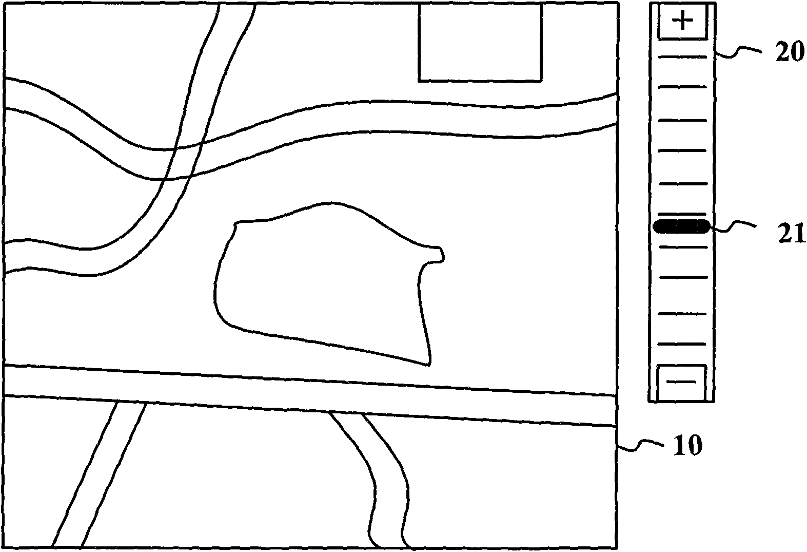
[0065]The initial state of the electronic map data is usually displayed by a map with a default scale.

[0066] The preset scale is set according to the user's usage habits. For example, the preset scale can be any one or more of the following: national view scale, provincial view scale, city view scale, region (town level) view scale and street view scale etc. Wherein, each preset scale corresponds to a specific zoom ...


PUM


Abstract

The invention provides a map display method, a map display system, a navigator and an electronic map; the map display method comprises the steps: a scaling module can display data of the electronic map and comprises at least one preset scale icon which is marked with prompting characters corresponding to a preset scale; when the preset scale icon is selected, the preset scale corresponding to thepreset scale icon can be acquired; the data of the electronic map corresponding to the preset scale; according to the acquired data of the electronic map, the displayed data of the electronic map is updated. By adopting the invention, the electronic map corresponding to the scale expected by the user can be rapidly and accurately switched.

Description

technical field [0001] The invention relates to the field of electronic maps, in particular to a map display method, a map display system, a navigator and an electronic map. Background technique [0002] When the existing electronic map is displayed, its initial state is usually displayed by a map with a default scale. During the use of the electronic map, the user can adjust the scale of the electronic map as required to realize the zooming of the electronic map. [0003] Such as figure 1 Shown is the method in the prior art to realize electronic map zooming by zooming in and out, figure 1 Including: electronic ground Figure 10 and the zoom ruler 20, the zoom ruler 20 has a benchmark 21, the user can drag the benchmark 21 arbitrarily to realize the electronic Figure 10 zoom. When dragging the pole 21 upwards, electronically Figure 10 The scale bar becomes larger, electronically Figure 10 Zoom in; when dragging down the pole 21, electronically Figure 10 The scale...

Claims


Application Information

Patent Timeline
Patent Type & Authority Applications(China)
IPC IPC(8): G09B29/00G09B29/10G01C21/26
Inventor 胡发根刘国栋
Owner NAVINFO
Why Eureka
Try Eureka