

Multi-resolution modeling method for three dimensional model of complex building
A three-dimensional model and multi-resolution technology, applied in the field of geospatial information systems, can solve problems such as weak simplification ability, loss of smooth group information in the model, and unfavorable visualization of virtual scenes, so as to improve the degree of automation and efficiency, ensure visual continuity, The effect of high execution efficiency
- Summary
- Abstract
- Description
- Claims
- Application Information
AI Technical Summary
Problems solved by technology
Method used
Image

Examples
Embodiment Construction
[0058] The technical scheme of the present invention is described in detail below in conjunction with accompanying drawing:
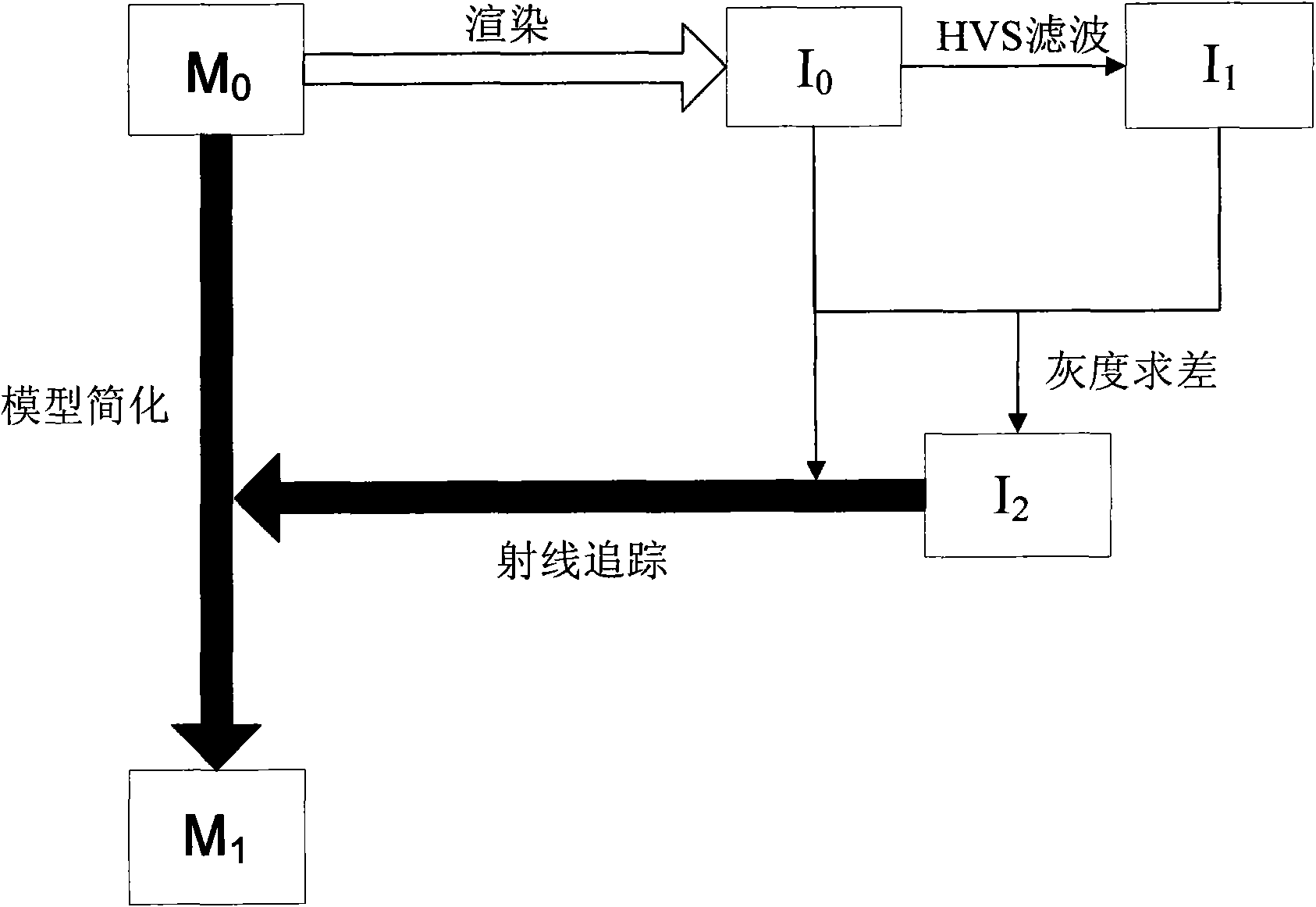
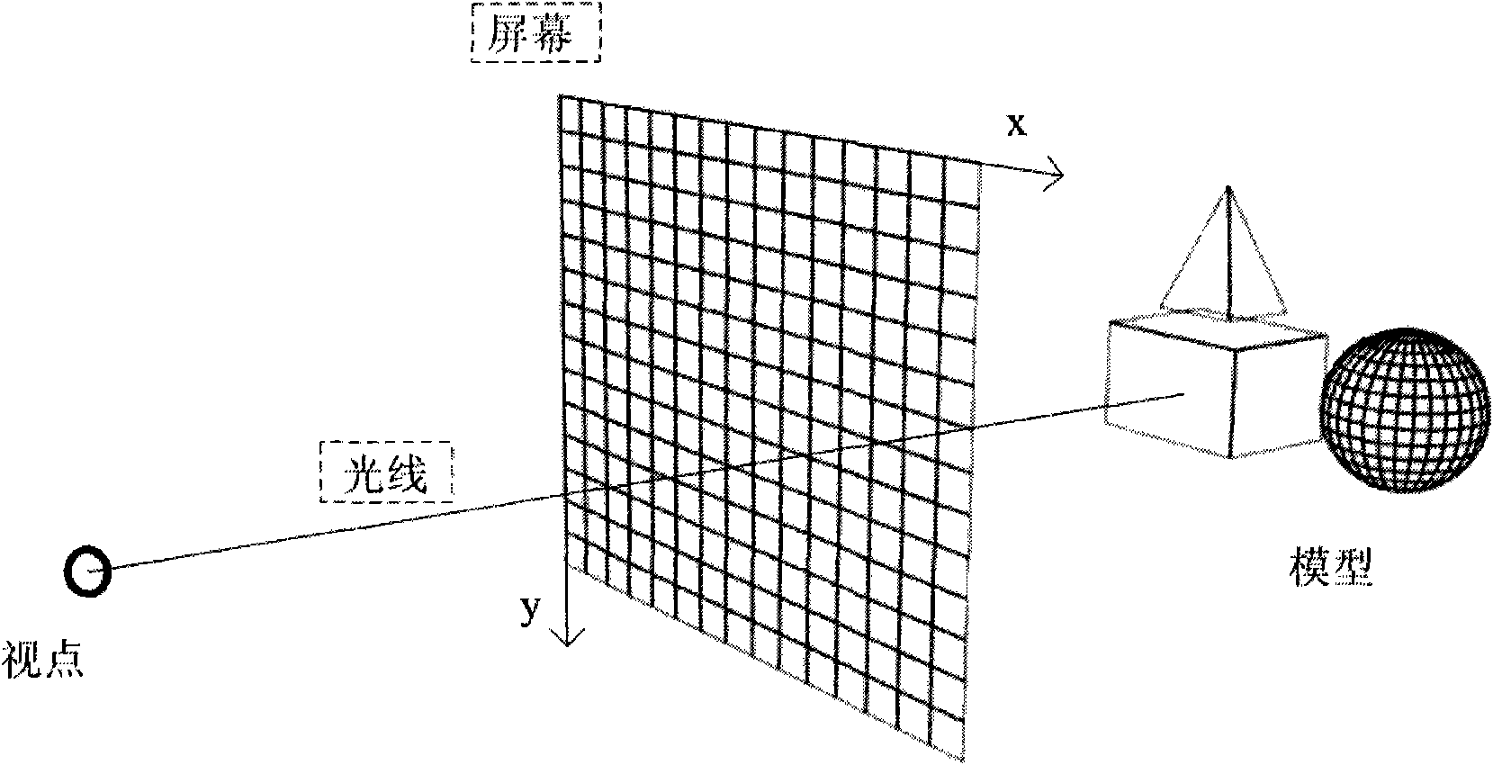
[0059] see figure 1 , the principle of the technical solution of the present invention is to simplify the three-dimensional model M of the original building 0 , the original rendered image I is obtained through the mapping process of object space and image space 0 ; Then carry out the process of image space processing, from the original rendered image I 0 Get Perceptually Reconstructed Image I 1 , the original rendered image I 0 and perceptual image I 1 Find the difference to obtain the difference image I 2 ;Final difference image I 2 Inversely map to the object space, output the simplified model data, and visualize the 3D simplified model M of complex buildings 1 , to complete the object space simplification process.
[0060] The implementation process of the embodiment of the present invention uses a computer to realize automatic processing, i...
PUM
 Abstract
Description
Claims
Application Information