Remote sensing image segmentation method based on region clustering
A remote sensing image and area technology, applied in image enhancement, image data processing, instruments, etc., can solve the problems of image segmentation accuracy to be improved, immature, etc., achieve good image segmentation effect, good adaptability and robustness, and eliminate noise Effect
- Summary
- Abstract
- Description
- Claims
- Application Information
AI Technical Summary
Problems solved by technology
Method used
Image
Examples
Embodiment
[0057] Attached Figure 4 The shown Xinyinggang remote sensing image is used as the remote sensing image to be segmented, and the image size is 500 rows*500 columns. The whole image segmentation process of this method is realized by using the standard C++ programming language. The read and write operations of remote sensing image data are implemented with the open source geographic data format conversion class library GDAL.
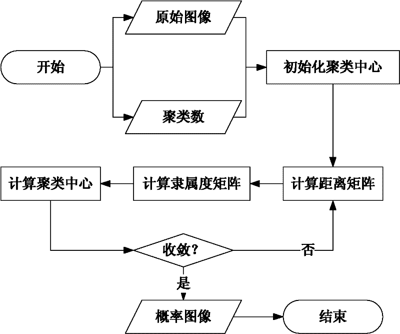
[0058] It mainly consists of four steps: region pre-segmentation; fuzzy clustering; region re-segmentation; merging of segmented objects.
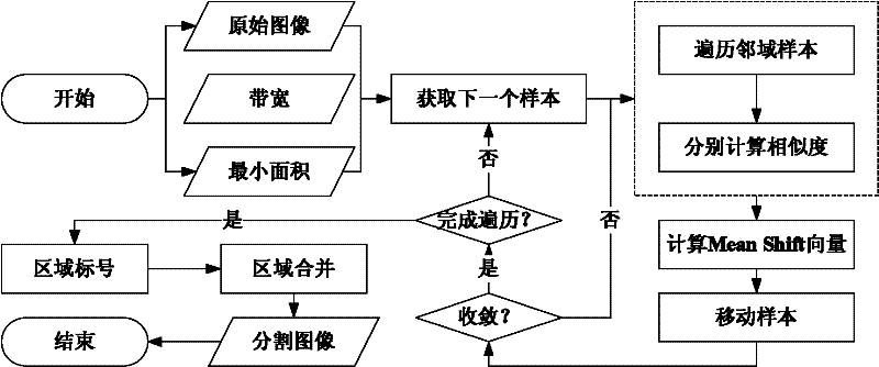
[0059] Step 1: Region pre-segmentation. Purpose: one is to remove image noise, and the other is to realize the preliminary clustering of pixels. (The whole process is attached figure 2 shown in the flowchart)
[0060] 1) Read data.
[0061] Use GDAL as a data reading and writing tool, use the GDALOpen method to read remote sensing image files, and convert them into integer arrays with the size of 500 rows*500 c...
PUM
 Abstract
Description
Claims
Application Information
 - R&D
- Intellectual Property
- Life Sciences
- Materials
- Tech Scout
- Unparalleled Data Quality
- Higher Quality Content
- 60% Fewer Hallucinations
Browse by: Latest US Patents, China's latest patents, Technical Efficacy Thesaurus, Application Domain, Technology Topic, Popular Technical Reports.
© 2025 PatSnap. All rights reserved.Legal|Privacy policy|Modern Slavery Act Transparency Statement|Sitemap|About US| Contact US: help@patsnap.com


