

Route planning method and service equipment based on real-time road condition
A technology of real-time road conditions and route planning, applied in the field of intelligent transportation, can solve the problems of slow response speed and many times of navigation, and achieve the effect of reducing the number of times of planning
- Summary
- Abstract
- Description
- Claims
- Application Information
AI Technical Summary
Problems solved by technology
Method used
Image

Examples
Embodiment 1
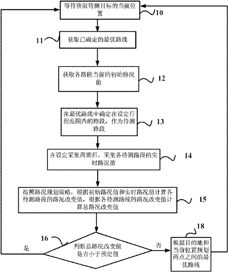
[0040] figure 1 The flow chart of the route planning method based on real-time road conditions provided by Embodiment 1 of the present invention is combined below figure 1 Embodiment 1 will be described in detail. Embodiment 1 of the present invention provides a route planning method based on real-time road conditions. The method of this embodiment can be executed independently by the vehicle navigator or the server, or can be executed in cooperation with each other. The targets to be measured can be vehicles and pedestrians. etc., the method includes:
[0041] Step 10. Waiting until the initial moment of the next route planning determination period, and obtaining the current position of the target to be measured;
[0042] Wait until the initial moment of the next route planning decision period. If this method is completed for the car navigator, the period is a fixed value, such as once every 10 minutes; if the server is completed, the period is triggered by waiting for a si...
Embodiment 2
[0054] Embodiment 2 of the present invention is based on the above-mentioned technical solution, preferably, according to the road condition planning strategy, calculate the road condition change value of each road section to be tested according to the initial road condition value and the real-time road condition value, and calculate the road condition change value according to the road condition change value of each route to be tested Calculating the total traffic change value includes:
[0055] Calculate the total road condition change value P according to the following formula;
[0056] P = Σ i = 1 n ( P i - P i 0 )
[0057] Among them, n is the total number of sections of the road section ...
Embodiment 3
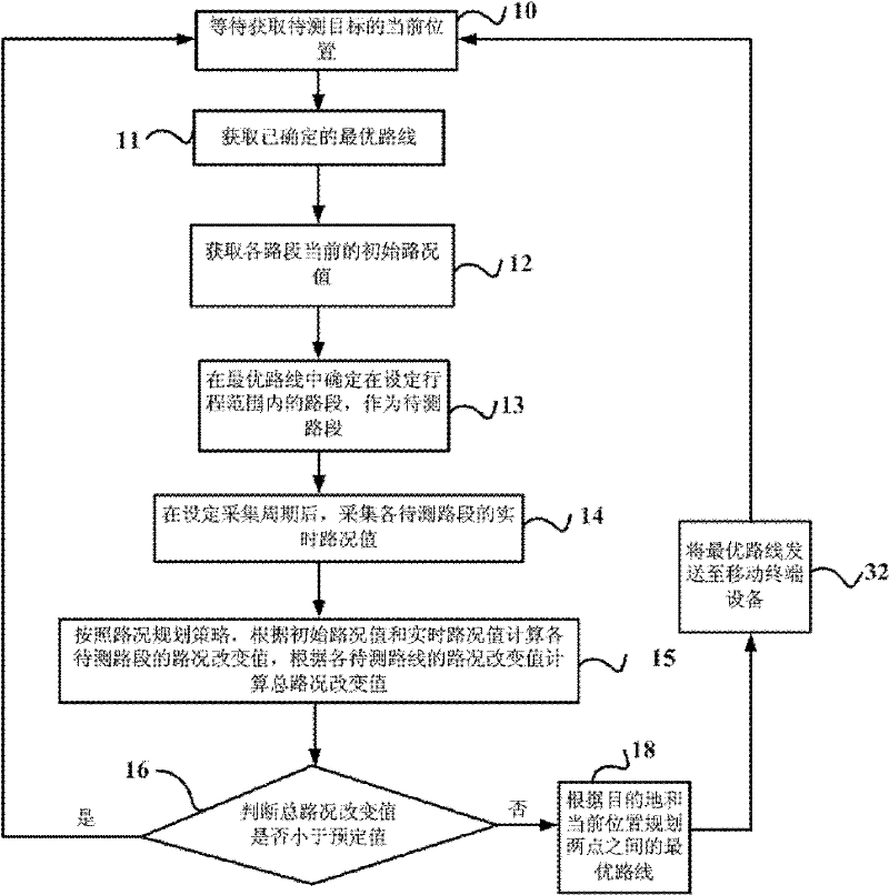
[0061] In Embodiment 3 of the present invention, it is preferable that the navigation server on the network side executes the operation of route planning, then after planning the optimal route between two points according to the destination and the current position, step 32 is also included: sending the optimal route to To mobile terminal equipment, such as mobile phones, PDAs, vehicle-mounted equipment, etc., such as figure 2 shown.
[0062] In actual use, the route planning method based on real-time road conditions provided by Embodiment 3 of the present invention is preferably completed by a navigation server. The navigation server has a fast calculation speed, can improve the efficiency of real-time navigation, and can greatly simplify the equipment of a vehicle-mounted navigator, such as a vehicle-mounted navigation system. The navigator can be a mobile phone, and the optimal route can be sent to the mobile terminal in the form of text information.
[0063] There are ma...
PUM
 Abstract
Description
Claims
Application Information