

Real time road condition based route planning method and service equipment thereof
A real-time road condition and route planning technology, applied in the field of intelligent transportation, can solve the problem of increasing the number of navigation route planning, and achieve the effect of reducing the number of planning times
- Summary
- Abstract
- Description
- Claims
- Application Information
AI Technical Summary
Problems solved by technology
Method used
Image

Examples
Embodiment 1
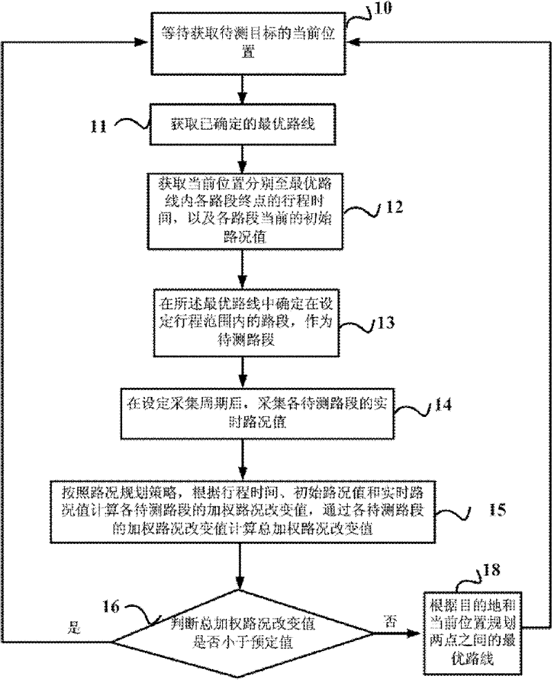
[0039] figure 1 The flow chart of the route planning method based on real-time road conditions provided by Embodiment 1 of the present invention is combined below figure 1 Embodiment 1 will be described in detail. Embodiment 1 of the present invention provides a route planning method based on real-time road conditions. The method of this embodiment can be executed by a vehicle navigator or a server, or by the cooperation of the two. The targets to be measured can be vehicles, pedestrians, etc. , the method includes:
[0040] Step 10. Waiting until the initial moment of the next route planning determination period, and obtaining the current position of the target to be measured;
[0041] Wait until the initial moment of the next route planning decision period. If this method is completed for the car navigator, the period is a fixed value, such as once every 10 minutes; if the server is completed, the period is triggered by waiting for a signal from the mobile terminal. Such ...
Embodiment 2
[0053] Embodiment 2 of the present invention is based on the above technical solution, preferably, according to the road condition planning strategy, calculate the weighted road condition change value of each road section to be tested according to the travel time, the initial road condition value and the real-time road condition value, through each The weighted road condition change value of the measured road section calculates the total weighted road condition change value including:
[0054] The total weighted road condition change value P is obtained according to the following formula:
[0055] P = Σ i = 1 n ΔP i × ( T - t i ) / T × V
[0056]...
Embodiment 3
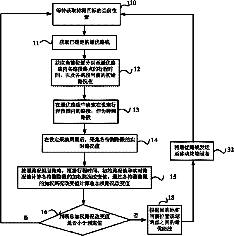
[0074] The difference between this embodiment and Embodiment 1 is that after the optimal route between two points is planned according to the destination and the current location, step 32 is also included: sending the optimal route to a mobile terminal device, such as a mobile phone, PDA, car equipment, etc., such as figure 2 shown.
[0075] In actual use, the route planning method based on real-time road conditions provided by Embodiment 3 of the present invention is preferably completed by the navigation server. The navigation server has a fast calculation speed, can improve the efficiency of real-time navigation, and can greatly simplify the equipment of the vehicle navigation terminal, such as the vehicle navigation terminal. The navigation terminal can be a mobile phone, and the optimal route can be sent to the mobile terminal in the form of text information.
[0076] There are many ways to determine the position of the target to be measured, one of which is to install ...
PUM
 Abstract
Description
Claims
Application Information