
Method for determining damage boundary of subsided farmland

A boundary and cultivated land technology, applied in the direction of measuring devices, instruments, surveying and navigation, etc., can solve problems such as the intensification of conflicts between workers and peasants, the impact of land reclamation work, and the loss of coal industry production, to achieve the effect of ensuring correctness and accuracy

Active Publication Date: 2014-05-21
CHINA UNIV OF MINING & TECH (BEIJING)
View PDF7 Cites 2 Cited by
  • Summary
  • Abstract
  • Description
  • Claims
  • Application Information

AI Technical Summary

Problems solved by technology

[0004] At present, there is a lack of unified standards for the boundary delineation of destroyed farmland in mining areas. On the one hand, it is impossible to follow in the settlement of subsidence land disputes, leading to intensified conflicts between workers and peasants. On the other hand, it also affects the implementation of land reclamation work, and even affects the production of the coal industry. incalculable loss

Method used


Image

  • Method for determining damage boundary of subsided farmland
  • Method for determining damage boundary of subsided farmland
  • Method for determining damage boundary of subsided farmland

Examples


Embodiment Construction

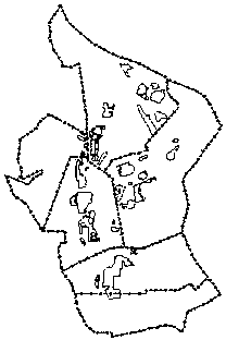
[0025] The present invention proposes a technical method for determining the boundary of subsidence cultivated land damage. The overall flow chart of the method of the present invention is as follows figure 1 Shown, in conjunction with accompanying drawing and embodiment detailed description is as follows (taking the Yanzhou coal field of Yanzhou mining area as example):

[0026] 1) Selection of data sources and determination of the area of ​​subsidence damage to be measured: Yanzhou mining area was founded in 1958 and has a history of more than 50 years. source data for research. In this embodiment, the detection time period is set as the topographic map data from 1995 to 2007. In this time period, the remote sensing data of the area where the mining area is selected are November 28, 1995, and August 21, 2000. 2 LandsatTM remote sensing Imagery (30m resolution), aerial imagery in 2005 (0.5m resolution), IRSP5 imagery in October 2007 (2.5m resolution) and Pakistan Resources S...


PUM


Abstract

The invention relates to a technical method for determining the damage boundary of a subsided farmland and belongs to the technical field of surveying and mapping as well as environmental monitoring. The method comprises the following steps: selecting corresponding remote sensing data and non-remote sensing data to determine a preliminary area of subsidence; extracting subsided water area boundary information in the subsidence area by using multi-scale wavelet transform edge detection, establishing an index model of subsidence land boundary buffering, buffering the boundary of a subsided water area by using the model and obtaining subsidence boundary information of the area to be surveyed and ground subsidence depth information; obtaining DEM (Digital Elevation Model) elevation information through a method for analyzing photogrammetric survey; determining and supplementing the subsidence boundary by using elevation variation information data of the area to be surveyed, wherein the elevation variation information data of the area to be surveyed are obtained through difference analysis of DEMs at different time phases; and then eliminating the subsidence land boundary information caused by coal mining activities; and finally obtaining subsidence land boundary and subsidence depth information of the area to be surveyed. According to the invention, the boundary of the subsided farmland can be rapidly determined and basic support can be provided to compensation and treatment of the subsidence land.

Description

technical field [0001] The invention belongs to the technical field of surveying, mapping and environmental monitoring, and in particular relates to a technical method for determining the damage boundary of subsidence cultivated land. Background technique [0002] Coal is the most important energy source in China. With the rapid development of China's mining industry, its development and utilization play an important role in the development of the national economy, but at the same time, the problems brought about by it have also emerged. The massive extraction of underground coal resources leads to the destruction of the balance and deformation of the overlying strata in the goaf, resulting in different degrees of surface subsidence damage. The forms of surface subsidence damage include: sinking basins, collapse funnels, steps, surface cracks, etc. The degree of subsidence in different regions of China is also different. For example, in the eastern plain area, which is the m...

Claims


Application Information

Patent Timeline
Patent Type & Authority Patents(China)
IPC IPC(8): G01C11/00G01C5/00
Inventor 胡振琪许献磊
Owner CHINA UNIV OF MINING & TECH (BEIJING)
Learn More